Articles
Bushfire Prone Land Map New South Wales
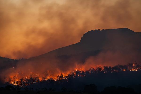
Australia might be an island, but approximately 70% of the country is considered semi-arid or desert land – making it the second driest continent in the world.
Warm and dry conditions when grasses are dead, fuels have dried and intense high-pressure systems are in place increase fire risk across many states within Australia. Here’s how to be the most informed and prepared in NSW.
What is a Bushfire Prone Property/Land?
Bushfire prone land (also referred to as BFPL) is land that has been identified by the local council and RFS as being subject to a bushfire attack or capable of supporting a bush fire.
Generally, land is categorised as bushfire prone based on the vegetation and if it is set near significant “dry fuel” (this can include leaf litter, bark, small branches and twigs, shrubbery, and so on).
With recent and continued bushfires across NSW, bush fire prone land maps in NSW are more necessary than ever.
Sign up today to access bushfire data
Search addresses to find bushfire overlays on or near your property.
Precautions to Take to Protect Your Property
It’s understandable to think that if the area has not been affected by a bush fire that it is safe from danger. However, conditions can change, especially with impending climate change increasing the risk of bushfire over time.
Some of the key precautions you can take to protect your property from bushfire include are at the build and maintenance level, such as:
Install metal gutter guards
Pay attention to weather conditions
Reduce any gaps/external openings to 2mm or less and fit seals around doors and windows
In the build stage, simplify the house outline and roof line to reduce debris build up and switch combustible materials like wood for fire resistant ones like lightweight steel
Maintain your land and home by regularly pruning trees, maintaining grass and clearing dry fuel like leaves
The main step is assessing the risk of bushfires in your area.
You can do this by checking the bushfire zone maps in NSW using Landchecker.
Councils are legally required to map bushfire prone land within their LGA’s and the NSW Bush Fire Prone Land (BFPL) dataset is a map prepared from council data that is certified by the Commissioner of the NSW Rural Fire Service.
Any area that can support a bushfire or is likely to be subject to a bushfire attack will be designated on a BFPL map.
There are three different vegetation categories that will be depicted from high to lower risk and map data is updated regularly to account for variations in vegetation and so on.
Here’s how to use a Map to Check if a Property is in a Bushfire Prone Zone:
You can utilise the Bushfire Prone Land Map for NSW, or other states via Landchecker. This tool will enable you to assess potential risk to the LGA of your existing or future property investment.
Since maps are updated periodically you will always receive the most up to date and accurate data at the time of your search.
It only takes a few clicks:
Using the Landchecker Map feature enter a relevant address
Click on “Due Diligence”
Apply the map layer “Bushfire Prone Area”. Zoom in/out as needed and use the right hand side to see the bushfire status of an area
All information is available for immediate download.
Not only will the report indicate if the area is bushfire prone, but it will also show other details like flooding, heritage status, zoning and much more as part of the free report. You can upgrade your report to receive an even more robust picture and additional data.
By understanding the geography and historical data of bushfires in your area, you’ll be able to make the most informed decisions about the land (and/or property) in question.