Our Story

Landchecker was founded in 2016 by Will Leaf and Toby Ewert of leading Melbourne based architecture practice Ewert Leaf, together with Ed Farquharson of prestige property developer, Moda. United in their shared frustration with the time-consuming process of gathering and analysing property information when seeking to provide advice to their clients or considering projects to pursue, the property trio set out to build a better alternative. And so Landchecker was born.


Will, Toby and Ed’s vision was simple: make property data accessible, transparent and useful. Today, the Landchecker application is that single-source of property information, designed to make for faster, insight-driven decisions.

Context

When Landchecker began, the property industry was Australia’s largest contributor to GDP, generating over $200 billion every year. Today, the property market is over four times the size of Australia’s GDP. And yet the lack of government investment in nationalised datasets and UX presented- and continues to present- the most common daily challenge for property professionals nationwide. And this isn’t just limited to Australia - the problem of accessing accurate and reliable property data is inherent in developed property markets worldwide.


Landchecker’s solution - a digital platform providing easy access to data on every property within coverage in Australia- reflects the type of innovation, agility and most importantly, customer-first mentality needed to break through the industry, modernise processes, and facilitate continued market growth.

Our Values

Our values drive how we approach everything at Landchecker. We know that the way we go about building solutions is just as important as the solutions themselves.


Customer-First


We provide a useful, user-oriented service that genuinely meets our members’ needs and enhances their day-to-day experience. It’s about our customers – not us. We focus on the benefits of our application for property professionals across all sectors, and constantly look for ways to create value for our community.


Trust


We focus on achieving the highest standards for our brand - the most accurate data, the most convenient product in our field, excellent customer service and consistently positive feedback. We’re trusted by our partners, appreciated by our members and respected by the broader industry.


Agility


We constantly adapt our product in response to market shifts and customer needs. We are flexible and responsive- we are committed to our values, yet open-minded when it comes to improving our application. We remain nimble and resilient in a thriving industry.


Innovation


We’re all about creating new, better ways of doing things. We’re always looking ahead; we don’t rest on our laurels. We’re solutions-focussed and resourceful in our approach.


People


Above all, we’re a team. We are motivated to make an impact for our members, in our business and for each other. We are inclusive and relationship-focused. We are accountable to each other and celebrate our collective success.

Our Partners

With the support of our major partners RACV and PEXA, we approach the future with an optimistic growth mindset. Our aim is to become Australia’s largest and most trusted property information services, relied upon by businesses and consumers alike. We are also looking to expand beyond our shores, as we seek to implement our solution design in relevant international markets. As a small but scalable company, we feel confident knowing we are supported in our continued growth.


RACV


Victoria’s most trusted insurance provider has always prided itself on helping members to safeguard their assets against risks. And for everyday Australians, when it comes to big financial risks, there is no bigger decision than buying, developing or extending your home. Since RACV’s joint initiative with Landchecker, RACV members have benefitted from accessing the most accurate and up-to-date property data sets on house listings in Australia, all through the Landchecker application. RACV and Landchecker work in conjunction with each other to empower customers to make informed decisions when investing in their home.


PEXA


Through its digital platform, PEXA has transformed the way property settlements are conducted in Australia, making it the leading property- tech company in its field world-wide. PEXA’s investment in the property industry has enabled transactional efficiency, which has in turn generated market capacity. Its shift towards more streamlined and consumer-friendly processes drives the way forward in the world of property data. PEXA and Landchecker now work together to provide transparent, real-time data for property customers, financial institutions and legal practitioners in the critical settlement stage of the property journey.

Coverage & Availability

The Landchecker platform now provides coverage of every property nationally. Customers can enjoy Landchecker’s interactive, map-based experience from their desktop, with seamless access to reliable data sets for any property or site, all within one single-source.

Our Team

As a business, we are proud of our Melbourne heritage and the dedicated team we have grown. We believe our entrepreneurial team blends a unique set of skills and experience drawn from the property, technology and finance industries, enhancing our offering.

Employee

Will Leaf

Co-Founder

Employee

Ed Farquharson

Co-Founder

Employee

Toby Ewert

Co-Founder

Employee

Adam Gandolfo

Chief Executive Officer

Employee

Joanna Chamberlain

Chief Financial Officer

Employee

Craig Heaven

Chief Revenue Officer

Employee

Georgie Edgerton

Customer Success Manager

Employee

Billy Jones

Sales Director

Employee

Monty Hanger

Sales Director

Employee

Finn Hammond

Growth Executive

Employee

Alyeah Sankar

Chief Customer and Innovation Officer

Employee

Nicolette Provis

Head of Product and UX

Employee

Rupert de Guzman

Chief Technology Officer

Employee

Andrew Connelly

Lead Software Engineer

Employee

Jem Lopez

Software Engineer

Employee

Dave Martinez

Software Engineer

Get in Touch

Level 1, 49-51 Stead Street

South Melbourne, VIC 3205

(03) 8638 8030
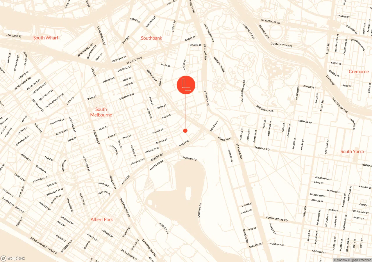
Map which shows where landchecker is located

Frequently Asked Questions

A

There are a number of reasons why this error might be occurring. For example, it may be a cancelled title.

If you receive this error, please submit an enquiry through our Contact page and someone from our team will be able to assist you.

A

Documents can also be downloaded from your Order Manager.

If you are having issues downloading the document from both your email and order manager, please reach out to the Landchecker Support Team via our live in-app support or by submitting an enquiry on our Contact page.

A

We welcome all feedback from our customers. Your involvement helps us to prioritise what functionality to develop and what improvements need to be made.

You can submit your feedback via our live in-app support or by submitting an enquiry on our Contact page.

A

We run regular webinars for our members.

Within a few days after registering as a starter member, you will receive an email with a registration link to join our fortnightly webinar running you through the Landchecker application. It explores the free functionality available for starter members, as well as running you through the Professional functionality.

Professional members are invited to join our fortnightly Professional training webinar - this registration link is emailed one week after a Professional plan is purchased.

If you have not yet received these emails, please reach out to the Landchecker Support Team via our live in-app support or by submitting an enquiry on our Contact page and we can send you a registration link.

A

Here's a 5 minute demo video link which you might find helpful. We are happy to offer you a 7-day trial to our Professional and high-resolution aerial imagery Plan, please join here.

Alternatively if you would prefer for one of our team members to call you, please complete an enquiry here.

A

The delivery time for documents vary depending on the document type. The delivery time is displayed next to each document prior to adding to your cart in the checkout process.

If you are concerned your document is taking too long to process, please reach out via our live in-app support or by submitting an enquiry on our Contact page.


A

Only an admin member or a member with billing permissions will be able to access invoices from their Landchecker account.

While on the Landchecker map, go to your Profile, select Business Account and click the Invoices tab. From here, you can download a copy of your invoices by clicking View PDF.

A

There are a range of tools available on the right hand side toolbar menu you can use including measurements, distance, area, and export options.

Distance and Area tools

    Start shapes or lines by clicking once and moving your mouse to draw the lines.

    To end shapes or lines, click twice.

    To adjust an existing shape or line, double click on the green dot to turn it blue (editable format).

Circle tool

    Click and drag to draw a circle using the circle tool.

    Click once and drag to move it to a different location.

    If you wish to edit the circle, click once to select the shape and select a green dot located on the circumference to adjust the size.

To Delete a line/shape select the line or shape on the map and click the Bin icon located in the toolbar menu on the right hand side.


A

Only a member with admin permissions will be able to invite team members to join their Landchecker account.

1. Go to your Profile located on the right corner.

2. Select Business Account.

3. Click on My Team.

4. Enter the email address of the member you wish to invite under the Invite Team Members to Your Business Account section, and click Send Invite.

5. The invited member will receive an email with a link to join the account

Once the member has successfully joined the account, they will appear under Active Members.

You can edit the members access permissions by clicking the 3 dots and selecting Edit. Here, you can toggle on and off access for permissions including admin, company purchases, billing, titles (Vic only), and high-resolution aerial imagery add-ons.


A

A high-resolution aerial imagery add-on purchase is instant, however this add-on will need to be assigned to a member in your account.

Only a member with admin permissions will be able to edit member permissions, including allocating access to the high-resolution aerial imagery add-ons.

To allocate the high-resolution aerial imagery:

1. Go to your Profile located on the right corner.

2. Select Business Account.

3. Click on My Team.

4. Locate the member you wish to grant access to high-resolution imagery (in the Active Members section).

5. Click on the 3 dots on the right hand side to edit this member’s permissions.

6. Find the section labelled Add-ons and toggle on or off the high-resolution aerial imagery access.

This member now has access to the high-resolution functionality.

A

Property reports contain detailed property information, including:

    Lot/Plan number

    SPI (Standard Parcel Identifier)

    Council property number

    Property sales history

    Property details including attributes, floor area, roof material, wall material and year built (if available)

    State electorate information

    Burglary statistics

    Closest schools

    Recent and proposed planning scheme amendments

    Site dimensions and land boundaries

    Planning zones and overlays

    Planning overlays in the vicinity

    Residential comparable sales

    Planning permit/DA history

    Nearby planning permits/DAs

    Elevation contours

    Easements

Property reports can be customised to suit your business’ needs - you can choose which of the above information is included in your reports and save your preferences.

Reports can also be branded with your own company logo under our Professional plans, by uploading your logo under Business Account - Preferences.

A

Only a member with admin permissions will be able to edit member permissions, including allocating access to the high-resolution aerial imagery add-ons.

To allocate the high-resolution aerial imagery:

1. Go to your Profile located on the right corner.

2. Select Business Account.

3. Click on My Team.

4. Locate the member you wish to grant access to high-resolution imagery (in the Active Members section).

5. Click on the 3 dots on the right hand side to edit this member’s permissions.

6. Find the section labelled Add-ons and toggle on or off the high-resolution aerial imagery access.

This member now has access to the high-resolution functionality.


A

To continue with the plan after your trial ends, you will need to add a credit card to your account.

To add a credit card to continue with your plan, head to your Profile, click on Business Account and click the Business Billing tab. Click Add New Card under the Manage Credit and Debit Cards section

If you have multiple cards in your account, the card set as the primary card is the account the plan fees will be debited from.

If your trial ends before you add a credit card to your account, you will need to visit the Plans page and activate a new plan.


A

You can reach our friendly support team via our live in-app support or by submitting an enquiry on our Contact page.

A

Landchecker’s plans can be purchased on a monthly or annual term, offering you flexibility to suit your business’ needs. Annual plans include a 10% discount on the monthly price.

There is a toggle under the price, switching the plan term between monthly and yearly. This will update the pricing on the plans page.


A

A high-resolution aerial imagery add-on purchase is instant, however this add-on will need to be assigned to a member in your account.


To purchase high-resolution aerial imagery add-ons


1. Go to your Profile located on the right corner
2. Select Business Account
3. Click on My Team
4. Click the EDIT button
5. Add the amount of seats you wish to add.
6. Update Plan


Please note that you will need to allocate the seats to the member you wish to grant permission to, refer to question 4 from Plans, pricing and managing your account section.

A

To create a new Lanchecker Plan, select OUR PLANS from the top right corner.

While on the Plans page you can expand the Functionality section to view and compare the functionality available in each plan, to choose the plan that best suits you.

Landchecker plans can be purchased annually or monthly. There is a toggle below the price, which will update your payment interval. Annual plans include a 10% discount.

Once you have chosen your plan, select Join Today.

If you do not yet have a Landchecker account, you will have the option to Create an Account. If you already have a Starter Member account, you will have the option to log into your account (or will be taken directly to the checkout page if you are currently logged in).

A

Landchecker is currently available in Victoria, New South Wales, Queensland, Tasmania, South Australia and Western Australia. Australian Capital Territory coming soon.

A

Landchecker Professional Plan allows you to download up to 15 Premium Property Reports per calendar month. Unused downloads do not carry over to the following month.

To download unlimited Premium Property Reports, simply upgrade your plan to Professional Plus by following these steps:

1. Go to your Profile

2. Select Business Account

3. Click the Plan tab where your current plan details will be displayed

4. From here, select Edit Plan

5. Click the dropdown menu and select Professional Plus

6. Click Update Plan

Note: only an Admin on the account can edit the plan.

Upgrading to Professional Plus comes with more benefits, including the ability to onboard more team members to the account and gain access to high-resolution aerial imagery data.


For further information or support, please contact our friendly team at support@landchecker.com.au