
Land Zoning & Zoning Maps
Discovering the correct land zone and zoning map for your specific property or area is a well-known challenge. Due to each state having unique zoning areas and data, all data varies in its availability and source. This has proved to be a demanding process for those seeking knowledge of zoning information.
By centralising all of this information, Landchecker demonstrates how this data and information can be simplified and converted into an accessible and adaptable format. The land zoning and zoning map tool is one that is used by professionals within the property industry and those seeking property information.
What are land zoning information and zoning maps useful for and what they can help with?
Obtaining land zoning information can often be a notoriously challenging process. It can take up precious time. Through the use of Landchecker, those with a vested interest in the property industry and those such as developers, town planners and architects can have this information readily available and accessible.
By way of a use case example, if a town planner needs to discover how they can allocate areas to rural spaces or farming, a flexible mapping tool highlighting zoning information is crucial for this process. Similarly, a developer can utilise land zoning information to locate a prime location for establishing a new development or alternatively make the conscious decision to avoid certain areas.
In addition to those based in the construction and property industry, people with a vested interest in zoning information for non-commercial purposes, such as homeowners or people who are seeking to be a homeowner, can also use the Landchecker tool for zoning information. To accommodate all levels of interest, Landchecker has various plans to suit all types of customers and their needs.
Landchecker provides you with consolidated data to inform you of land zoning and zoning maps in states such as NSW, VIC, QLD, WA, SA, Tasmania and ACT. Each state and area will have its respective land zoning and zoning map information. Attempting to source these individually can be timely. Landchecker can provide you with access to all this information in a consolidated and easy to understand format.
What specific data points are given and how is this data sourced?
Data shown on a land zoning map can include areas of land zoning as rural living zone, urban growth zone or farming zone. These data points will provide a clear insight into what the area may be used for in alignment with the respective council and government regulations.
By creating a tool based on data, we understand and value our customer's interest and value in the data source. We remain transparent and open about where our data is sourced. All of our data is sourced and used by Landchecker has been gathered from hundreds of trusted sources, such as local councils and governments.
Why use Landchecker for Land zoning?
Landchecker provides a seamless user experience, our team is dedicated to ensuring a seamless flow, making upgrades and improvements as needed. We welcome and encourage feedback to continuously improve the application for all interested parties and users.
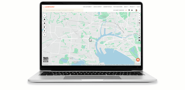
As we live in a digital world, Landchecker is made available to you through a variety of mediums such as desktop, phone or tablet. When using Lanchecker for land zoning, you can follow these simple steps. You can also view additional information including land boundaries and property reports.
If you’re interested in using Landchecker to assist in making data-driven decisions, either personally or professionally, get in touch with our team to discover our plans tailored to you and how we can streamline your research process.

What does my plan include?
Paid yearly Paid monthly | Starter Free | Standard | Advanced | Enterprise Contact Sales |
|---|---|---|---|---|
Additional cost per member | ||||
Property Information | ||||
... and many more | ||||
Map Views | ||||
ICEYE Flood Layer? | ||||
Metromap high resolution aerial imagery? | ||||
... and many more | ||||
Tools | ||||
Measuring tools? | ||||
Planning permit filtering? | ||||
Planning permit alerts? | 10 per member | Unlimited | Unlimited | |
Save properties to Projects? | ||||
Site Consolidation ? | ||||
... and many more | ||||
Documents & Reports | ||||
Title and Document searches? | ||||
Premium property reports | 10 per member | Unlimited | Unlimited | |
... and many more | ||||
Business Features | ||||
Credit terms available | ||||
... and many more | ||||


