
Product Help
How to view neighbourhood plans in Brisbane
Brisbane City Council neighbourhood plans sit within the place-based plans layer in Landchecker.
They break down planning areas into boundaries, precincts, and sub-precincts, giving you a more granular view of the planning controls that apply to a site beyond its base zone. This data is available on all plans, including the free plan.
How do I turn on neighbourhood plans for a Brisbane property?
1. Search for a Brisbane property address using the search bar, or navigate your map to the Brisbane area.
2. In the left-hand panel, click Planning Layers.
3. Under planning layers, click Place-based plans to expand the section.
4. In the dropdown, select Neighbourhood plans. Three sublayers will appear: Boundaries, Precincts, and Sub-precincts.
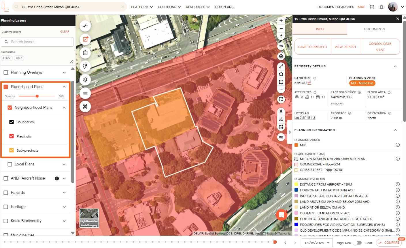
5. Tick the checkbox next to each sublayer you want to display. You can enable all three, or toggle on only the ones relevant to your assessment.
Once enabled, the neighbourhood plan boundaries will appear as overlays on the map.
6. For more details on the neighbourhood plan applicable to the selected property, open the right-hand panel and scroll to the Planning information section. Click the i (information) button to learn more about the plan.
7. If the property falls within a neighbourhood plan area, click View report to download a report showing the neighbourhood plan layer and the controls that apply to that site.
Can I adjust how the neighbourhood plan layers look on the map?
Yes. To reduce visual clutter or overlay neighbourhood plans alongside other layers, you can adjust the opacity of each sublayer using the opacity slider. Drag it left to make the layer more transparent, or right to increase it.
If you use neighbourhood plans regularly, you can save them as a favourite by clicking the star icon next to the layer. This pins it to your favourites for quicker access in future sessions.
What is the difference between boundaries, precincts, and sub-precincts?
Neighbourhood plan boundaries show the outer extent of a neighbourhood plan area. Precincts divide that area into smaller zones with specific planning intent or controls.
Sub-precincts provide an even finer breakdown within a precinct, often carrying more detailed use or built form requirements.
You can enable all three together for a complete picture, or isolate one layer if you only need a specific level of detail.
Which plan do I need to view neighbourhood plans layer?
Neighbourhood plans are available on all Landchecker plans, including the free plan. You can access this layer without needing to upgrade.
Are neighbourhood plans available outside Brisbane?
Currently, neighbourhood plan coverage focuses on Brisbane City Council properties. If you are looking for place-based planning information in other Queensland councils or states, check the planning layers panel to see what is available in your area, as coverage continues to expand.
If you have questions about neighbourhood plans or need help navigating the planning layers panel, start a live chat with our support team from within the platform.