Articles
NSW Koala Management Strategy And Proposed Habitat Maps
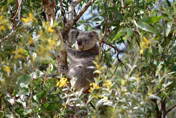
Koalas are not just synonymous with Australia, but also iconic fixtures of our culture across the world.
Unfortunately, they are facing a dramatic and continued decline, and as such, the koala population was listed as endangered on 12th February 2022.
Apart from being an important ecological concern, in the context of property development, there are now additional considerations required for how a project may impact koalas.
What is the NSW Koala Management Strategy?
As building development projects continue to increase and expand across many areas of NSW, the koala community is under pressure.
As a result of this, the NSW Government has released standardised maps that identify key habitats for koalas. They are intended to help halt the rapid decrease of the environment they rely on for food, breeding and shelter.
The maps act as a necessary guide for councils and developers to use in an effort to help protect, stabilise, conserve and increase the koala population for the future.
Over one hundred million dollars has been pledged by the NSW Government as part of a 5-year investment plan to manage the above goals over the long term. This is known as the “NSW Koala Management Strategy”.
One of the key components of this is private land conservation agreements and ensuring local actions align with the management focus and reduce threats.
What do the Maps do?
The maps use data from the Atlas of NSW Wildlife and relate to the state environmental planning policy 44 and offer information as to:
Where koalas live
Where the trees that support them are located
Which areas need are marked for protection
Their data will help inform key decision making on mitigation of activities such as native forestry.
Map information will also help support local communities to conserve koalas, and protect, restore and improve the condition of 47,000 hectares of koala habitat.
They are viewed as so important because of the role this data can play in mitigating the impact of the two biggest threats to koalas: habitat loss and climate change.
Some of the key targets for the NSW Koala Management Strategy include:
Adding up to 15,000 hectares of koala habitat to the national park estate
Adding protection status to 7,000 hectares of koala habitat on private land
Restoring 20,000 hectares of habitat
A goal of doubling the koala population by the year 2050
How the Maps Help Property Owners:
The data and categorised land available via the Koala Habitat maps support koala conservation at many levels – including property owners in relevant areas.
They are a resource and tool that private landholders and developers can use to understand koala conservation decisions and the prioritised locations for the establishment of new koala reserves and conservation agreements.
Although the maps do not categorise land for regulatory purposes, they provide the necessary information to support decision making in a land and property context.
For example:
Landowners can also use the maps to identify areas marked for restoration
Landowners can find which land areas should be off limits for development
There are several layers to the maps, including statewide spatial information like:
Koala Habitat
Finding a koala habitat at any location
Preferred tree species koalas are known to use for food/shelter
The likelihood of finding a koala at a location
Koala sightings in NSW