
Product Help
How to view permit coverage
View the Lanchecker coverage map today to see if we show permits/DAs in your area.
1. Turn on the planning permit layer
In the layers menu on the left-hand-side of your map view, click on the Planning Permits icon.
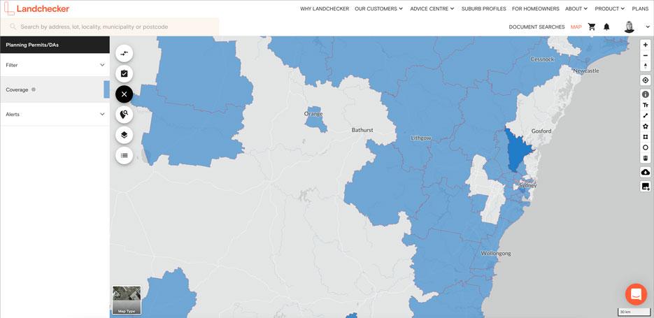
2. Check permit coverage of an area
Select Coverage in the Planning Permits/DAs side panel
In the map, view (in blue) the areas in Australia where planning permit information is digitised, hence accessible through Landchecker.
Drag / zoom in to view your search area. If it is blue, it is covered.
NB: It is important to check the coverage of your search area, because if there aren’t any permits that are showing up in your search, it is likely that the area isn’t covered.