Product Help
How to use the Distance To tool
Assess the location of a property to nearby amenities and see how far you can walk, bike or drive within a specified time period using the Distance To tool, via the right-hand side information panel for every property in Australia.
1. Search a property on the address search bar
2. On the right-hand side information panel, scroll down to view the Distance To section
3. Select a Travel Mode
Walking
Cycling
Driving
4. Select a time frame from 5 minutes to 60 minutes. You can select a maximum of 4 time frames.
If you want to start over and select different time frames or a new travel mode, simply click the Reset button.
5. Click Submit
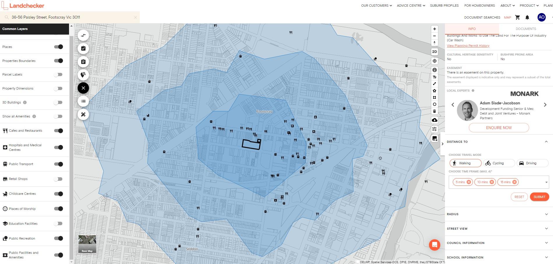
Once you’ve submitted your selection, a blue overlay appears on the map showing the areas covered by the search options you have set.
If you have selected more than one time frame, multiple shades of blue overlays will appear on the map to differentiate the ‘catchment areas’ that fall within the time frames you’ve selected.
How to Switch on Amenities while using the Distance To tool
Head to the Common Layers circle on the left-hand side of the platform and switch on all Amenities, or individually by type, to assess the property’s proximity to nearby amenities including public transport, schools, restaurants and hospitals.