
Product Help
A quick overview of drawing tools
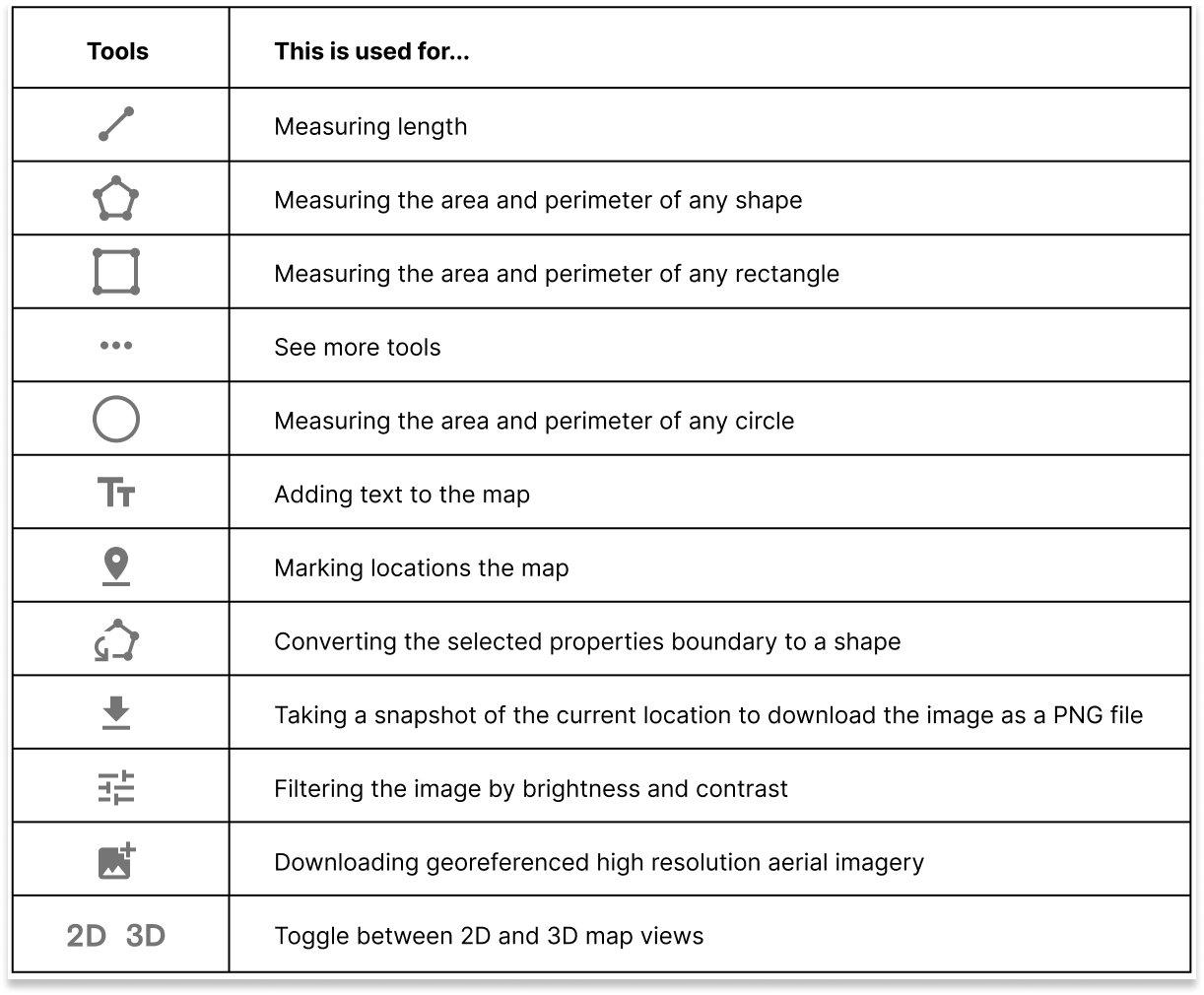
Create site plans and measure the area of a property right from your desktop using the drawing tools. The following options are available on the right-hand side Toolbar:
What's included in your plan
Drawing tools are available on Standard, Advanced and Enterprise plans.
Standard Plan
Everything you need for measurements and simple site plans:
Advanced and Enterprise Plans
All Standard features, plus enhanced tools for more complex work:
Sign up today to access Drawing Tools
On a plan already? Simply head over to the map to see the latest updates.
Customise Markups and Annotations
All markups and annotations are saved in the left-hand Tools library, where they can be reviewed and managed. If you're on an Advanced or Enterprise plan, you'll have extra controls to:
Customise a shape's fill colour
Edit a shape's stroke colour and weight
Advanced and Enterprise customers can also save markups and annotations directly to projects.
This makes it easy to keep all property insights in one place and ensures a smoother workflow when working across multiple sites.
If you regularly use projects, upgrading your plan is a great way to combine both tools for a more efficient process.
Get a Sneak Peek at the New Features Coming Soon at Landchecker
We're currently upgrading the tools on the right-hand side panel to give you a better experience measuring and annotating properties, creating site plans, and so much more!
Here’s a sneak peek into what our team is working on.
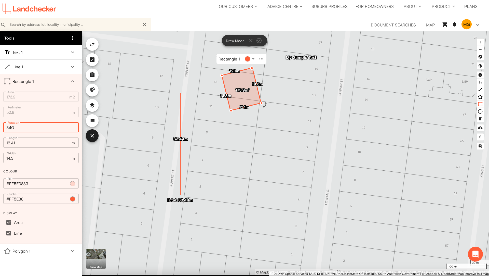
Edit Size, Rotation, Bearing and Length
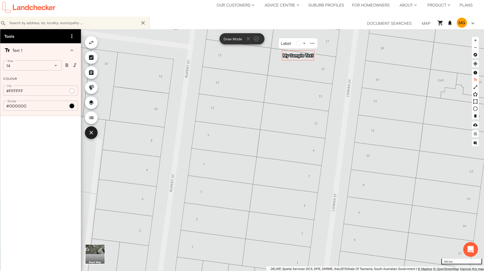
Edit Text Size, Italic and Bold
Import and Export GeoJSON
Watch this space for more updates to this section.