
Release Notes
Release notes - new look for hazards and draft activity centres data
Here’s what's new in Landchecker late October 2025
New look hazards
We've added clear source labelling for all flood, bushfire and landslide hazard data across the platform.
Whether it's state-level mapping or council-specific overlays, you'll see exactly where your hazard information is coming from.
Here's what we've added:
On the map – Choose between state, council, or ICEYE flood layers, clearly labelled so you know what you're viewing
In the info panel – See the source authority, status, and when it was last updated.
In your reports – All flood data and sources automatically included in premium property reports, ready to share with clients
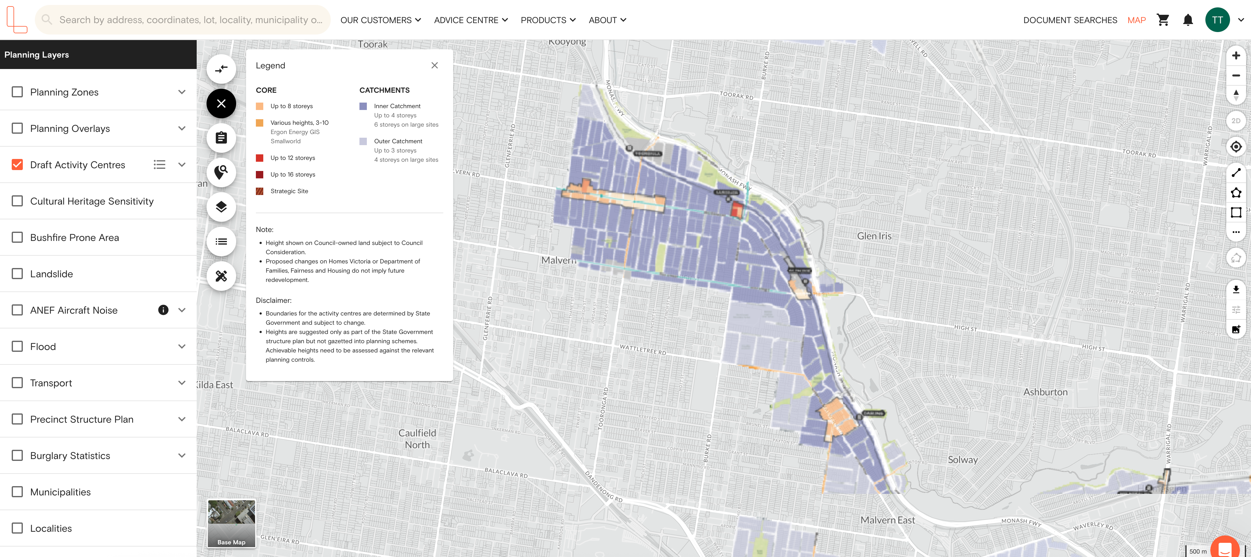
Victorian Draft Activity Centres
The Victorian government is proposing 60 activity centres around existing transport infrastructure. Phase 1 and Phase 2 are mapped on our platform, providing you with instant access to where the Victorian government plans to concentrate housing and development across Melbourne.
What this means for property professionals like you:
Identify development opportunities before they become obvious
Complete due diligence faster with all the draft maps in one place
Overlay draft activity centres with existing planning zones (HCTZ, BFO)


