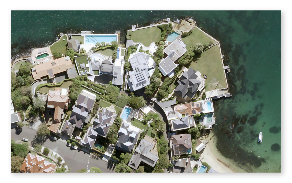
High-Resolution Aerial Imagery
Affordable, flexible subscriptions from just $50 / mo
VIEW SUBSCRIPTION PLANSLoading ...
Assess sites without leaving your desk
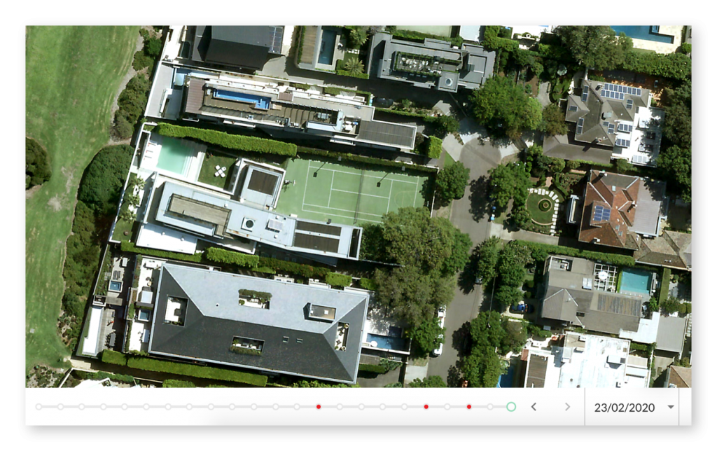
View clear and current High-Resolution Aerial Imagery of Victoria and New South Wales.
Imagery is captured from a plane flying at low altitude, resulting in photographs 6x higher resolution than the best available satellite image.
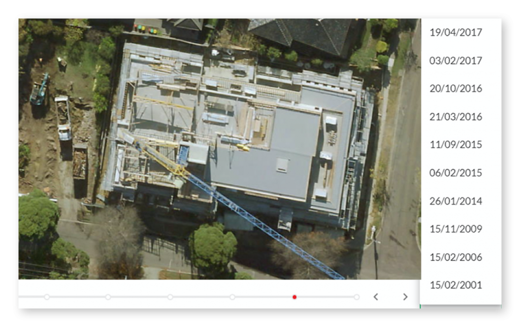
Understand changes over time
Browse an extensive timeline of past aerial images to uncover changes over time and seasonal differences.
New images are available 3-4 times a year in metro areas.
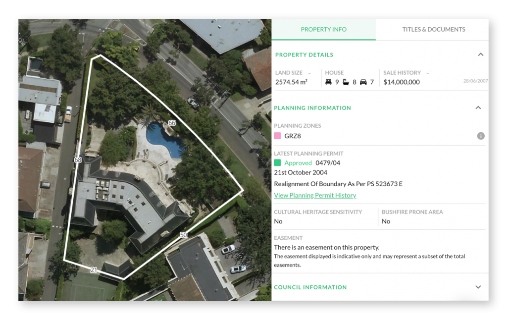
Save time, get all your property information in one place
Landchecker is an all-in-one source of property information. Check planning information and restrictions, site size, planning permits, previous sale price and more. You can even conduct Title and Document searches.
Made to measure
Measure areas of interest with ease. Quickly determine length, area and radius, then export imagery with saved measurements and text annotations for future reference.
Export beautiful high-resolution photographs
Export crisp, high-resolution aerial photographs of properties for reports or marketing material. This is a great way to illustrate how a property is situated within a site or the proximity to services.
Affordable, instant, flexible, unlimited
Affordable plans starting from just $50 / mo
Subscribe online and get started instantly – Not a pushy salesperson in sight
Cancel at any time, there are no lock-in contracts
No data caps, so you don’t need to worry about getting locked out towards the end of the month
Want to get technical?
Who is the provider of high-res aerial imagery?
High-res aerial imagery is provided by Aerometrex. Since its establishment in 1980, Aerometrex has built a very strong national and international reputation as a leading practitioner of aerial imaging, photogrammetry, 3D modelling and LiDAR surveys.
What is the coverage?
High-Resolution Aerial Imagery is currently available in metro areas in Victoria and New South Wales. New images are available 3-4 times a year in metro areas.
What resolution are the images?
Image resolutions range from 5 – 10 cm (measured per pixel as GSD – ground sample distance) and have an accuracy of up to 2 pixels.
What are the export options?
Export a Georeferenced image with comprehensive projection options. We will email you the image, World File and Projection file to import into a GIS or CAD application.


