
Company News
New 3D Building View helps professionals to conduct desktop assessments
The latest version of Landchecker Professional includes the option to view buildings in 3D. When used in conjunction with High-Resolution Aerial Imagery and planning layers, professionals can quickly gain an in-depth understanding of a suburb or area without leaving their desk.
Plus, new useability improvements enhance the everyday experience for all users across all subscription types
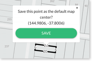
Set your local area as the default map location when Landchecker is opened
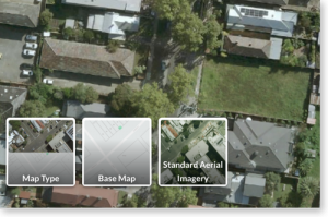
‘Map Type’ has moved to a more accessible location
To turn on Aerial imagery, navigate to the bottom left-hand corner of the map
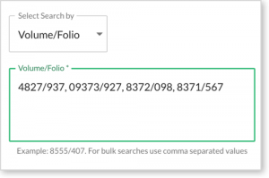
Conduct bulk Title or Document searches with ease
Under ‘Document Searches’ paste a list of Volume/Folio numbers.
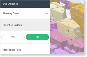
In NSW, view the Height of Building planning restriction in 3D
In the Due Diligence section, under ‘Building Heights’ select ‘3D’.
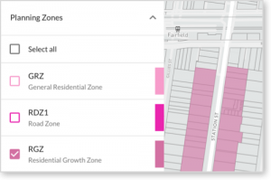
Select / unselect all layers
Easily view just one or two layers of interest on the map.
Want to conduct desktop assessments including 3D buildings? Subscribe to Landchecker Professional today, your all-in-one source of property information.