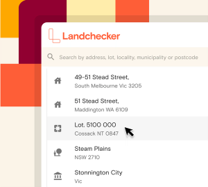
Search for a property by address, lot, locality, municipality, postcode. Toggle to search by coordinates.

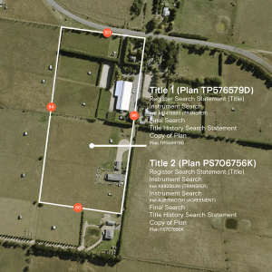
Access competitively priced title, plan, instrument and company searches directly from the Landchecker map, and enjoy a more streamlined process to acquire the documentation you need for your subject property.

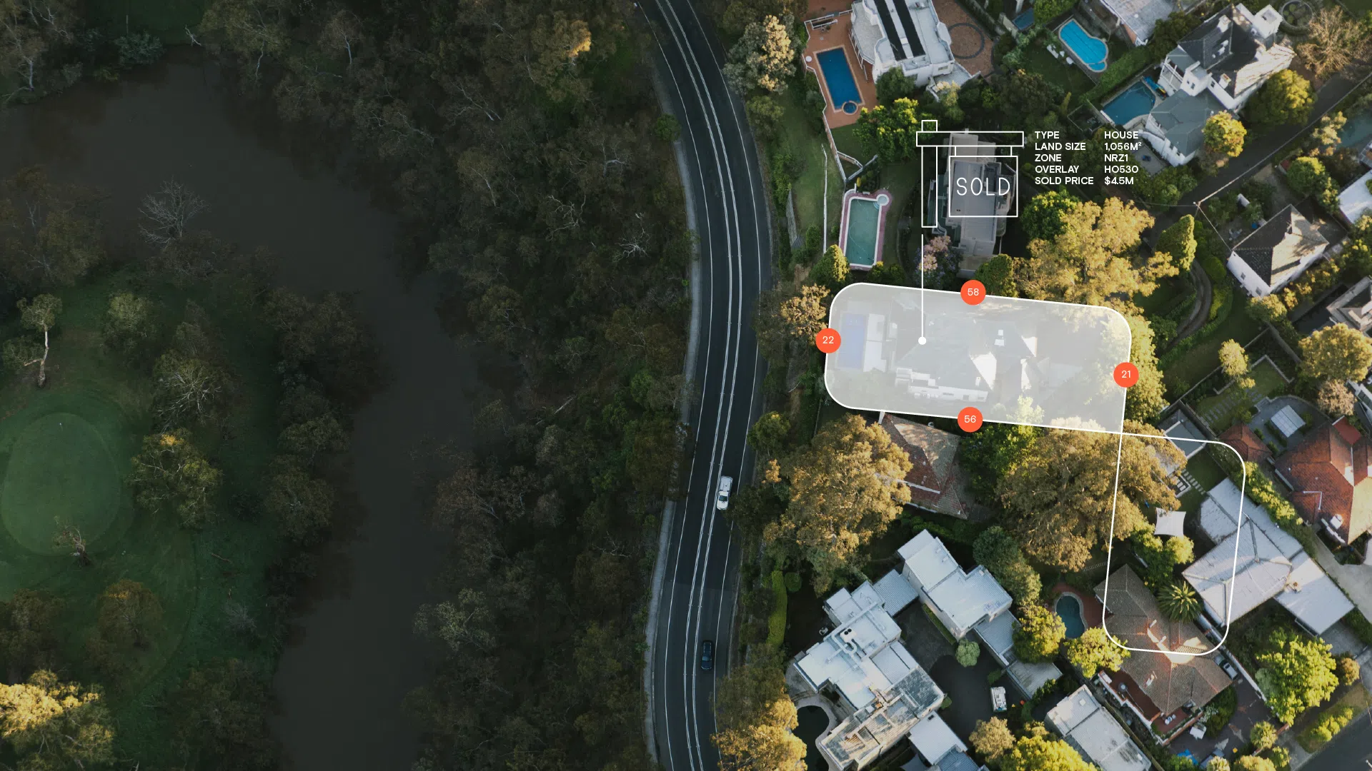
View your subject property and surrounds in high-resolution imagery from aerial vantage. High-resolution images provided by Aerometrex are six times higher in resolution than the best available satellite image. Access current and historic images to form a clear view of your subject property over time, to date. High-resolution images are updated quarterly in Metro areas across every state.

Consolidate all the information relating to your subject property in one easy-to-read PDF, and customise it with your company logo for ready distribution to clients. The Premium Property Reports arms you with comprehensive data sets you need to make the best property decisions for you and your clients, with confidence.

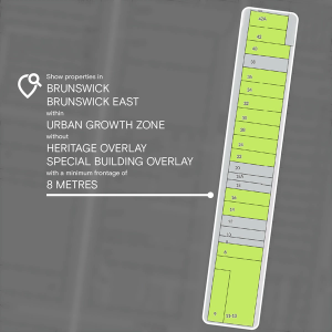
Narrow down an entire state to a handful of suitable sites in seconds using our advanced filters. Simplify your site acquisition with one map-view showing identified potential. Scout out prospective properties for your next listing or project in a single search, from desktop vantage.

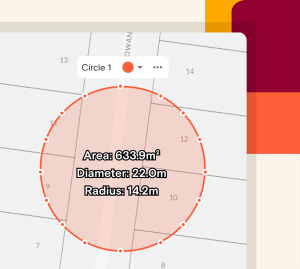
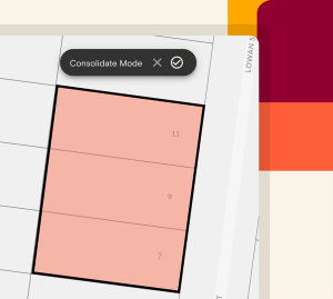
Plot and annotate a property from the map view using shape, line, pin and text tools. Edit the colour and opacity, group and rename shapes then share with your team to collaborate.

Save your properties to projects, upload documents then share and collaborate with your team members. Manage past, present and prospective projects efficiently and streamline your work-flow effectively through one access point.

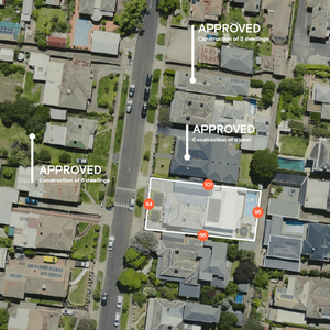
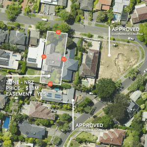
Keep your finger on the pulse of local permit or development application activity with the Permit/DA Filter and Permit/DA Alerts functions in Landchecker. View approved, pending and rejected permits/DA's easily in your map-view using the traffic light filtering system. Opt for daily or weekly alerts on the status of permits/DA's in your locality relevant to your subject property.

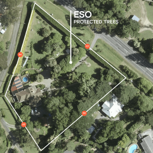
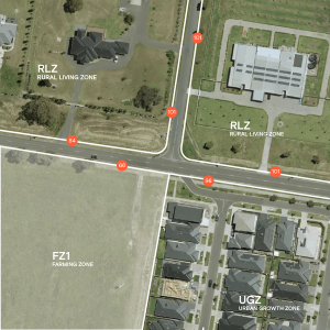
Quickly see consolidated information such as land size, frontage, orientation and zoning on the map to analyse future site potential.

Experience a whole new dimension with 3D terrain views that seamlessly integrate with our high-resolution imagery, comprehensive data layers and powerful drawing tools.

Virtually explore and navigate through neighbourhoods to see properties, cities, and landmarks from a first-person perspective.