Traralgon VIC 3844

This Traralgon suburb profile includes demographic data and planning information to help you make an informed property decision.
An average home in Traralgon is owned with a mortgage by couples without children. The average age in Traralgon is 39. Separate houses are common in Traralgon and the area is mostly FARMING ZONE (50.54%), NEIGHBOURHOOD RESIDENTIAL ZONE (13.31%) and GENERAL RESIDENTIAL ZONE (11.31%).
Traralgon demographics
Population
26907
Average Age
39
Age Distribution
Employment Type
Median Weekly Income
Traveled to Work
Car
88.2%
Tram
0.0%
Bicycle
0.4%
Train
0.2%
Walking
2.3%
Bus
0.7%
Traralgon property information
Number of Bedrooms
Tenure Type
Property Types in Traralgon
Separate house
Semi detached house
Unit/Apartment
Median monthly mortgage repayments
$1,300
Median weekly rental payments
$275
Average number of bedrooms per dwelling
3.1
Average number of people per household
2
Household Composition
Family Composition
Couple family without children
One parent family
Couple family with children
TRARALGON planning zones
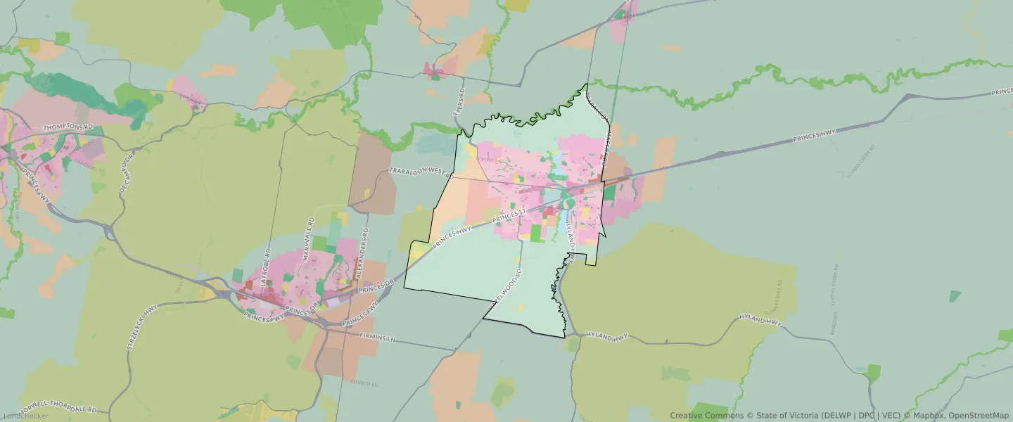
| Zone Code | Zone Name | Percentage Covered | Area Covered | |
|---|---|---|---|---|
| ACZ | ACTIVITY CENTRE ZONE | 0.87% | 488,513㎡ | |
| C1Z | COMMERCIAL 1 ZONE | 0.17% | 94,936.35㎡ | |
| C2Z | COMMERCIAL 2 ZONE | 0.29% | 163,638.24㎡ | |
| FZ | FARMING ZONE | 50.54% | 28,397,363.56㎡ | |
| GRZ | GENERAL RESIDENTIAL ZONE | 11.31% | 6,355,872.67㎡ | |
| IN1Z | INDUSTRIAL 1 ZONE | 0.63% | 351,976.96㎡ | |
| IN3Z | INDUSTRIAL 3 ZONE | 0.21% | 115,917.48㎡ | |
| LDRZ | LOW DENSITY RESIDENTIAL ZONE | 3.15% | 1,771,465.14㎡ | |
| MUZ | MIXED USE ZONE | 0.28% | 158,692.14㎡ | |
| NRZ | NEIGHBOURHOOD RESIDENTIAL ZONE | 13.31% | 7,481,254.42㎡ | |
| PCRZ | PUBLIC CONSERVATION AND RESOURCE ZONE | 1.42% | 797,657.45㎡ | |
| PPRZ | PUBLIC PARK AND RECREATION ZONE | 2.43% | 1,368,409.02㎡ | |
| PUZ | PUBLIC USE ZONE | 1.98% | 1,112,973.37㎡ | |
| RGZ | RESIDENTIAL GROWTH ZONE | 1.06% | 595,392.72㎡ | |
| RLZ | RURAL LIVING ZONE | 6.99% | 3,929,058.08㎡ | |
| SUZ | SPECIAL USE ZONE | 1.2% | 676,426.59㎡ | |
| TRZ1 | TRANSPORT ZONE | 0.72% | 402,954.52㎡ | |
| TRZ2 | TRANSPORT ZONE | 2.23% | 1,253,823.99㎡ | |
| UFZ | URBAN FLOODWAY ZONE | 1.2% | 675,003.39㎡ |
Looking to research a property in TRARALGON?
Go to mapData Source - ABS