Nadgee NSW 2551
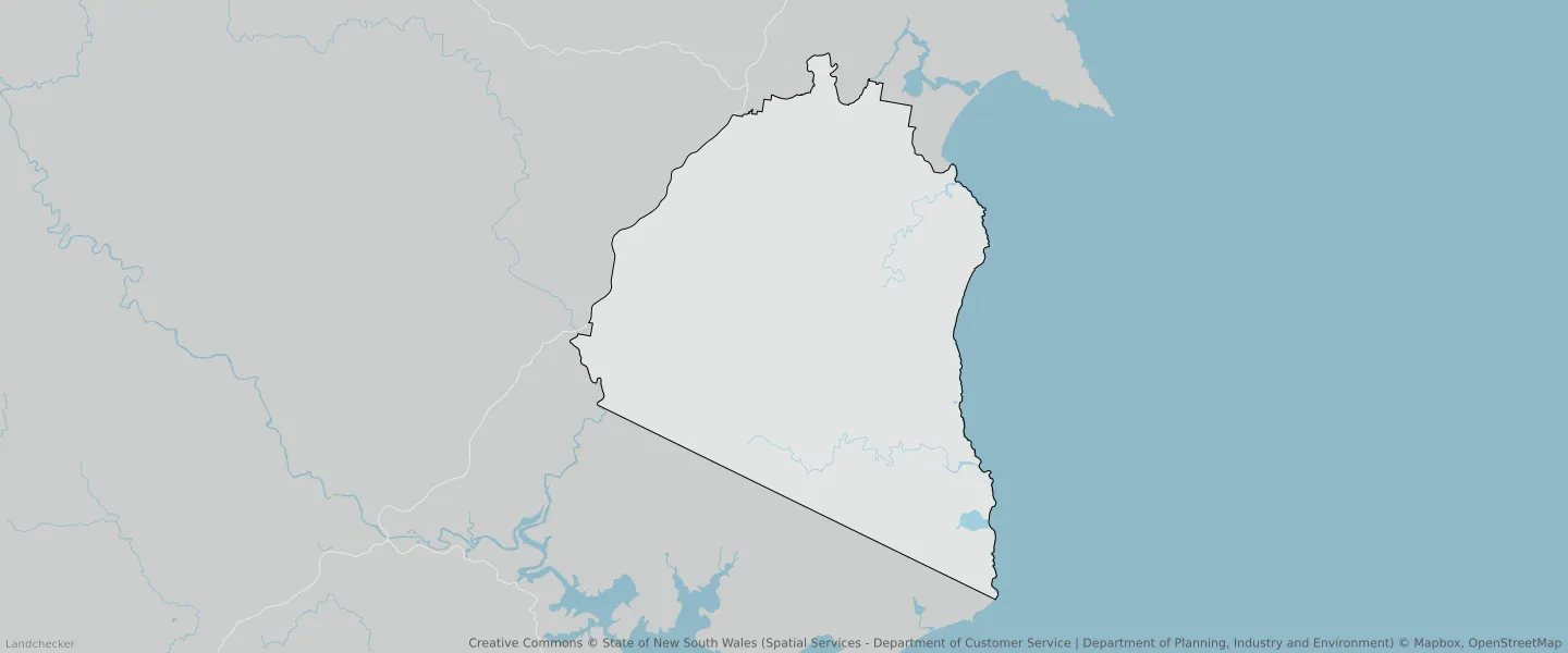
This Nadgee suburb profile includes demographic data and planning information to help you make an informed property decision.
An average home in Nadgee is other/not stated by group households. The average age in Nadgee is 0. Units and Apartments are common in Nadgee and the area is mostly Forestry (50.72%), National Parks and Nature Reserves (47.86%) and Environmental Conservation (0.43%).
NADGEE planning zones
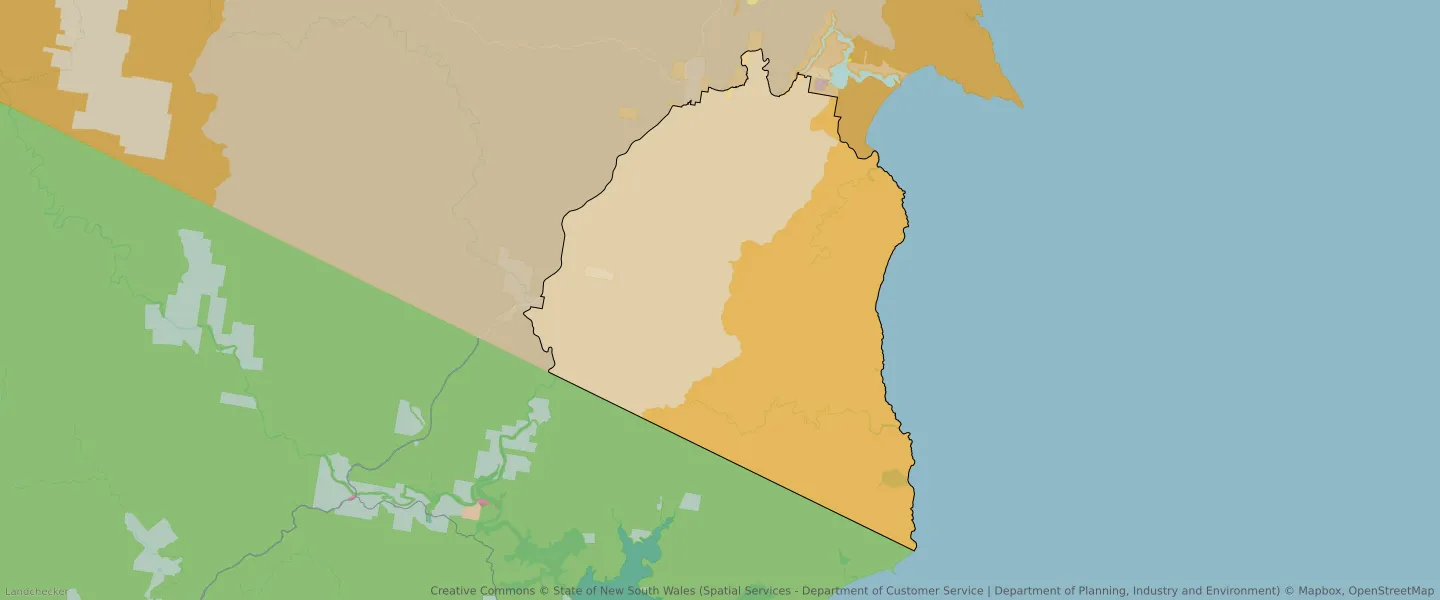
| Zone Code | Zone Name | Percentage Covered | Area Covered | |
|---|---|---|---|---|
| C1 | National Parks and Nature Reserves | 47.86% | 202,501,346.13㎡ | |
| C2 | Environmental Conservation | 0% | 4,359.01㎡ | |
| C3 | Environmental Conservation | 0.43% | 1,836,387.65㎡ | |
| RU2 | Rural Landscape | 0.36% | 1,544,943.12㎡ | |
| RU3 | Forestry | 50.72% | 214,751,775.44㎡ |
Looking to research a property in NADGEE?
Go to mapData Source - ABS