Mindarie WA 6030
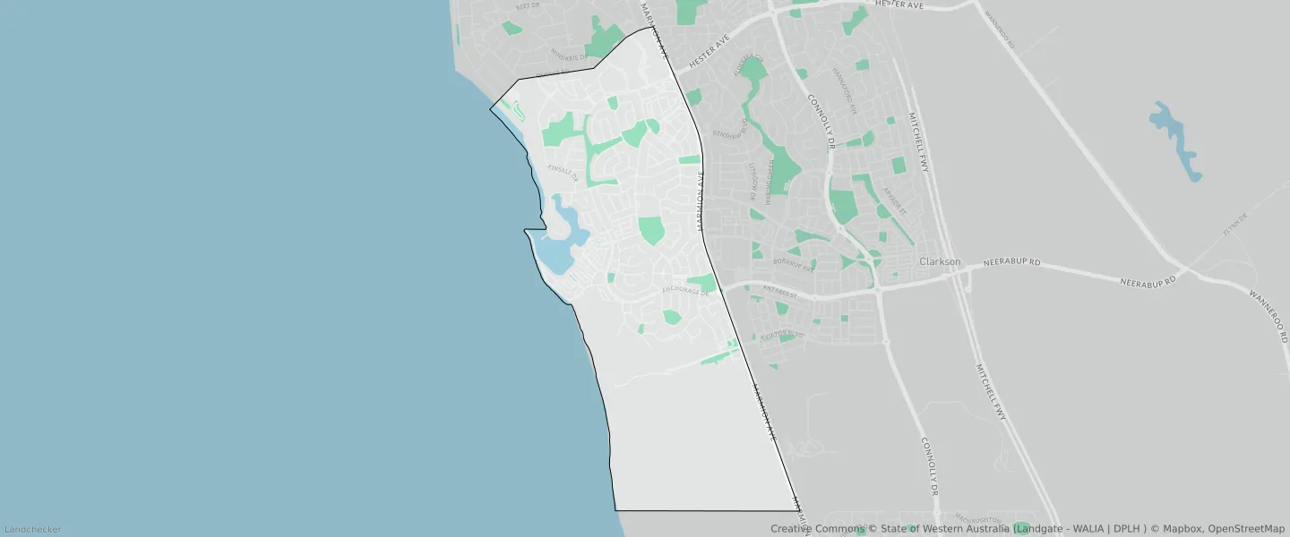
This Mindarie suburb profile includes demographic data and planning information to help you make an informed property decision.
An average home in Mindarie is owned with a mortgage by couples with children. The average age in Mindarie is 45. Separate houses are common in Mindarie and the area is mostly URBAN ZONE (55.32%), URBAN (55.32%) and R20 (38.16%).
Mindarie demographics
Population
7867
Average Age
45
Age Distribution
Employment Type
Median Weekly Income
Traveled to Work
Car
81.6%
Tram
0.0%
Bicycle
0.2%
Train
5.2%
Walking
1.5%
Bus
0.8%
Mindarie property information
Number of Bedrooms
Tenure Type
Property Types in Mindarie
Separate house
Semi detached house
Unit/Apartment
Median monthly mortgage repayments
$2,362
Median weekly rental payments
$500
Average number of bedrooms per dwelling
3.9
Average number of people per household
3
Household Composition
Family Composition
Couple family without children
One parent family
Couple family with children
MINDARIE planning zones
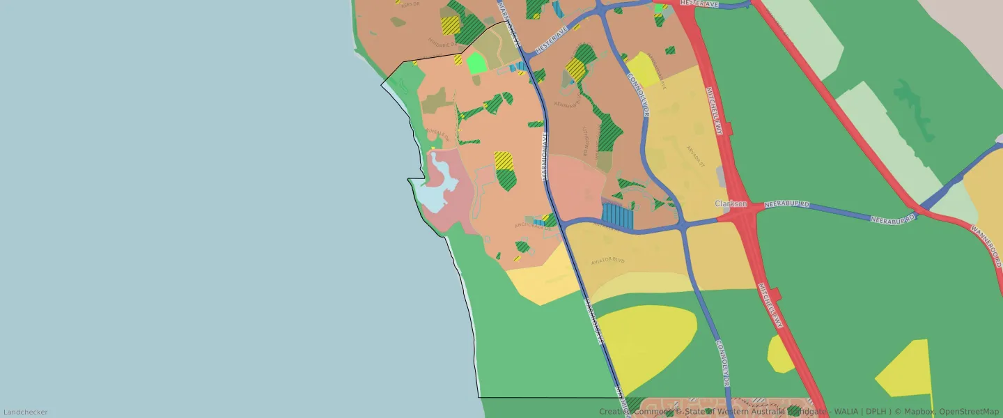
| Zone Code | Zone Name | Percentage Covered | Area Covered | |
|---|---|---|---|---|
| COMMERCIAL | COMMERCIAL | 0.14% | 8,987.59㎡ | |
| DRAINAGE AND WATERWAYS | DRAINAGE AND WATERWAYS | 0.23% | 14,483.52㎡ | |
| EDUCATION | EDUCATION | 0.63% | 39,383.83㎡ | |
| ENVIRONMENTAL CONSERVATION RESERVE | ENVIRONMENTAL CONSERVATION RESERVE | 1.1% | 68,297.21㎡ | |
| OTHER REGIONAL ROADS | OTHER REGIONAL ROADS RESERVE | 2.24% | 139,636.08㎡ | |
| PRIVATE COMMUNITY PURPOSES | PRIVATE COMMUNITY PURPOSES | 2.81% | 175,073.08㎡ | |
| PUBLIC OPEN SPACE | PUBLIC OPEN SPACE | 2.76% | 172,141.15㎡ | |
| PUBLIC PURPOSES | PUBLIC PURPOSES | 0.2% | 12,702.94㎡ | |
| PUBLIC PURPOSES | PUBLIC PURPOSES RESERVE | 0.2% | 12,702.94㎡ | |
| PUBLIC PURPOSES - HIGH SCHOOL | PUBLIC PURPOSES - HIGH SCHOOL RESERVE | 0.72% | 44,999.23㎡ | |
| PUBLIC PURPOSES - PUBLIC UTILITIES | PUBLIC PURPOSES - PUBLIC UTILITIES | 0.01% | 892.69㎡ | |
| PUBLIC PURPOSES - PUBLIC UTILITIES | PUBLIC PURPOSES - PUBLIC UTILITIES RESERVE | 0.01% | 892.69㎡ | |
| R20 | R20 | 38.16% | 2,378,608.64㎡ | |
| R30 | R30 | 0.23% | 14,220.01㎡ | |
| R40 | R40 | 1.55% | 96,907.43㎡ | |
| REGIONAL OPEN SPACE | REGIONAL OPEN SPACE | 37.89% | 2,361,469.13㎡ | |
| REGIONAL OPEN SPACE | REGIONAL OPEN SPACE RESERVE | 37.89% | 2,361,469.13㎡ | |
| RESIDENTIAL | RESIDENTIAL | 24.84% | 1,548,242.74㎡ | |
| SERVICE COMMERCIAL | SERVICE COMMERCIAL | 0.35% | 22,126.41㎡ | |
| SPECIAL USE | SPECIAL USE | 5.56% | 346,792.62㎡ | |
| URBAN | URBAN | 55.32% | 3,448,242.41㎡ | |
| URBAN | URBAN ZONE | 55.32% | 3,448,242.41㎡ | |
| URBAN DEVELOPMENT | URBAN DEVELOPMENT | 4.15% | 258,952.52㎡ | |
| WATERWAYS | WATERWAYS | 3.82% | 238,117.7㎡ | |
| WATERWAYS | WATERWAYS RESERVE | 3.82% | 238,117.7㎡ |
Looking to research a property in MINDARIE?
Go to mapData Source - ABS