Lesmurdie WA 6076
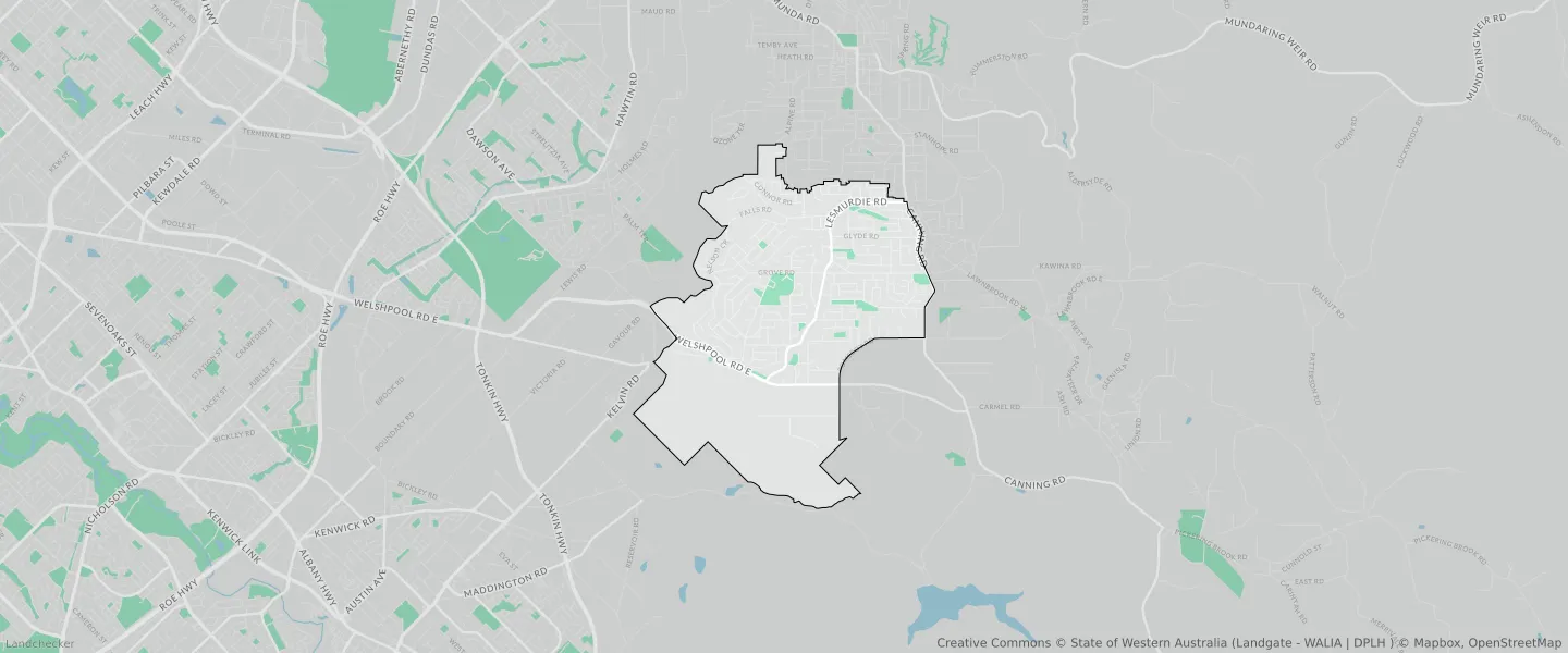
This Lesmurdie suburb profile includes demographic data and planning information to help you make an informed property decision.
An average home in Lesmurdie is owned with a mortgage by couples with children. The average age in Lesmurdie is 44. Separate houses are common in Lesmurdie and the area is mostly URBAN ZONE (55.77%), URBAN (55.77%) and REGIONAL OPEN SPACE RESERVE (38.32%).
Lesmurdie demographics
Population
8413
Average Age
44
Age Distribution
Employment Type
Median Weekly Income
Traveled to Work
Car
87.8%
Tram
0.0%
Bicycle
0.4%
Train
0.7%
Walking
1.4%
Bus
2.0%
Lesmurdie property information
Number of Bedrooms
Tenure Type
Property Types in Lesmurdie
Separate house
Semi detached house
Unit/Apartment
Median monthly mortgage repayments
$2,100
Median weekly rental payments
$350
Average number of bedrooms per dwelling
3.7
Average number of people per household
3
Household Composition
Family Composition
Couple family without children
One parent family
Couple family with children
LESMURDIE planning zones
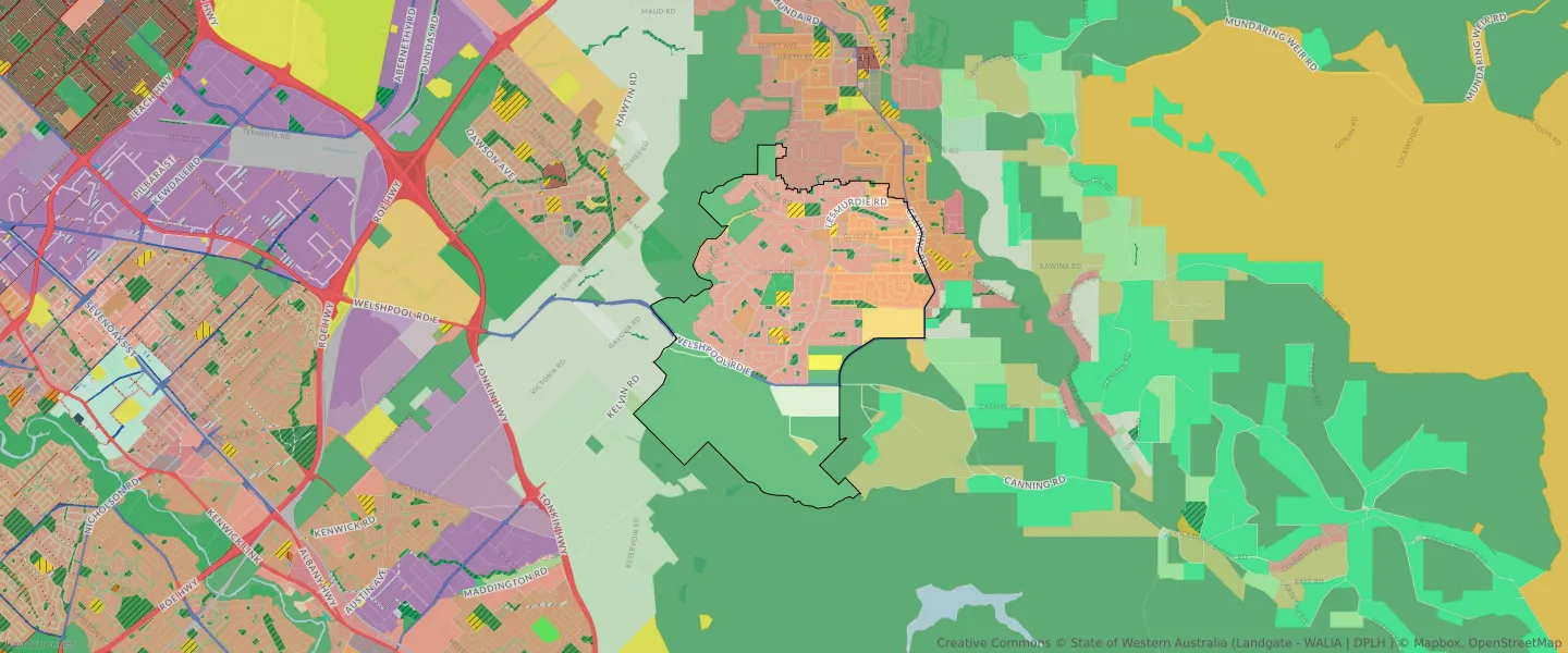
| Zone Code | Zone Name | Percentage Covered | Area Covered | |
|---|---|---|---|---|
| CIVIC AND COMMUNITY | CIVIC AND COMMUNITY | 0.03% | 3,697.59㎡ | |
| COMMERCIAL | COMMERCIAL | 0.12% | 16,194.35㎡ | |
| LOCAL OPEN SPACE | LOCAL OPEN SPACE | 2.69% | 366,833.27㎡ | |
| OTHER REGIONAL ROADS | OTHER REGIONAL ROADS RESERVE | 1.51% | 205,332.42㎡ | |
| PRIVATE CLUBS AND INSTITUTIONS | PRIVATE CLUBS AND INSTITUTIONS | 1.9% | 258,647.88㎡ | |
| PUBLIC PURPOSES | PUBLIC PURPOSES | 1.08% | 146,685.72㎡ | |
| PUBLIC PURPOSES | PUBLIC PURPOSES RESERVE | 1.08% | 146,685.72㎡ | |
| PUBLIC PURPOSES - HIGH SCHOOL | PUBLIC PURPOSES - HIGH SCHOOL RESERVE | 0.79% | 107,891.86㎡ | |
| R10 | R10 | 10.11% | 1,380,017.45㎡ | |
| R5 | R5 | 33.1% | 4,516,864.58㎡ | |
| REGIONAL OPEN SPACE | REGIONAL OPEN SPACE | 38.32% | 5,227,327.88㎡ | |
| REGIONAL OPEN SPACE | REGIONAL OPEN SPACE RESERVE | 38.32% | 5,227,327.88㎡ | |
| RESIDENTIAL | RESIDENTIAL | 36.83% | 5,025,976.1㎡ | |
| RURAL | RURAL | 3.61% | 492,970.84㎡ | |
| RURAL | RURAL ZONE | 3.61% | 492,970.84㎡ | |
| RURAL CONSERVATION | RURAL CONSERVATION | 0.31% | 42,464.17㎡ | |
| SERVICE STATION | SERVICE STATION | 0.04% | 4,795.03㎡ | |
| SPECIAL RURAL | SPECIAL RURAL | 2.92% | 398,593.99㎡ | |
| SPECIAL USE | SPECIAL USE | 0.03% | 4,048.07㎡ | |
| URBAN | URBAN | 55.77% | 7,610,068.51㎡ | |
| URBAN | URBAN ZONE | 55.77% | 7,610,068.51㎡ | |
| URBAN DEVELOPMENT | URBAN DEVELOPMENT | 3.09% | 421,978.16㎡ |
Looking to research a property in LESMURDIE?
Go to mapData Source - ABS