Langford WA 6147
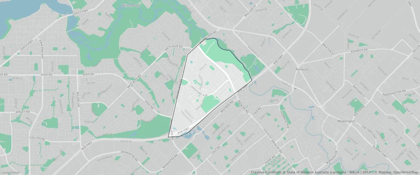
This Langford suburb profile includes demographic data and planning information to help you make an informed property decision.
An average home in Langford is owned with a mortgage by couples with children. The average age in Langford is 36. Separate houses are common in Langford and the area is mostly URBAN ZONE (70.07%), URBAN (70.07%) and RESIDENTIAL (41.55%).
Langford demographics
Population
5505
Average Age
36
Age Distribution
Employment Type
Median Weekly Income
Traveled to Work
Car
82.2%
Tram
0.0%
Bicycle
0.6%
Train
1.5%
Walking
0.7%
Bus
3.6%
Langford property information
Number of Bedrooms
Tenure Type
Property Types in Langford
Separate house
Semi detached house
Unit/Apartment
Median monthly mortgage repayments
$1,500
Median weekly rental payments
$300
Average number of bedrooms per dwelling
3.3
Average number of people per household
3
Household Composition
Family Composition
Couple family without children
One parent family
Couple family with children
LANGFORD planning zones
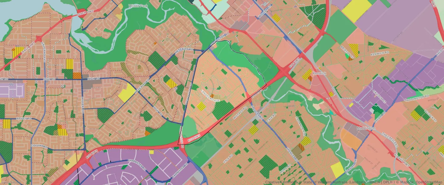
| Zone Code | Zone Name | Percentage Covered | Area Covered | |
|---|---|---|---|---|
| CIVIC AND COMMUNITY | CIVIC AND COMMUNITY | 0.35% | 11,554.65㎡ | |
| DISTRICT DISTRIBUTOR ROAD | DISTRICT DISTRIBUTOR ROAD | 1.83% | 59,995.32㎡ | |
| EDUCATION | EDUCATION | 1.51% | 49,751.42㎡ | |
| INFRASTRUCTURE SERVICES | INFRASTRUCTURE SERVICES | 0.05% | 1,483.52㎡ | |
| LOCAL CENTRE | LOCAL CENTRE | 0.98% | 32,296.93㎡ | |
| LOCAL DISTRIBUTOR ROAD | LOCAL DISTRIBUTOR ROAD | 1.73% | 56,717.81㎡ | |
| LOCAL ROAD | LOCAL ROAD | 12.22% | 401,394.39㎡ | |
| OTHER REGIONAL ROADS | OTHER REGIONAL ROADS RESERVE | 2.93% | 96,196.07㎡ | |
| PRIMARY REGIONAL ROADS | PRIMARY REGIONAL ROADS RESERVE | 6.24% | 204,943.59㎡ | |
| PRIVATE COMMUNITY PURPOSES | PRIVATE COMMUNITY PURPOSES | 2.09% | 68,772.23㎡ | |
| PUBLIC OPEN SPACE | PUBLIC OPEN SPACE | 7.17% | 235,534.3㎡ | |
| R20 | R20 | 30.39% | 998,464.12㎡ | |
| R30 | R30 | 1.17% | 38,473.6㎡ | |
| R40 | R40 | 9.67% | 317,849.79㎡ | |
| R50 | R50 | 0.48% | 15,704.98㎡ | |
| R60 | R60 | 0.8% | 26,377.18㎡ | |
| REGIONAL OPEN SPACE | REGIONAL OPEN SPACE | 20.05% | 658,941.02㎡ | |
| REGIONAL OPEN SPACE | REGIONAL OPEN SPACE RESERVE | 20.05% | 658,941.02㎡ | |
| RESIDENTIAL | RESIDENTIAL | 41.55% | 1,365,259.44㎡ | |
| SERVICE COMMERCIAL | SERVICE COMMERCIAL | 0.47% | 15,326.84㎡ | |
| URBAN | URBAN | 70.07% | 2,302,387.5㎡ | |
| URBAN | URBAN ZONE | 70.07% | 2,302,387.5㎡ | |
| URBAN DEVELOPMENT | URBAN DEVELOPMENT | 0.14% | 4,654.26㎡ | |
| WATERWAYS | WATERWAYS | 0.71% | 23,378.37㎡ | |
| WATERWAYS | WATERWAYS RESERVE | 0.71% | 23,378.37㎡ |
Looking to research a property in LANGFORD?
Go to mapData Source - ABS