Jarrahdale WA 6124
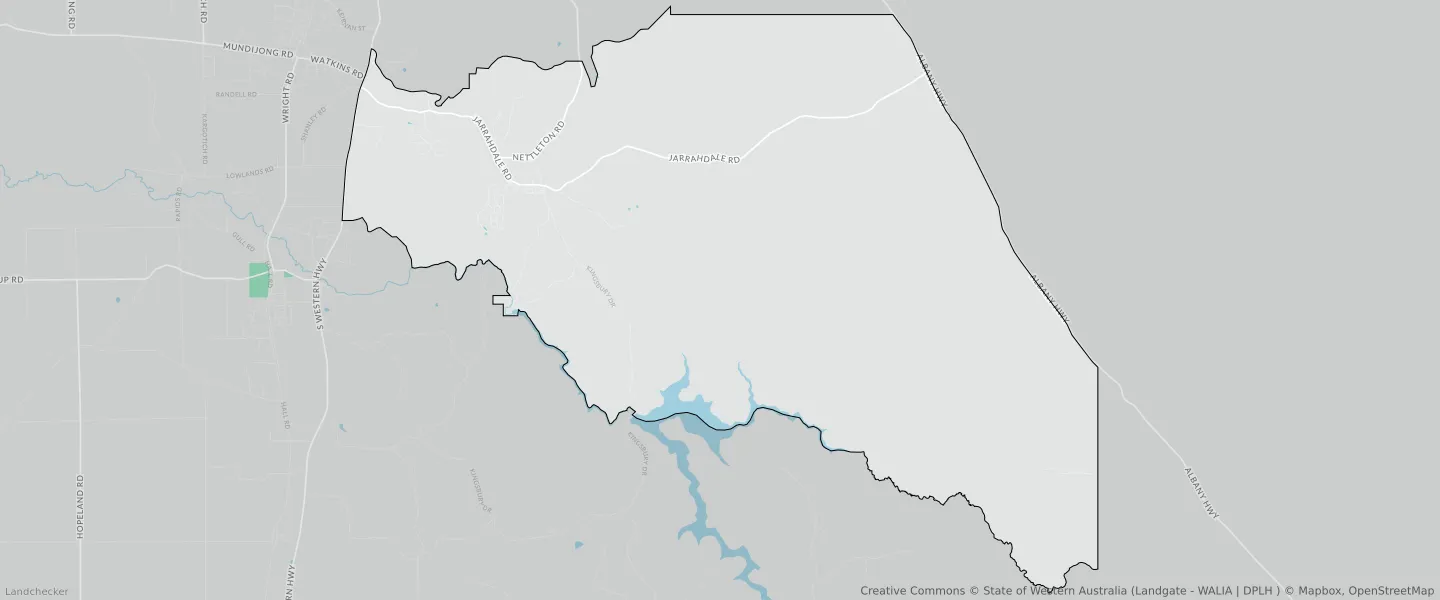
This Jarrahdale suburb profile includes demographic data and planning information to help you make an informed property decision.
An average home in Jarrahdale is owned with a mortgage by couples without children. The average age in Jarrahdale is 43. Separate houses are common in Jarrahdale and the area is mostly STATE FORESTS RESERVE (81.04%), REGIONAL OPEN SPACE RESERVE (8.26%) and REGIONAL OPEN SPACE (8.26%).
Jarrahdale demographics
Population
1205
Average Age
43
Age Distribution
Employment Type
Median Weekly Income
Traveled to Work
Car
84.8%
Tram
0.0%
Bicycle
0.0%
Train
0.0%
Walking
4.0%
Bus
1.9%
Jarrahdale property information
Number of Bedrooms
Tenure Type
Property Types in Jarrahdale
Separate house
Semi detached house
Unit/Apartment
Median monthly mortgage repayments
$1,965
Median weekly rental payments
$325
Average number of bedrooms per dwelling
3.5
Average number of people per household
3
Household Composition
Family Composition
Couple family without children
One parent family
Couple family with children
JARRAHDALE planning zones
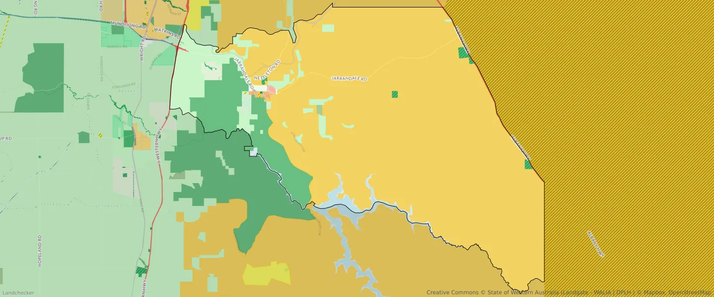
| Zone Code | Zone Name | Percentage Covered | Area Covered | |
|---|---|---|---|---|
| CEMETERY | CEMETERY | 0.01% | 20,637.87㎡ | |
| CIVIC AND COMMUNITY | CIVIC AND COMMUNITY | 0% | 11,449.56㎡ | |
| CULTURAL FACILITIES | CULTURAL FACILITIES | 0% | 418.12㎡ | |
| DRAINAGE AND WATERWAYS | DRAINAGE AND WATERWAYS | 0% | 1,108.4㎡ | |
| EDUCATION | EDUCATION | 0.01% | 31,985.73㎡ | |
| ENVIRONMENTAL CONSERVATION | ENVIRONMENTAL CONSERVATION | 0.08% | 203,233.59㎡ | |
| LOCAL ROAD | LOCAL ROAD | 0.21% | 525,246.51㎡ | |
| PRIMARY DISTRIBUTOR ROAD | PRIMARY DISTRIBUTOR ROAD | 0.09% | 222,542.72㎡ | |
| PRIMARY REGIONAL ROADS | PRIMARY REGIONAL ROADS RESERVE | 0.33% | 823,709.09㎡ | |
| PUBLIC OPEN SPACE | PUBLIC OPEN SPACE | 0.85% | 2,144,495.08㎡ | |
| PUBLIC PURPOSES - SPECIAL USES | PUBLIC PURPOSES - SPECIAL USES RESERVE | 0.01% | 22,890.24㎡ | |
| R10 | R10 | 0.06% | 144,853.19㎡ | |
| R12.5 | R12.5 | 0.08% | 213,041.52㎡ | |
| R5 | R5 | 0.01% | 19,916.81㎡ | |
| RAILWAYS | RAILWAYS RESERVE | 0.27% | 693,602.84㎡ | |
| REGIONAL OPEN SPACE | REGIONAL OPEN SPACE | 8.26% | 20,867,175.93㎡ | |
| REGIONAL OPEN SPACE | REGIONAL OPEN SPACE RESERVE | 8.26% | 20,867,175.93㎡ | |
| RESIDENTIAL | RESIDENTIAL | 0.15% | 375,646.1㎡ | |
| RURAL | RURAL | 8.19% | 20,704,722.01㎡ | |
| RURAL | RURAL | 6.03% | 15,255,849.24㎡ | |
| RURAL | RURAL ZONE | 8.19% | 20,704,722.01㎡ | |
| RURAL | RURAL ZONE | 6.03% | 15,255,849.24㎡ | |
| RURAL RESIDENTIAL | RURAL RESIDENTIAL | 0.8% | 2,017,525.92㎡ | |
| RURAL TOWNSITE | RURAL TOWNSITE | 0.01% | 13,134㎡ | |
| SPECIAL USE | SPECIAL USE | 0.24% | 617,335.21㎡ | |
| STATE FORESTS | STATE FORESTS RESERVE | 81.04% | 204,852,467.61㎡ | |
| URBAN | URBAN | 0.29% | 738,493.15㎡ | |
| URBAN | URBAN ZONE | 0.29% | 738,493.15㎡ | |
| WATERWAYS | WATERWAYS | 1.61% | 4,067,201.59㎡ | |
| WATERWAYS | WATERWAYS RESERVE | 1.61% | 4,067,201.59㎡ |
Looking to research a property in JARRAHDALE?
Go to mapData Source - ABS