Gwandalan NSW 2259
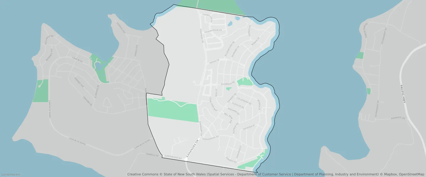
This Gwandalan suburb profile includes demographic data and planning information to help you make an informed property decision.
An average home in Gwandalan is owned with a mortgage by couples without children. The average age in Gwandalan is 42. Separate houses are common in Gwandalan and the area is mostly Environmental Living (41.93%), Environmental Conservation (21.89%) and Low Density Residential (11.56%).
Gwandalan demographics
Population
3785
Average Age
42
Age Distribution
Employment Type
Median Weekly Income
Traveled to Work
Car
91.8%
Tram
0.0%
Bicycle
0.0%
Train
0.0%
Walking
1.0%
Bus
0.0%
Gwandalan property information
Number of Bedrooms
Tenure Type
Property Types in Gwandalan
Separate house
Semi detached house
Unit/Apartment
Median monthly mortgage repayments
$1,800
Median weekly rental payments
$385
Average number of bedrooms per dwelling
3.3
Average number of people per household
3
Household Composition
Family Composition
Couple family without children
One parent family
Couple family with children
GWANDALAN planning zones
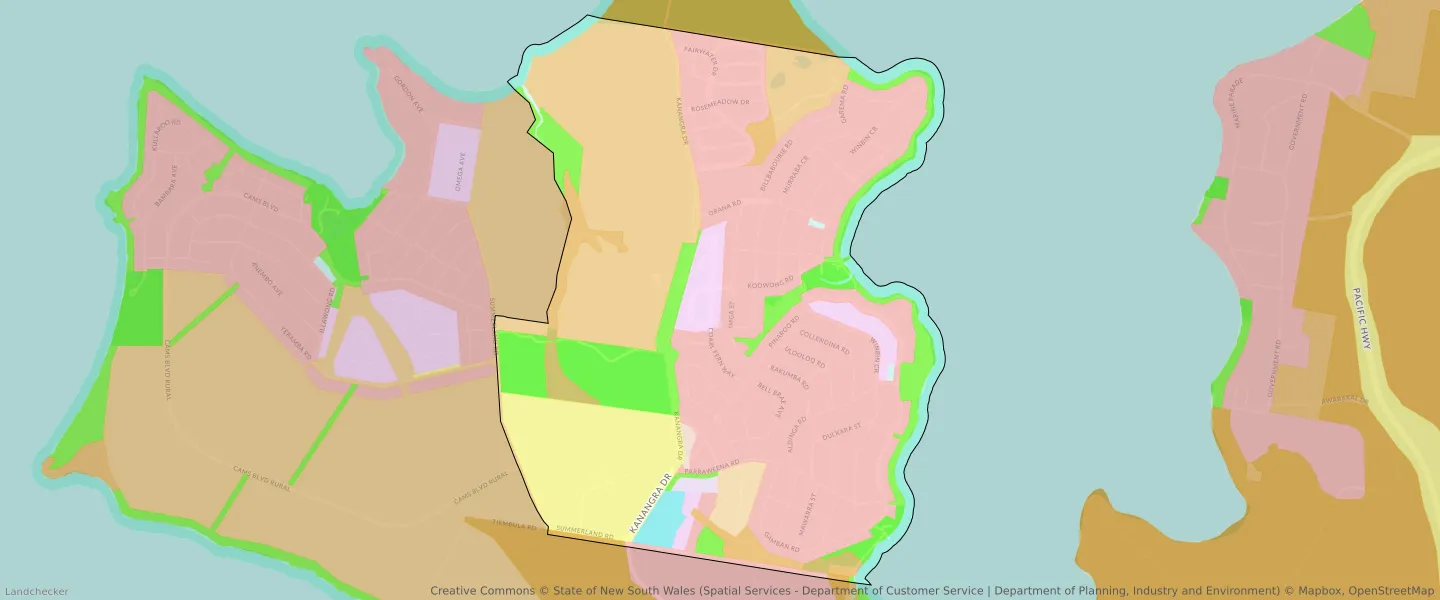
| Zone Code | Zone Name | Percentage Covered | Area Covered | |
|---|---|---|---|---|
| C1 | National Parks and Nature Reserves | 0.26% | 8,066.26㎡ | |
| C2 | Environmental Conservation | 3.84% | 120,899.19㎡ | |
| C3 | Environmental Conservation | 21.89% | 689,511.76㎡ | |
| C4 | Environmental Living | 1.35% | 42,598.27㎡ | |
| E1 | Local Centre | 1.04% | 32,798.22㎡ | |
| E4 | General Industrial | 0.32% | 9,938.79㎡ | |
| R1 | General Residential | 3.29% | 103,683.64㎡ | |
| R2 | Environmental Living | 41.93% | 1,320,982.9㎡ | |
| R5 | Large Lot Residential | 0.19% | 6,120.08㎡ | |
| RE1 | Low Density Residential | 11.56% | 364,236.63㎡ | |
| SP2 | Infrastructure | 9.74% | 306,947.94㎡ | |
| W1 | Environmental Living | 0.2% | 6,239.87㎡ | |
| W1 | Environmental Living | 0.08% | 2,538.97㎡ | |
| W2 | Recreational Waterways | 4.51% | 142,116.47㎡ |
Looking to research a property in GWANDALAN?
Go to mapData Source - ABS