Granton TAS 7030
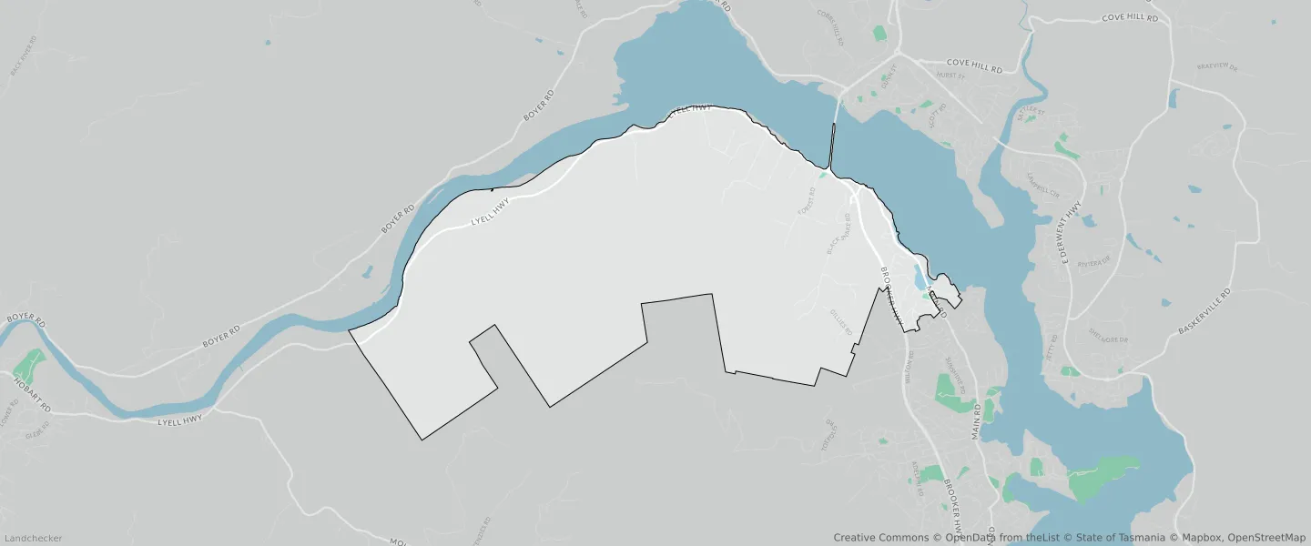
This Granton suburb profile includes demographic data and planning information to help you make an informed property decision.
An average home in Granton is owned with a mortgage by couples with children. The average age in Granton is 40. Separate houses are common in Granton and the area is mostly RURAL RESOURCE (63.95%), RURAL (45.59%) and LANDSCAPE CONSERVATION (15.49%).
Granton demographics
Population
1903
Average Age
40
Age Distribution
Employment Type
Median Weekly Income
Traveled to Work
Car
89.4%
Tram
0.0%
Bicycle
0.0%
Train
0.0%
Walking
1.5%
Bus
2.4%
Granton property information
Number of Bedrooms
Tenure Type
Property Types in Granton
Separate house
Semi detached house
Unit/Apartment
Median monthly mortgage repayments
$1,671
Median weekly rental payments
$330
Average number of bedrooms per dwelling
3.5
Average number of people per household
3
Household Composition
Family Composition
Couple family without children
One parent family
Couple family with children
GRANTON planning zones
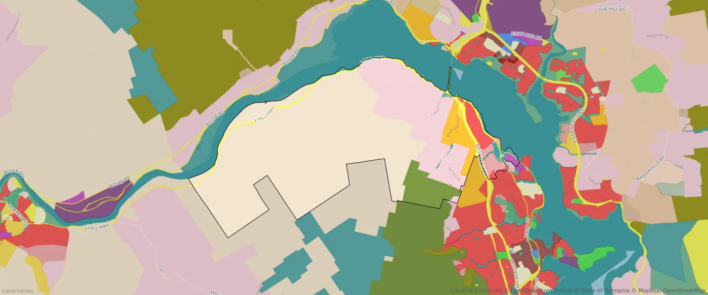
| Zone Code | Zone Name | Percentage Covered | Area Covered | |
|---|---|---|---|---|
| ENVIRONMENTAL MANAGEMENT | ENVIRONMENTAL MANAGEMENT | 0.84% | 211,766.99㎡ | |
| ENVIRONMENTAL MANAGEMENT | ENVIRONMENTAL MANAGEMENT | 3.05% | 770,273.06㎡ | |
| FUTURE URBAN | FUTURE URBAN | 3.26% | 823,727.61㎡ | |
| GENERAL RESIDENTIAL | GENERAL RESIDENTIAL | 1.93% | 487,705㎡ | |
| LANDSCAPE CONSERVATION | LANDSCAPE CONSERVATION | 4.79% | 1,209,660.74㎡ | |
| LANDSCAPE CONSERVATION | LANDSCAPE CONSERVATION | 15.49% | 3,913,682.08㎡ | |
| LIGHT INDUSTRIAL | LIGHT INDUSTRIAL | 0.28% | 71,926.01㎡ | |
| LOW DENSITY RESIDENTIAL | LOW DENSITY RESIDENTIAL | 1.35% | 340,352.62㎡ | |
| OPEN SPACE | OPEN SPACE | 0.08% | 20,325.73㎡ | |
| OPEN SPACE | OPEN SPACE | 0.11% | 27,298.4㎡ | |
| PARTICULAR PURPOSE | PARTICULAR PURPOSE | 0.19% | 48,946.82㎡ | |
| RURAL | RURAL | 45.59% | 11,518,326.2㎡ | |
| RURAL LIVING | RURAL LIVING | 5.93% | 1,497,021.33㎡ | |
| RURAL LIVING | RURAL LIVING | 14.29% | 3,611,513.09㎡ | |
| RURAL RESOURCE | RURAL RESOURCE | 63.95% | 16,157,064.66㎡ | |
| UTILITIES | UTILITIES | 1.34% | 338,205.23㎡ | |
| UTILITIES | UTILITIES | 1.57% | 398,011.1㎡ |
Looking to research a property in GRANTON?
Go to mapData Source - ABS