Fortescue WA 6716
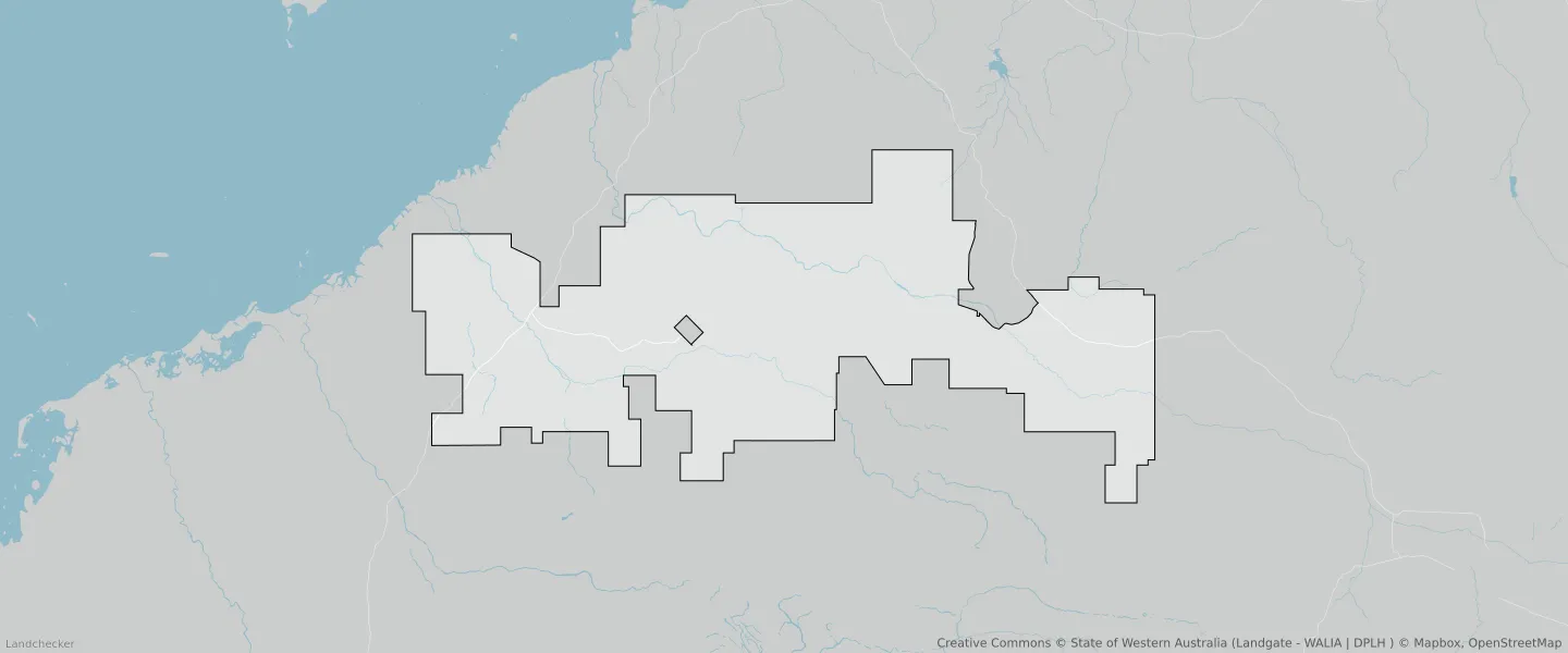
This Fortescue suburb profile includes demographic data and planning information to help you make an informed property decision.
An average home in Fortescue is other/not stated by couples without children. The average age in Fortescue is 40. Separate houses are common in Fortescue and the area is mostly RURAL ZONE (64.45%), RURAL (64.45%) and PUBLIC PURPOSES RESERVE (33.39%).
Fortescue demographics
Population
190
Average Age
40
Age Distribution
Employment Type
Median Weekly Income
Traveled to Work
Car
24.5%
Tram
0.0%
Bicycle
0.0%
Train
0.0%
Walking
11.2%
Bus
38.5%
Fortescue property information
Number of Bedrooms
Tenure Type
Property Types in Fortescue
Separate house
Semi detached house
Unit/Apartment
Median monthly mortgage repayments
$0
Median weekly rental payments
$50
Average number of bedrooms per dwelling
2.0
Average number of people per household
2
Household Composition
Family Composition
Couple family without children
One parent family
Couple family with children
FORTESCUE planning zones
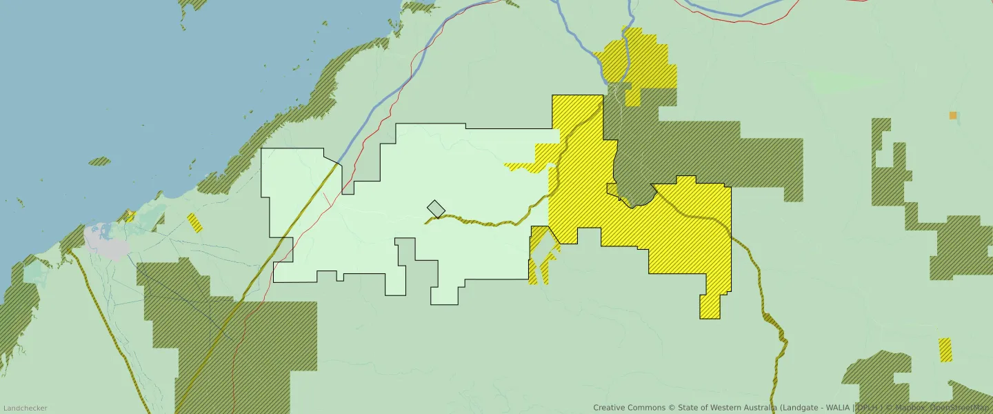
| Zone Code | Zone Name | Percentage Covered | Area Covered | |
|---|---|---|---|---|
| CONSERVATION RECREATION AND NATURAL LANDSCAPES | CONSERVATION RECREATION AND NATURAL LANDSCAPES | 0.01% | 508,423.8㎡ | |
| DISTRICT ROADS | DISTRICT ROADS | 0% | 193,613.2㎡ | |
| LOCAL ROAD | LOCAL ROAD | 0.05% | 4,570,117.04㎡ | |
| OTHER PURPOSES | OTHER PURPOSES - INFRASTRUCTURE | 2.05% | 191,299,823.49㎡ | |
| PUBLIC PURPOSES | PUBLIC PURPOSES | 33.39% | 3,121,090,425.83㎡ | |
| PUBLIC PURPOSES | PUBLIC PURPOSES RESERVE | 33.39% | 3,121,090,425.83㎡ | |
| RURAL | RURAL | 64.45% | 6,024,102,547.56㎡ | |
| RURAL | RURAL | 0% | 265,757.66㎡ | |
| RURAL | RURAL ZONE | 64.45% | 6,024,102,547.56㎡ | |
| RURAL | RURAL ZONE | 0% | 265,757.66㎡ | |
| STATE AND REGIONAL ROADS | STATE AND REGIONAL ROADS | 0.04% | 3,707,578.07㎡ |
Looking to research a property in FORTESCUE?
Go to mapData Source - ABS