Dawesville WA 6211
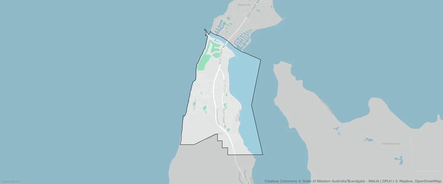
This Dawesville suburb profile includes demographic data and planning information to help you make an informed property decision.
An average home in Dawesville is owned with a mortgage by couples without children. The average age in Dawesville is 43. Separate houses are common in Dawesville and the area is mostly URBAN ZONE (33.63%), URBAN (33.63%) and WATERWAYS RESERVE (32.73%).
Dawesville demographics
Population
7143
Average Age
43
Age Distribution
Employment Type
Median Weekly Income
Traveled to Work
Car
80.6%
Tram
0.0%
Bicycle
0.0%
Train
1.1%
Walking
0.9%
Bus
4.3%
Dawesville property information
Number of Bedrooms
Tenure Type
Property Types in Dawesville
Separate house
Semi detached house
Unit/Apartment
Median monthly mortgage repayments
$1,842
Median weekly rental payments
$350
Average number of bedrooms per dwelling
3.6
Average number of people per household
3
Household Composition
Family Composition
Couple family without children
One parent family
Couple family with children
DAWESVILLE planning zones
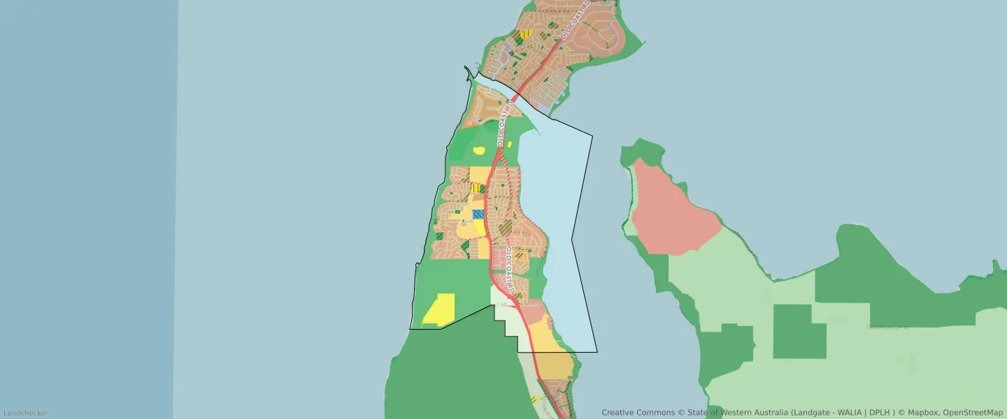
| Zone Code | Zone Name | Percentage Covered | Area Covered | |
|---|---|---|---|---|
| EDUCATION | EDUCATION | 0.19% | 35,000.91㎡ | |
| ENVIRONMENTAL CONSERVATION RESERVE | ENVIRONMENTAL CONSERVATION RESERVE | 1.77% | 327,335.76㎡ | |
| LOCAL CENTRE | LOCAL CENTRE | 0.02% | 4,482.81㎡ | |
| LOCAL DISTRIBUTOR ROAD | LOCAL DISTRIBUTOR ROAD | 1.9% | 352,813.05㎡ | |
| LOCAL ROAD | LOCAL ROAD | 5.33% | 987,514.5㎡ | |
| NEIGHBOURHOOD CENTRE | NEIGHBOURHOOD CENTRE | 0.26% | 48,149.26㎡ | |
| PRIMARY REGIONAL ROADS | PRIMARY REGIONAL ROADS RESERVE | 2.56% | 474,090.05㎡ | |
| PRIVATE COMMUNITY PURPOSES | PRIVATE COMMUNITY PURPOSES | 1.63% | 302,313.12㎡ | |
| PUBLIC OPEN SPACE | PUBLIC OPEN SPACE | 0.85% | 157,981.75㎡ | |
| PUBLIC PURPOSES | PUBLIC PURPOSES | 0.03% | 5,924.83㎡ | |
| PUBLIC PURPOSES | PUBLIC PURPOSES RESERVE | 0.03% | 5,924.83㎡ | |
| PUBLIC PURPOSES - HIGH SCHOOL | PUBLIC PURPOSES - HIGH SCHOOL RESERVE | 0.43% | 80,110.33㎡ | |
| PUBLIC PURPOSES - PUBLIC UTILITIES | PUBLIC PURPOSES - PUBLIC UTILITIES | 2.49% | 462,289.46㎡ | |
| PUBLIC PURPOSES - PUBLIC UTILITIES | PUBLIC PURPOSES - PUBLIC UTILITIES RESERVE | 2.49% | 462,289.46㎡ | |
| R100 | R100 | 0.04% | 7,609.3㎡ | |
| R12.5 | R12.5 | 0.51% | 95,100.32㎡ | |
| R20 | R20 | 13% | 2,409,999.7㎡ | |
| R30 | R30 | 0.06% | 10,452.49㎡ | |
| R40 | R40 | 1.35% | 250,107.36㎡ | |
| R5 | R5 | 1.72% | 318,728.98㎡ | |
| R60 | R60 | 0.07% | 12,890.12㎡ | |
| REGIONAL OPEN SPACE | REGIONAL OPEN SPACE | 24.72% | 4,584,710.95㎡ | |
| REGIONAL OPEN SPACE | REGIONAL OPEN SPACE RESERVE | 24.72% | 4,584,710.95㎡ | |
| RESIDENTIAL | RESIDENTIAL | 16.46% | 3,053,088.65㎡ | |
| RURAL | RURAL | 3.43% | 636,817.99㎡ | |
| RURAL | RURAL ZONE | 3.43% | 636,817.99㎡ | |
| RURAL RESIDENTIAL | RURAL RESIDENTIAL | 3.11% | 576,017.77㎡ | |
| SPECIAL USE | SPECIAL USE | 0.21% | 38,205.66㎡ | |
| TOURISM | TOURISM | 0.02% | 4,433.97㎡ | |
| URBAN | URBAN | 33.63% | 6,236,711.73㎡ | |
| URBAN | URBAN ZONE | 33.63% | 6,236,711.73㎡ | |
| URBAN DEVELOPMENT | URBAN DEVELOPMENT | 5.29% | 980,253.29㎡ | |
| WATERWAYS | WATERWAYS | 32.73% | 6,069,350.66㎡ | |
| WATERWAYS | WATERWAYS RESERVE | 32.73% | 6,069,350.66㎡ |
Looking to research a property in DAWESVILLE?
Go to mapData Source - ABS