Davenport WA 6230
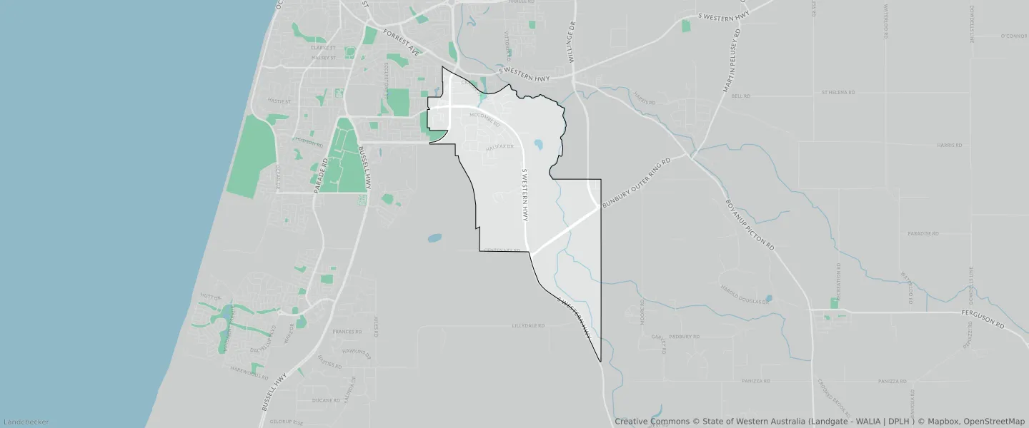
This Davenport suburb profile includes demographic data and planning information to help you make an informed property decision.
An average home in Davenport is other/not stated by couples with children. The average age in Davenport is 53. Units and Apartments are common in Davenport and the area is mostly INDUSTRIAL ZONE (38.13%), INDUSTRIAL (38.13%) and RURAL ZONE (25.6%).
Davenport demographics
Population
8
Average Age
53
Age Distribution
Employment Type
Median Weekly Income
Traveled to Work
Car
0.0%
Tram
0.0%
Bicycle
0.0%
Train
0.0%
Walking
0.0%
Bus
0.0%
Davenport property information
Number of Bedrooms
Tenure Type
Property Types in Davenport
Separate house
Semi detached house
Unit/Apartment
Median monthly mortgage repayments
$0
Median weekly rental payments
$669
Average number of bedrooms per dwelling
1.0
Average number of people per household
1
Household Composition
Family Composition
Couple family without children
One parent family
Couple family with children
DAVENPORT planning zones
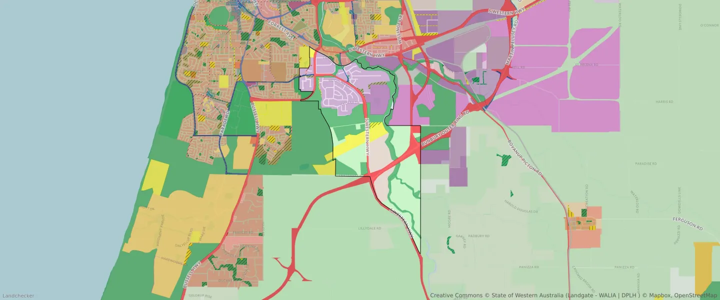
| Zone Code | Zone Name | Percentage Covered | Area Covered | |
|---|---|---|---|---|
| DISTRICT DISTRIBUTOR ROAD | DISTRICT DISTRIBUTOR ROAD | 0.25% | 29,069.62㎡ | |
| ENVIRONMENTAL CONSERVATION RESERVE | ENVIRONMENTAL CONSERVATION RESERVE | 0.86% | 100,954.34㎡ | |
| GENERAL INDUSTRY | GENERAL INDUSTRY | 5.16% | 605,168.64㎡ | |
| INDUSTRIAL | INDUSTRIAL | 38.13% | 4,469,744.12㎡ | |
| INDUSTRIAL | INDUSTRIAL ZONE | 38.13% | 4,469,744.12㎡ | |
| INDUSTRIAL DEVELOPMENT | INDUSTRIAL DEVELOPMENT | 9.06% | 1,062,052.87㎡ | |
| LIGHT INDUSTRY | LIGHT INDUSTRY | 19.63% | 2,301,484.69㎡ | |
| LOCAL DISTRIBUTOR ROAD | LOCAL DISTRIBUTOR ROAD | 0.1% | 11,958.57㎡ | |
| LOCAL ROAD | LOCAL ROAD | 3.38% | 396,720.63㎡ | |
| PRIMARY REGIONAL ROADS | PRIMARY REGIONAL ROADS RESERVE | 8.23% | 964,244.39㎡ | |
| PUBLIC OPEN SPACE | PUBLIC OPEN SPACE | 0.07% | 7,904.18㎡ | |
| PUBLIC PURPOSES | PUBLIC PURPOSES | 0.45% | 53,061.29㎡ | |
| PUBLIC PURPOSES | PUBLIC PURPOSES RESERVE | 0.45% | 53,061.29㎡ | |
| PUBLIC PURPOSES - AIRPORT | PUBLIC PURPOSES - AIRPORT RESERVE | 5.6% | 656,652.08㎡ | |
| PUBLIC PURPOSES - SPECIAL USES | PUBLIC PURPOSES - SPECIAL USES RESERVE | 0.35% | 41,328.35㎡ | |
| RAILWAYS | RAILWAYS RESERVE | 0.29% | 34,261.01㎡ | |
| REGIONAL OPEN SPACE | REGIONAL OPEN SPACE | 21.36% | 2,503,845.68㎡ | |
| REGIONAL OPEN SPACE | REGIONAL OPEN SPACE RESERVE | 21.36% | 2,503,845.68㎡ | |
| RURAL | RURAL | 25.6% | 2,999,935.13㎡ | |
| RURAL | RURAL | 0% | 71.77㎡ | |
| RURAL | RURAL | 24.79% | 2,904,853.92㎡ | |
| RURAL | RURAL ZONE | 25.6% | 2,999,935.13㎡ | |
| RURAL | RURAL ZONE | 0% | 71.77㎡ | |
| RURAL | RURAL ZONE | 24.79% | 2,904,853.92㎡ | |
| URBAN | URBAN | 0.03% | 3,965.53㎡ | |
| URBAN | URBAN ZONE | 0.03% | 3,965.53㎡ | |
| WATERWAYS | WATERWAYS | 0.4% | 46,990.41㎡ | |
| WATERWAYS | WATERWAYS RESERVE | 0.4% | 46,990.41㎡ |
Looking to research a property in DAVENPORT?
Go to mapData Source - ABS