Craigie WA 6025
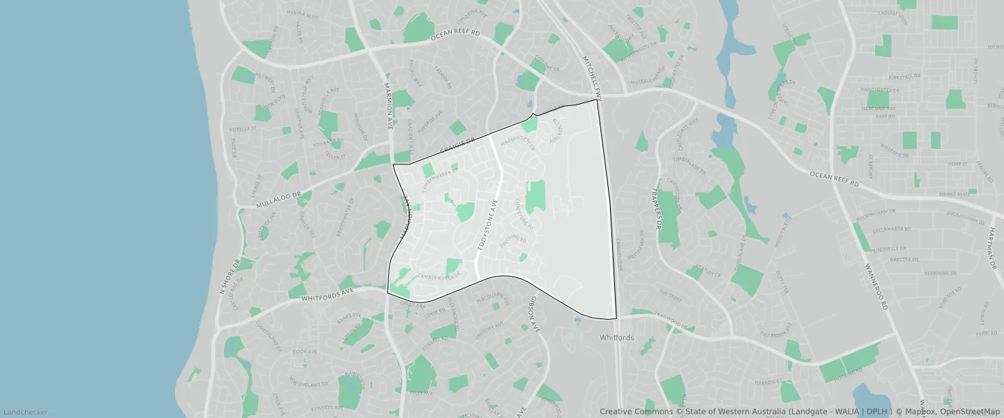
This Craigie suburb profile includes demographic data and planning information to help you make an informed property decision.
An average home in Craigie is owned with a mortgage by couples with children. The average age in Craigie is 35. Separate houses are common in Craigie and the area is mostly URBAN ZONE (64.29%), URBAN (64.29%) and RESIDENTIAL (38.37%).
Craigie demographics
Population
6456
Average Age
35
Age Distribution
Employment Type
Median Weekly Income
Traveled to Work
Car
84.9%
Tram
0.0%
Bicycle
0.4%
Train
3.5%
Walking
0.7%
Bus
1.4%
Craigie property information
Number of Bedrooms
Tenure Type
Property Types in Craigie
Separate house
Semi detached house
Unit/Apartment
Median monthly mortgage repayments
$1,733
Median weekly rental payments
$375
Average number of bedrooms per dwelling
3.4
Average number of people per household
2
Household Composition
Family Composition
Couple family without children
One parent family
Couple family with children
CRAIGIE planning zones
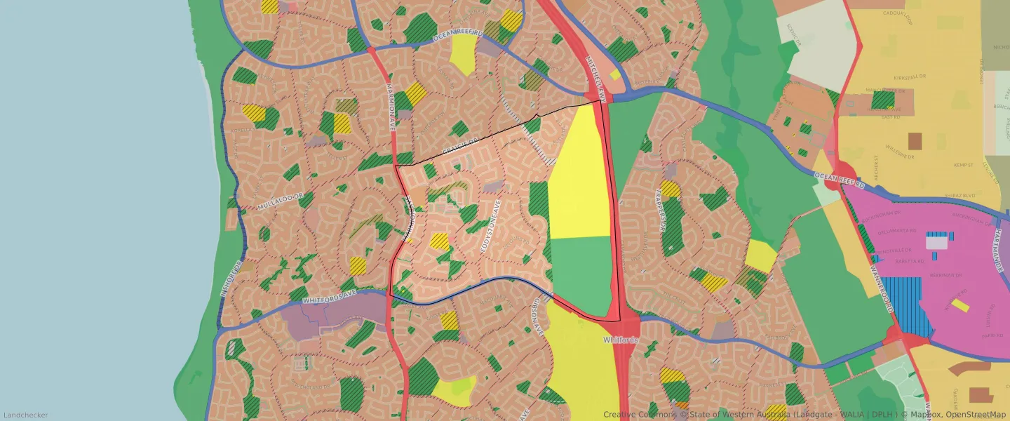
| Zone Code | Zone Name | Percentage Covered | Area Covered | |
|---|---|---|---|---|
| COMMERCIAL | COMMERCIAL | 0.47% | 21,990.49㎡ | |
| DRAINAGE AND WATERWAYS | DRAINAGE AND WATERWAYS | 0.74% | 34,805.85㎡ | |
| ENVIRONMENTAL CONSERVATION RESERVE | ENVIRONMENTAL CONSERVATION RESERVE | 0.64% | 30,101.28㎡ | |
| LOCAL DISTRIBUTOR ROAD | LOCAL DISTRIBUTOR ROAD | 5.16% | 243,253.8㎡ | |
| LOCAL ROAD | LOCAL ROAD | 10.21% | 481,488.16㎡ | |
| MIXED USE | MIXED USE | 0.13% | 6,182㎡ | |
| OTHER REGIONAL ROADS | OTHER REGIONAL ROADS RESERVE | 0.89% | 41,820.84㎡ | |
| PRIMARY REGIONAL ROADS | PRIMARY REGIONAL ROADS RESERVE | 5.45% | 257,253.78㎡ | |
| PRIVATE COMMUNITY PURPOSES | PRIVATE COMMUNITY PURPOSES | 0.85% | 40,151.08㎡ | |
| PUBLIC OPEN SPACE | PUBLIC OPEN SPACE | 6.9% | 325,492.33㎡ | |
| PUBLIC PURPOSES | PUBLIC PURPOSES | 0.83% | 39,233.7㎡ | |
| PUBLIC PURPOSES | PUBLIC PURPOSES RESERVE | 0.83% | 39,233.7㎡ | |
| PUBLIC PURPOSES - PUBLIC UTILITIES | PUBLIC PURPOSES - PUBLIC UTILITIES | 17.42% | 821,765.87㎡ | |
| PUBLIC PURPOSES - PUBLIC UTILITIES | PUBLIC PURPOSES - PUBLIC UTILITIES RESERVE | 17.42% | 821,765.87㎡ | |
| R20 | R20 | 17.63% | 831,621.02㎡ | |
| R20/40 | R20/40 | 19.29% | 910,169.87㎡ | |
| R25 | R25 | 0.35% | 16,452.31㎡ | |
| R30 | R30 | 0.44% | 20,621.88㎡ | |
| R40 | R40 | 0.53% | 25,059.95㎡ | |
| R50 | R50 | 0.06% | 2,715.93㎡ | |
| R60 | R60 | 0.07% | 3,069.12㎡ | |
| REGIONAL OPEN SPACE | REGIONAL OPEN SPACE | 11.95% | 563,757.38㎡ | |
| REGIONAL OPEN SPACE | REGIONAL OPEN SPACE RESERVE | 11.95% | 563,757.38㎡ | |
| RESIDENTIAL | RESIDENTIAL | 38.37% | 1,810,001.71㎡ | |
| URBAN | URBAN | 64.29% | 3,032,703.34㎡ | |
| URBAN | URBAN ZONE | 64.29% | 3,032,703.34㎡ |
Looking to research a property in CRAIGIE?
Go to mapData Source - ABS