Clarkson WA 6030
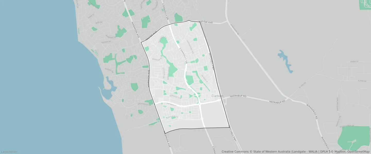
This Clarkson suburb profile includes demographic data and planning information to help you make an informed property decision.
An average home in Clarkson is owned with a mortgage by couples with children. The average age in Clarkson is 34. Separate houses are common in Clarkson and the area is mostly URBAN ZONE (81.93%), URBAN (81.93%) and R20 (34.38%).
Clarkson demographics
Population
13904
Average Age
34
Age Distribution
Employment Type
Median Weekly Income
Traveled to Work
Car
80.0%
Tram
0.0%
Bicycle
0.3%
Train
7.1%
Walking
1.2%
Bus
1.5%
Clarkson property information
Number of Bedrooms
Tenure Type
Property Types in Clarkson
Separate house
Semi detached house
Unit/Apartment
Median monthly mortgage repayments
$1,733
Median weekly rental payments
$350
Average number of bedrooms per dwelling
3.5
Average number of people per household
3
Household Composition
Family Composition
Couple family without children
One parent family
Couple family with children
CLARKSON planning zones
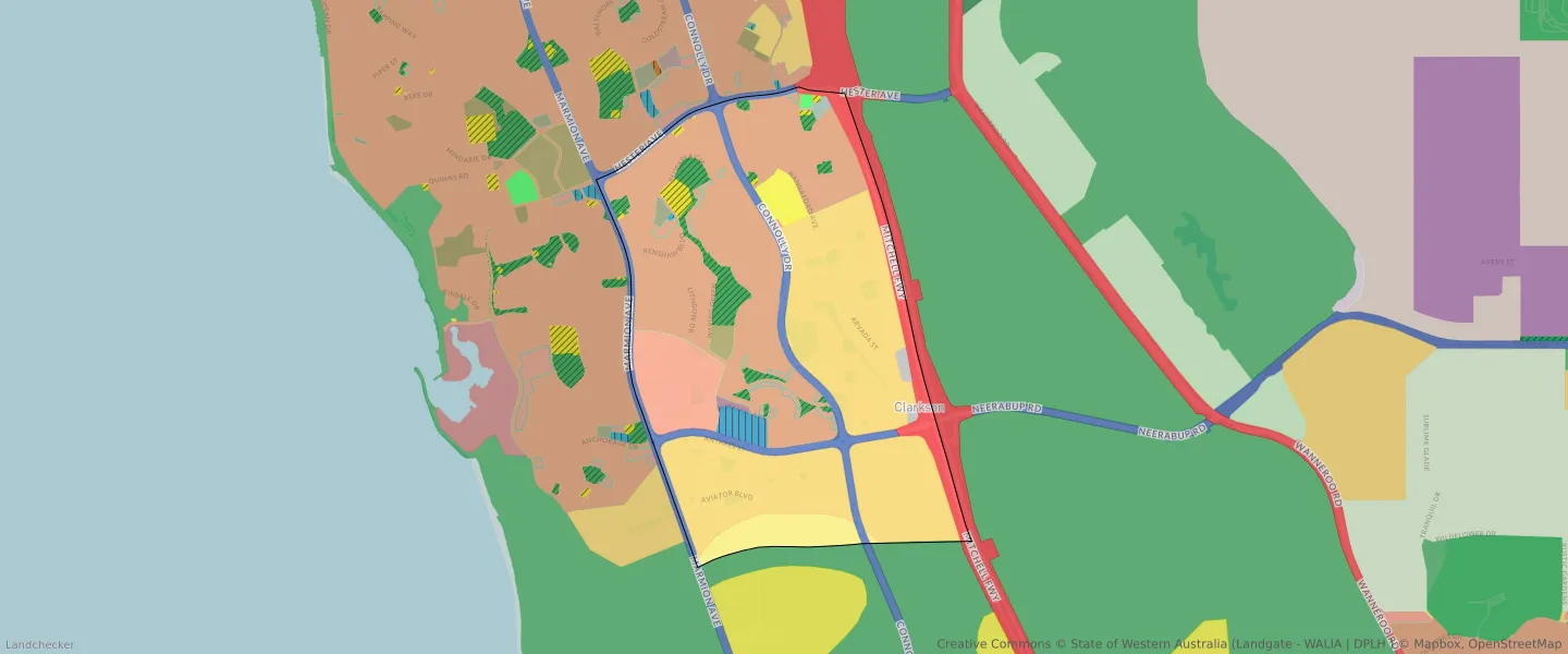
| Zone Code | Zone Name | Percentage Covered | Area Covered | |
|---|---|---|---|---|
| CENTRE | CENTRE | 4.7% | 314,820.41㎡ | |
| COMMERCIAL | COMMERCIAL | 0.62% | 41,454.28㎡ | |
| DRAINAGE AND WATERWAYS | DRAINAGE AND WATERWAYS | 0.25% | 16,695.7㎡ | |
| EDUCATION | EDUCATION | 0.53% | 35,533.09㎡ | |
| LOCAL ROAD | LOCAL ROAD | 18.79% | 1,259,117.76㎡ | |
| MIXED USE | MIXED USE | 0.26% | 17,503.2㎡ | |
| OTHER REGIONAL ROADS | OTHER REGIONAL ROADS RESERVE | 7% | 468,982.98㎡ | |
| PRIMARY REGIONAL ROADS | PRIMARY REGIONAL ROADS RESERVE | 4.88% | 326,912.59㎡ | |
| PRIVATE COMMUNITY PURPOSES | PRIVATE COMMUNITY PURPOSES | 0.6% | 40,001.84㎡ | |
| PUBLIC OPEN SPACE | PUBLIC OPEN SPACE | 5.51% | 369,203.65㎡ | |
| PUBLIC PURPOSES | PUBLIC PURPOSES | 0.72% | 48,054.24㎡ | |
| PUBLIC PURPOSES | PUBLIC PURPOSES RESERVE | 0.72% | 48,054.24㎡ | |
| PUBLIC PURPOSES - HIGH SCHOOL | PUBLIC PURPOSES - HIGH SCHOOL RESERVE | 1.19% | 79,809.26㎡ | |
| PUBLIC PURPOSES - PUBLIC UTILITIES | PUBLIC PURPOSES - PUBLIC UTILITIES | 0.13% | 8,875.02㎡ | |
| PUBLIC PURPOSES - PUBLIC UTILITIES | PUBLIC PURPOSES - PUBLIC UTILITIES RESERVE | 0.13% | 8,875.02㎡ | |
| PUBLIC PURPOSES - TERTIARY EDUCATION | PUBLIC PURPOSES - TERTIARY EDUCATION | 0.3% | 20,247.21㎡ | |
| R20 | R20 | 34.38% | 2,304,042.04㎡ | |
| R30 | R30 | 6.88% | 461,202.5㎡ | |
| R40 | R40 | 3.69% | 247,063.24㎡ | |
| R60 | R60 | 0.59% | 39,845.71㎡ | |
| R80 | R80 | 0.33% | 22,270.71㎡ | |
| RAILWAYS | RAILWAYS RESERVE | 0.7% | 46,679.7㎡ | |
| REGIONAL OPEN SPACE | REGIONAL OPEN SPACE | 0.07% | 4,647.28㎡ | |
| REGIONAL OPEN SPACE | REGIONAL OPEN SPACE RESERVE | 0.07% | 4,647.28㎡ | |
| RESIDENTIAL | RESIDENTIAL | 34.1% | 2,284,929.57㎡ | |
| SERVICE COMMERCIAL | SERVICE COMMERCIAL | 1.02% | 68,279.82㎡ | |
| URBAN | URBAN | 81.93% | 5,490,272.08㎡ | |
| URBAN | URBAN ZONE | 81.93% | 5,490,272.08㎡ | |
| URBAN DEFERRED | URBAN DEFERRED ZONE | 3.8% | 254,871.27㎡ | |
| URBAN DEVELOPMENT | URBAN DEVELOPMENT | 18.61% | 1,246,692.04㎡ |
Looking to research a property in CLARKSON?
Go to mapData Source - ABS