Brunswick WA 6224
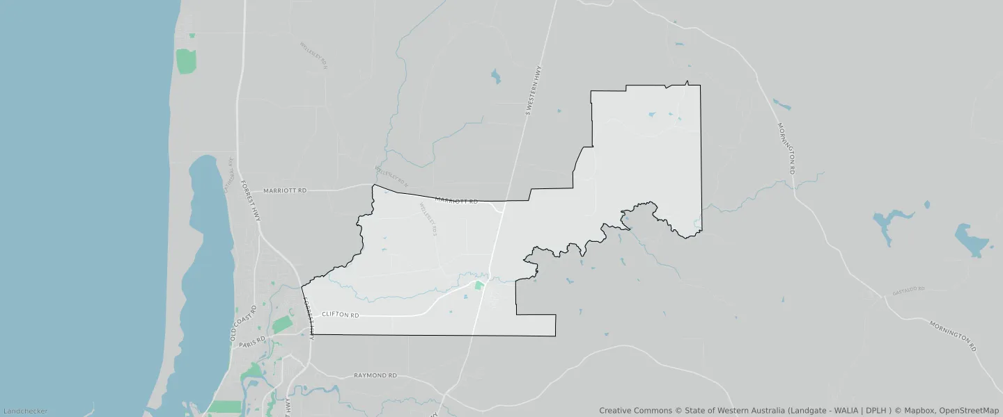
This Brunswick suburb profile includes demographic data and planning information to help you make an informed property decision.
An average home in Brunswick is owned with a mortgage by couples without children. The average age in Brunswick is 44. Separate houses are common in Brunswick and the area is mostly RURAL ZONE (94.56%), RURAL (94.56%) and RURAL ZONE (50.94%).
Brunswick demographics
Population
1195
Average Age
44
Age Distribution
Employment Type
Median Weekly Income
Traveled to Work
Car
83.3%
Tram
0.0%
Bicycle
1.0%
Train
0.0%
Walking
3.5%
Bus
2.0%
Brunswick property information
Number of Bedrooms
Tenure Type
Property Types in Brunswick
Separate house
Semi detached house
Unit/Apartment
Median monthly mortgage repayments
$1,398
Median weekly rental payments
$250
Average number of bedrooms per dwelling
3.2
Average number of people per household
3
Household Composition
Family Composition
Couple family without children
One parent family
Couple family with children
BRUNSWICK planning zones
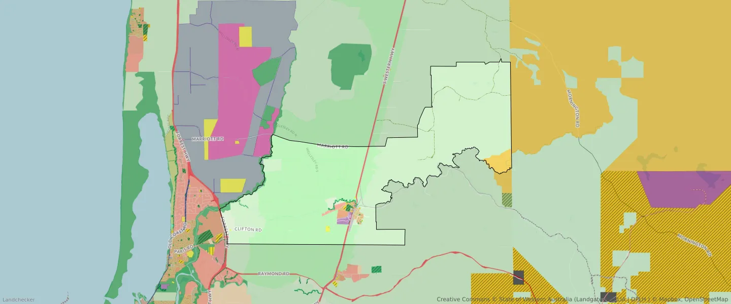
| Zone Code | Zone Name | Percentage Covered | Area Covered | |
|---|---|---|---|---|
| CIVIC AND COMMUNITY | CIVIC AND COMMUNITY | 0.01% | 6,017.97㎡ | |
| COMMERCIAL | COMMERCIAL | 0.02% | 20,588.73㎡ | |
| DRAINAGE AND WATERWAYS | DRAINAGE AND WATERWAYS | 0.38% | 365,067.23㎡ | |
| EDUCATION | EDUCATION | 0.04% | 37,202.23㎡ | |
| EMERGENCY SERVICES | EMERGENCY SERVICES | 0% | 2,598.96㎡ | |
| ENVIRONMENTAL CONSERVATION RESERVE | ENVIRONMENTAL CONSERVATION RESERVE | 0.01% | 5,385.81㎡ | |
| FORESHORE | FORESHORE | 0.53% | 515,216.07㎡ | |
| GENERAL INDUSTRY | GENERAL INDUSTRY | 0.31% | 300,795.29㎡ | |
| HERITAGE | HERITAGE | 0% | 1,390.2㎡ | |
| INDUSTRIAL | INDUSTRIAL | 0.46% | 445,336.25㎡ | |
| INDUSTRIAL | INDUSTRIAL ZONE | 0.46% | 445,336.25㎡ | |
| INFRASTRUCTURE SERVICES | INFRASTRUCTURE SERVICES | 0.03% | 29,410.17㎡ | |
| LIGHT INDUSTRY | LIGHT INDUSTRY | 0.12% | 111,981.05㎡ | |
| LOCAL DISTRIBUTOR ROAD | LOCAL DISTRIBUTOR ROAD | 0.12% | 115,975.52㎡ | |
| LOCAL ROAD | LOCAL ROAD | 1.42% | 1,376,987.13㎡ | |
| PRIMARY REGIONAL ROADS | PRIMARY REGIONAL ROADS RESERVE | 0.49% | 478,398.19㎡ | |
| PRIORITY AGRICULTURE | PRIORITY AGRICULTURE | 39.75% | 38,608,647.14㎡ | |
| PRIVATE COMMUNITY PURPOSES | PRIVATE COMMUNITY PURPOSES | 0.01% | 7,459.62㎡ | |
| PUBLIC OPEN SPACE | PUBLIC OPEN SPACE | 0.15% | 142,333.55㎡ | |
| PUBLIC PURPOSES | PUBLIC PURPOSES | 0% | 926.23㎡ | |
| PUBLIC PURPOSES | PUBLIC PURPOSES RESERVE | 0% | 926.23㎡ | |
| PUBLIC PURPOSES - PUBLIC UTILITIES | PUBLIC PURPOSES - PUBLIC UTILITIES | 0.09% | 89,774.09㎡ | |
| PUBLIC PURPOSES - PUBLIC UTILITIES | PUBLIC PURPOSES - PUBLIC UTILITIES RESERVE | 0.09% | 89,774.09㎡ | |
| R15/30 | R15/30 | 0.72% | 698,882.36㎡ | |
| R2.5 | R2.5 | 0.05% | 52,260.04㎡ | |
| RAILWAYS | RAILWAYS RESERVE | 0.55% | 533,088.44㎡ | |
| REGIONAL DISTRIBUTOR ROAD | REGIONAL DISTRIBUTOR ROAD | 0.48% | 470,399.81㎡ | |
| REGIONAL OPEN SPACE | REGIONAL OPEN SPACE | 0.71% | 690,363.38㎡ | |
| REGIONAL OPEN SPACE | REGIONAL OPEN SPACE RESERVE | 0.71% | 690,363.38㎡ | |
| RESIDENTIAL | RESIDENTIAL | 0.77% | 751,142.4㎡ | |
| RURAL | RURAL | 94.56% | 91,856,012.42㎡ | |
| RURAL | RURAL | 50.94% | 49,486,884.98㎡ | |
| RURAL | RURAL ZONE | 94.56% | 91,856,012.42㎡ | |
| RURAL | RURAL ZONE | 50.94% | 49,486,884.98㎡ | |
| RURAL RESIDENTIAL | RURAL RESIDENTIAL | 1.06% | 1,033,294.65㎡ | |
| SERVICE COMMERCIAL | SERVICE COMMERCIAL | 0% | 2,357.64㎡ | |
| STATE FORESTS | STATE FORESTS RESERVE | 1.68% | 1,628,836.13㎡ | |
| TOURISM | TOURISM | 0.01% | 10,829.79㎡ | |
| URBAN | URBAN | 1.46% | 1,419,165.88㎡ | |
| URBAN | URBAN ZONE | 1.46% | 1,419,165.88㎡ | |
| URBAN DEVELOPMENT | URBAN DEVELOPMENT | 0.33% | 317,627.32㎡ |
Looking to research a property in BRUNSWICK?
Go to mapData Source - ABS