Boronia VIC 3155

This Boronia suburb profile includes demographic data and planning information to help you make an informed property decision.
An average home in Boronia is owned with a mortgage by couples with children. The average age in Boronia is 39. Separate houses are common in Boronia and the area is mostly NEIGHBOURHOOD RESIDENTIAL ZONE (63.91%), GENERAL RESIDENTIAL ZONE (6.64%) and INDUSTRIAL 1 ZONE (5.77%).
Boronia demographics
Population
23607
Average Age
39
Age Distribution
Employment Type
Median Weekly Income
Traveled to Work
Car
87.0%
Tram
0.0%
Bicycle
0.6%
Train
2.9%
Walking
1.6%
Bus
1.0%
Boronia property information
Number of Bedrooms
Tenure Type
Property Types in Boronia
Separate house
Semi detached house
Unit/Apartment
Median monthly mortgage repayments
$1,870
Median weekly rental payments
$376
Average number of bedrooms per dwelling
3.0
Average number of people per household
2
Household Composition
Family Composition
Couple family without children
One parent family
Couple family with children
BORONIA planning zones
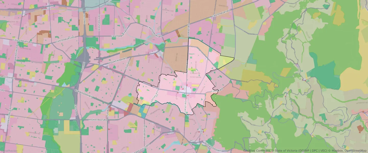
| Zone Code | Zone Name | Percentage Covered | Area Covered | |
|---|---|---|---|---|
| C1Z | COMMERCIAL 1 ZONE | 2.12% | 238,485.22㎡ | |
| GRZ | GENERAL RESIDENTIAL ZONE | 6.64% | 747,942.95㎡ | |
| GWZ | GREEN WEDGE ZONE | 0.01% | 1,127.29㎡ | |
| IN1Z | INDUSTRIAL 1 ZONE | 5.77% | 649,941.27㎡ | |
| LDRZ | LOW DENSITY RESIDENTIAL ZONE | 4.31% | 485,807.9㎡ | |
| MUZ | MIXED USE ZONE | 0.32% | 35,810.42㎡ | |
| NRZ | NEIGHBOURHOOD RESIDENTIAL ZONE | 63.91% | 7,201,065.6㎡ | |
| PCRZ | PUBLIC CONSERVATION AND RESOURCE ZONE | 0.26% | 29,488.99㎡ | |
| PCRZ | PUBLIC CONSERVATION AND RESOURCE ZONE | 0% | 13.96㎡ | |
| PPRZ | PUBLIC PARK AND RECREATION ZONE | 3.48% | 392,603.52㎡ | |
| PUZ | PUBLIC USE ZONE | 4.29% | 483,348.09㎡ | |
| RGZ | RESIDENTIAL GROWTH ZONE | 0.03% | 3,876.03㎡ | |
| SUZ | SPECIAL USE ZONE | 2.01% | 226,227.78㎡ | |
| TRZ1 | TRANSPORT ZONE | 0.83% | 93,483㎡ | |
| TRZ2 | TRANSPORT ZONE | 3.87% | 436,512.33㎡ | |
| TRZ3 | TRANSPORT ZONE | 0.94% | 106,387.39㎡ | |
| UFZ | URBAN FLOODWAY ZONE | 1.21% | 136,087.18㎡ |
Looking to research a property in BORONIA?
Go to mapData Source - ABS