Boddington WA 6390
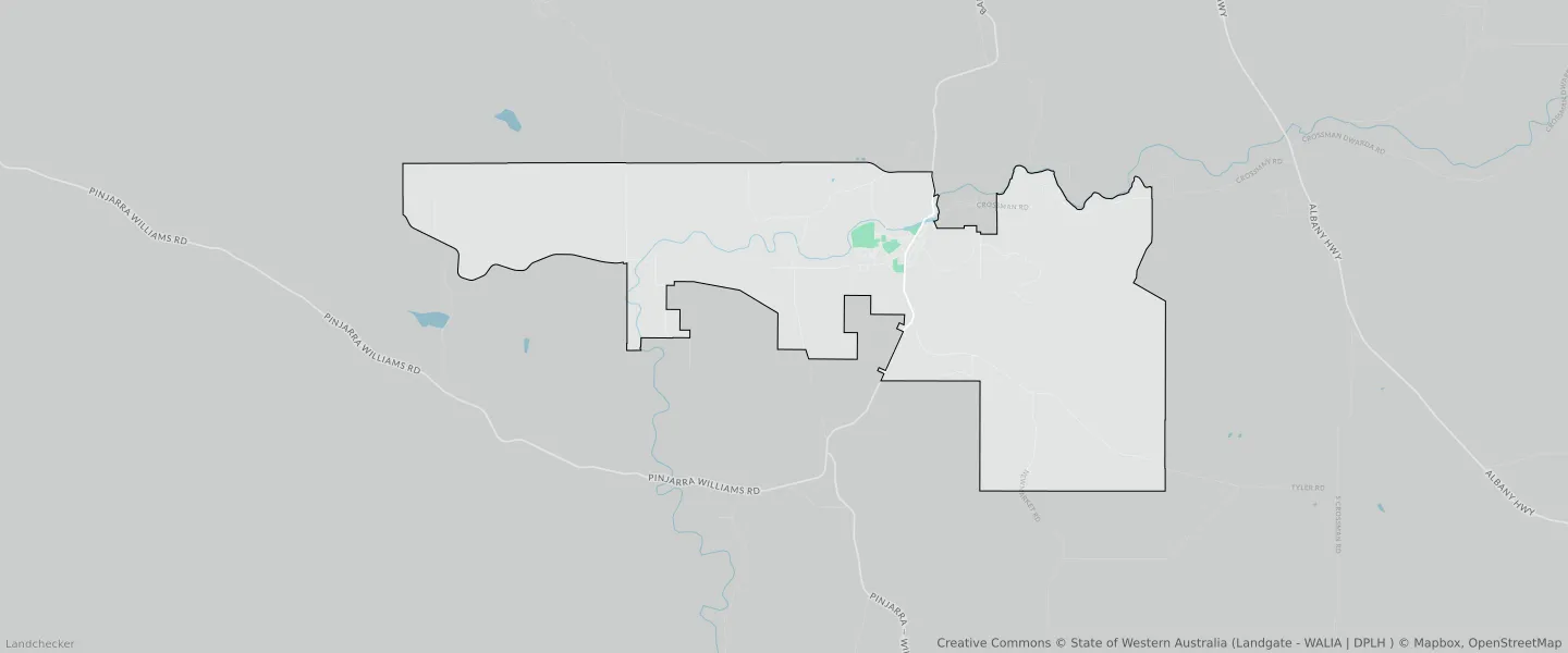
This Boddington suburb profile includes demographic data and planning information to help you make an informed property decision.
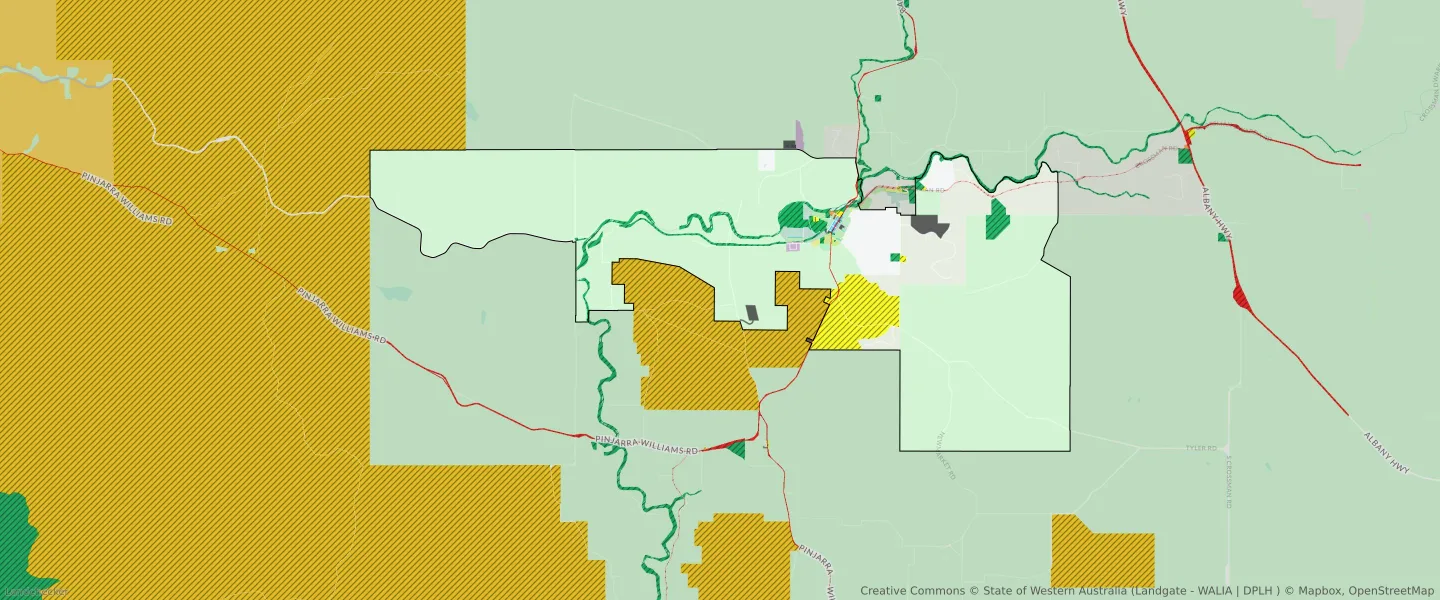
An average home in Boddington is owned with a mortgage by couples without children. The average age in Boddington is 40. Separate houses are common in Boddington and the area is mostly RURAL ZONE (77.3%), RURAL (77.3%) and RURAL RESIDENTIAL (6.16%).
Boddington demographics
Population
1178
Average Age
40
Age Distribution
Employment Type
Median Weekly Income
Traveled to Work
Car
83.1%
Tram
0.0%
Bicycle
1.0%
Train
0.0%
Walking
8.6%
Bus
3.8%
Boddington property information
Number of Bedrooms
Tenure Type
Property Types in Boddington
Separate house
Semi detached house
Unit/Apartment
Median monthly mortgage repayments
$1,517
Median weekly rental payments
$280
Average number of bedrooms per dwelling
3.4
Average number of people per household
3
Household Composition
Family Composition
Couple family without children
One parent family
Couple family with children
BODDINGTON planning zones
| Zone Code | Zone Name | Percentage Covered | Area Covered | |
|---|---|---|---|---|
| CEMETERY | CEMETERY | 0.02% | 20,162.41㎡ | |
| CIVIC AND COMMUNITY | CIVIC AND COMMUNITY | 0.01% | 7,680.98㎡ | |
| COMMERCIAL | COMMERCIAL | 0.06% | 71,254.07㎡ | |
| DRAINAGE AND WATERWAYS | DRAINAGE AND WATERWAYS | 0.14% | 156,723.08㎡ | |
| EDUCATION | EDUCATION | 0.02% | 26,609.81㎡ | |
| EMERGENCY SERVICES | EMERGENCY SERVICES | 0% | 4,338.89㎡ | |
| ENVIRONMENTAL CONSERVATION | ENVIRONMENTAL CONSERVATION | 0.52% | 594,625.35㎡ | |
| GENERAL INDUSTRY | GENERAL INDUSTRY | 0.1% | 113,952.08㎡ | |
| GOVERNMENT SERVICES | GOVERNMENT SERVICES | 0.01% | 15,890.53㎡ | |
| INFRASTRUCTURE SERVICES | INFRASTRUCTURE SERVICES | 0.15% | 174,133.19㎡ | |
| LOCAL DISTRIBUTOR ROAD | LOCAL DISTRIBUTOR ROAD | 0.13% | 149,666.73㎡ | |
| LOCAL ROAD | LOCAL ROAD | 1.41% | 1,612,751.63㎡ | |
| MEDICAL SERVICES | MEDICAL SERVICES | 0.01% | 16,320.17㎡ | |
| PRIMARY DISTRIBUTOR ROAD | PRIMARY DISTRIBUTOR ROAD | 0.13% | 149,189.76㎡ | |
| PUBLIC OPEN SPACE | PUBLIC OPEN SPACE | 3.04% | 3,479,704.19㎡ | |
| PUBLIC PURPOSES | PUBLIC PURPOSES | 3.98% | 4,553,911.53㎡ | |
| PUBLIC PURPOSES | PUBLIC PURPOSES RESERVE | 3.98% | 4,553,911.53㎡ | |
| R10 | R10 | 0.05% | 52,256.24㎡ | |
| R15 | R15 | 0.08% | 87,019.91㎡ | |
| R2 | R2 | 0.05% | 59,799.33㎡ | |
| R20 | R20 | 0.15% | 177,417.48㎡ | |
| R30 | R30 | 0.1% | 117,943.25㎡ | |
| R40 | R40 | 0.06% | 65,429.37㎡ | |
| R5 | R5 | 0.39% | 450,992.63㎡ | |
| RECREATION | RECREATION | 0.07% | 80,508.25㎡ | |
| RESIDENTIAL | RESIDENTIAL | 0.88% | 1,010,686.82㎡ | |
| RURAL | RURAL | 77.3% | 88,550,548.45㎡ | |
| RURAL | RURAL ZONE | 77.3% | 88,550,548.45㎡ | |
| RURAL RESIDENTIAL | RURAL RESIDENTIAL | 6.16% | 7,057,089.08㎡ | |
| RURAL SMALLHOLDING | RURAL SMALLHOLDING | 1.95% | 2,237,692.4㎡ | |
| SPECIAL USE | SPECIAL USE | 3.88% | 4,449,889.98㎡ | |
| STATE FOREST | STATE FOREST | 0% | 70.22㎡ | |
| TOURISM | TOURISM | 0.02% | 18,440.59㎡ |
Looking to research a property in BODDINGTON?
Go to mapData Source - ABS