Bickley WA 6076
This Bickley suburb profile includes demographic data and planning information to help you make an informed property decision.
An average home in Bickley is owned with a mortgage by couples with children. The average age in Bickley is 48. Separate houses are common in Bickley and the area is mostly RURAL ZONE (62.24%), RURAL (62.24%) and REGIONAL OPEN SPACE RESERVE (31.27%).
Bickley demographics
Population
713
Average Age
48
Age Distribution
Employment Type
Median Weekly Income
Traveled to Work
Car
84.8%
Tram
0.0%
Bicycle
0.0%
Train
0.0%
Walking
2.3%
Bus
1.1%
Bickley property information
Number of Bedrooms
Tenure Type
Property Types in Bickley
Separate house
Semi detached house
Unit/Apartment
Median monthly mortgage repayments
$2,600
Median weekly rental payments
$350
Average number of bedrooms per dwelling
3.8
Average number of people per household
3
Household Composition
Family Composition
Couple family without children
One parent family
Couple family with children
BICKLEY planning zones
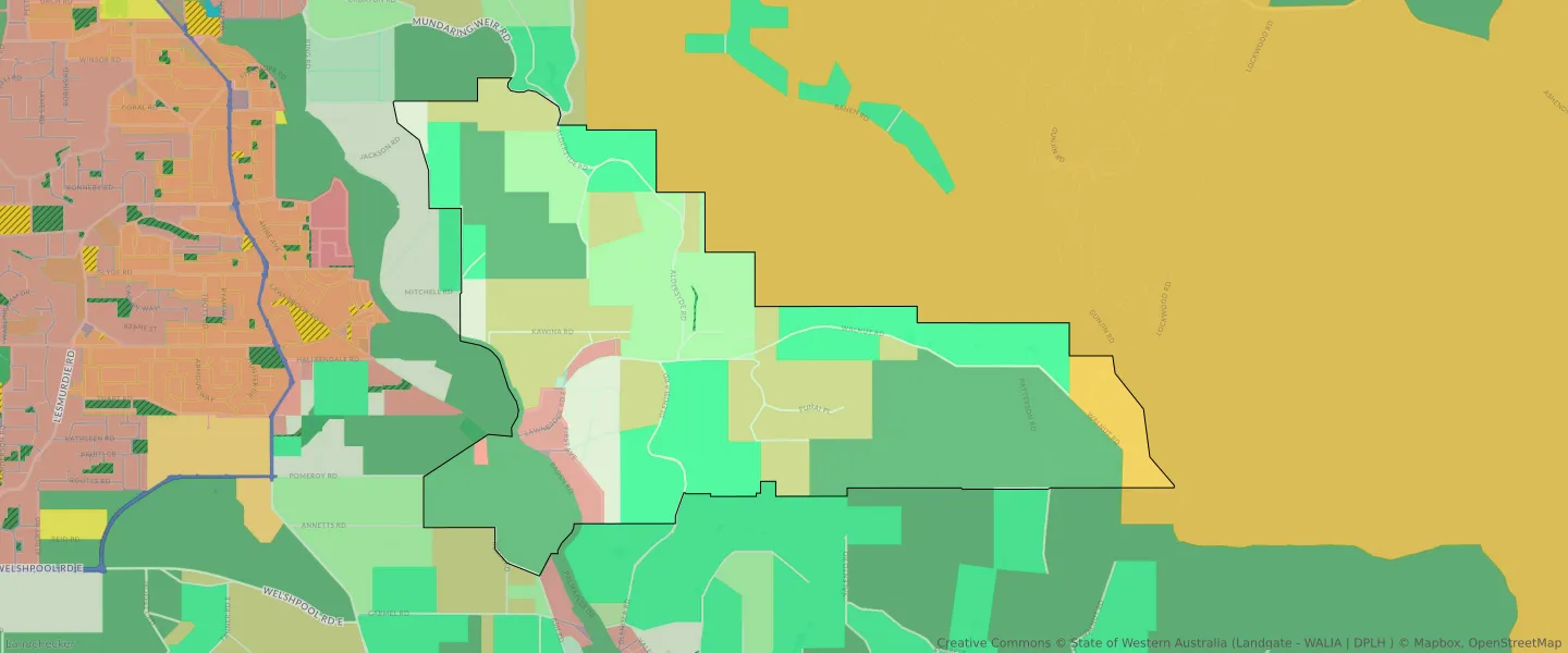
| Zone Code | Zone Name | Percentage Covered | Area Covered | |
|---|---|---|---|---|
| LOCAL OPEN SPACE | LOCAL OPEN SPACE | 0.05% | 4,669.11㎡ | |
| R5 | R5 | 2.6% | 256,456.68㎡ | |
| REGIONAL OPEN SPACE | REGIONAL OPEN SPACE | 31.27% | 3,085,478.94㎡ | |
| REGIONAL OPEN SPACE | REGIONAL OPEN SPACE RESERVE | 31.27% | 3,085,478.94㎡ | |
| RESIDENTIAL BUSHLAND | RESIDENTIAL BUSHLAND | 2.59% | 255,891.31㎡ | |
| RURAL | RURAL | 62.24% | 6,141,937.1㎡ | |
| RURAL | RURAL ZONE | 62.24% | 6,141,937.1㎡ | |
| RURAL AGRICULTURE | RURAL AGRICULTURE | 20.16% | 1,989,439.1㎡ | |
| RURAL CONSERVATION | RURAL CONSERVATION | 20.55% | 2,027,519.13㎡ | |
| RURAL LANDSCAPE INTEREST | RURAL LANDSCAPE INTEREST | 13.35% | 1,317,194.38㎡ | |
| SPECIAL RURAL | SPECIAL RURAL | 4.67% | 461,065.29㎡ | |
| STATE FORESTS | STATE FORESTS RESERVE | 3.44% | 339,829.62㎡ | |
| URBAN | URBAN | 3.05% | 300,625.26㎡ | |
| URBAN | URBAN ZONE | 3.05% | 300,625.26㎡ |
Looking to research a property in BICKLEY?
Go to mapData Source - ABS