
Product Help
How to convert parcels in your consolidated sites into shapes
Once you've created a consolidated site, you can save each parcel as a reusable shape in your tools library. This makes it easy to reference that same site area across different projects without having to recreate it each time.
Here are the steps on how to convert individual parcels in your consolidated site into a shape:
1. Create your consolidated site by combining multiple properties.
2. Click the Convert to Shape button at the bottom of your map view.
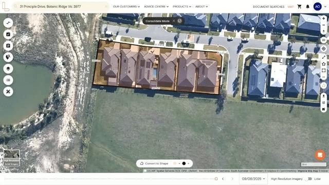
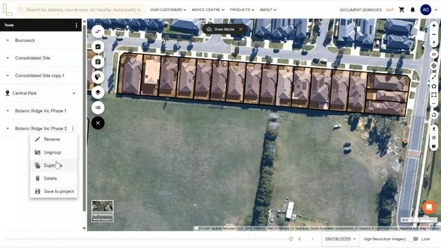
3. You will enter Draw Mode and your shapes will automatically appear in the tools library on the left-hand side menu, saved as a group.
To ungroup a set of objects, simply click the three-dot button and select Ungroup from the dropdown menu.
NOTE: The original consolidated site remains on your map. You can also save your consolidated site in a project and download a consolidated site report.
Duplicate the parcels from your consolidated site
You can duplicate the shapes if you need the same boundaries for a different project.
1. In the tools library, hover over a specific shape, click the three-dot button and select Duplicate.
2. Hold the SHIFT key down, and click to select the objects you want to move in bulk.
This feature comes in handy for property professionals, such as town planners, architects, and property developers, saving hours by converting consolidated sites into reusable shapes.
There’s no need to manually recreate the same property boundaries for every assessment or project.