
Product Help
How to change a tool’s fill colour, stroke and opacity
After using the drawing and text tool, you can adjust their display attributes using the menu on the left-hand side tools panel.
1. Use the address search bar to locate the property or area where you want to add the shapes.
2. Click the toolbar icons on the right-hand side to draw a shape or line, or add text and pin markers on the map.
3. Adjust the fill colour, stroke colour, and stroke weight of a polygon, rectangle, line, or circle using the menu on the left-hand side tools panel.
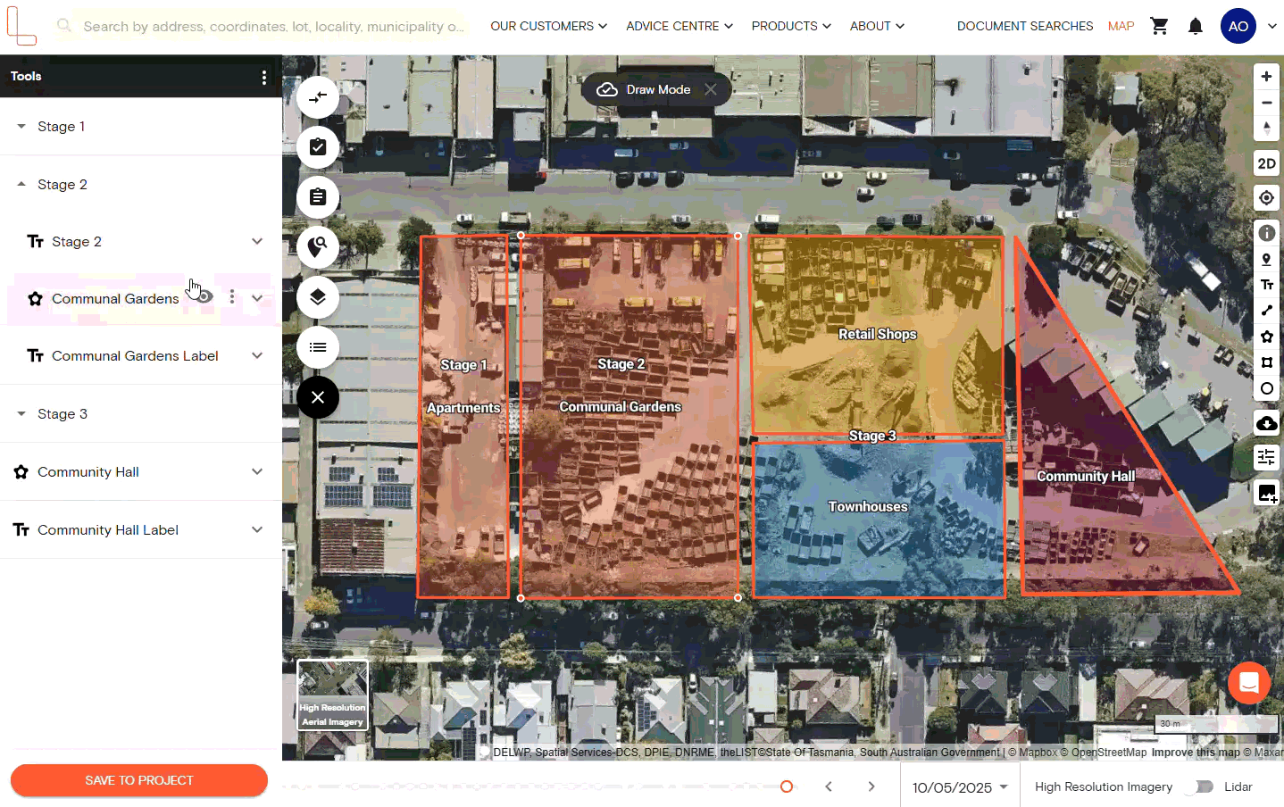
Edit the fill and stroke colours
There are three ways to choose a customised colour for the markups and annotations you’ve added on the map:
Choose a custom shade from the gradient tool
Manually enter the hex code
Select one of the standard colours
1. For polygons, rectangles and circles, you can modify the opacity level of the fill colour.
You can even set it to zero to remove the colour, leaving only the stroke or outline as seen in the sample image above.
2. For lines or multi-path lines, you can change the colour and adjust the opacity level.
3. For text labels, you can change their fill and stroke colours.
Upgrade today to edit display attributes
On a plan already? Simply head over to the map to see the latest updates.
Edit the Stroke Weight
After drawing a shape or line on the map, you can adjust the stroke weight, also known as line thickness or line weight. The available stroke weight settings range from 1 to 10 points.
Follow the steps below to change the stroke weight of completed shapes and lines.
1. Select the object with the stroke you want to modify.
2. In the Tools panel on the left-hand side, locate the Stroke Weight section and click the desired stroke weight in points.
You can also use the up and down or left and right arrow keys for incremental adjustments.
Related Help Articles:
How to measure area and perimeter
How to measure length using the Distance Tool
How to add text labels on the map
How to mark locations using the map pin tool
How to group and ungroup tools
How to change unit measurements
How to rename completed shapes, measurements and markups
How to delete completed shapes, measurements and markups