November 18, 2026
Spend less time setting up your Projects with faster property imports, and export CAD-ready site boundaries.
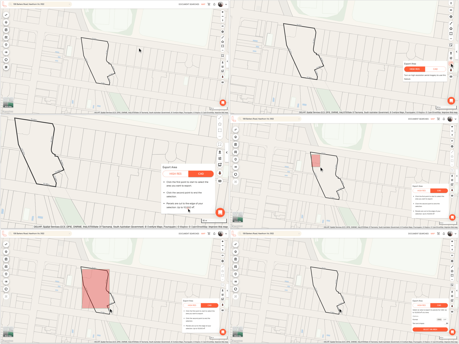
Take a site's boundaries straight into CAD
Before you can test a layout, you need the site drawn up. CAD exports let you select a site, or a cluster of parcels, and download it as a DWG or DXF file you can open in your CAD software or send to your architect or town planner.
Each file includes:
- Official parcel boundaries in GDA2020, Australia's current datum.
- Edge dimensions, labelled on each boundary.
- A base map image aligned to the boundaries so you can see the site in context.
Need the steps? Read the guide to CAD exports.
Spend less time matching addresses when you import
Importing a list of properties into a project used to leave you matching any unrecognised addresses manually. We've improved the import so there's less to fix yourself:
- Pick from suggested addresses. For an address we couldn't match, the import now suggests likely addresses.
- Fix unmatched rows in bulk. Use bulk search to sort out every unmatched row in one pass, instead of one at a time.
Large projects are quicker to work through too:
- Combine filters. You can now use more than one filter at a time, like land size over 300 m² and a “Development opportunity” label.
- Choose your columns. Pick which columns appear in the property table, so you only see what you need.
Read these help articles to learn more about Projects.
Want to make faster, insight-driven property decisions? Join Landchecker for free today.