
Product Help
How to view the draft maps for the train and tram activity centres in Victoria
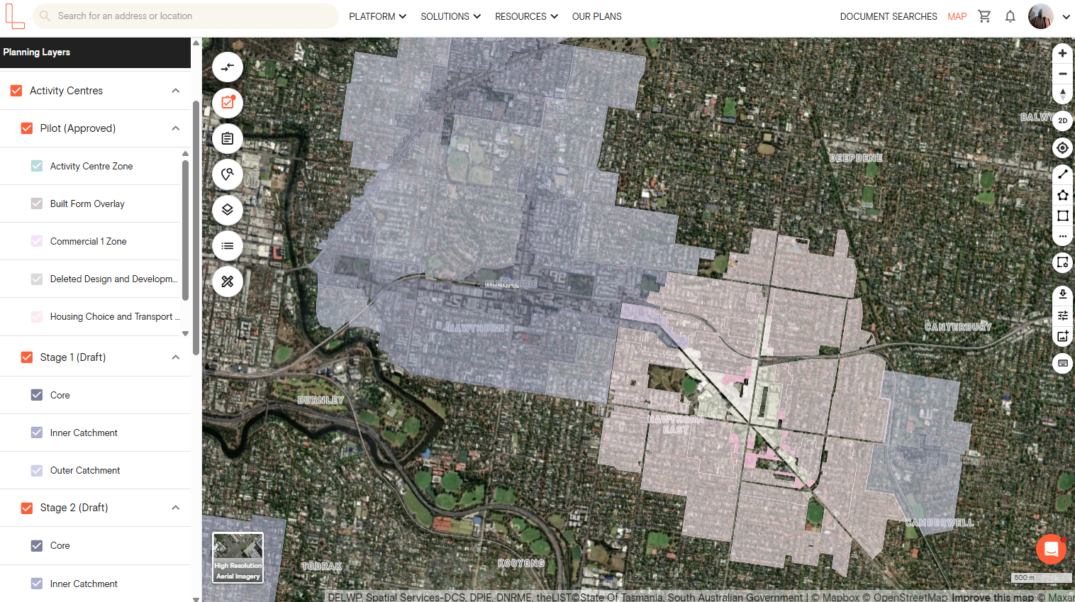
Access the draft plan for Victoria’s train and tram activity centre program on Landchecker. This layer helps you assess future development potential in areas undergoing planning changes.
1. Open the Planning Layers panel on the left side of your map
2. Find Activity Centres and click the dropdown arrow
3. Choose from the three available groups and tick the checkboxes to display them on the map
Pilot (Approved)
Stage 1 (Draft)
Stage 2 (Draft)
4. Each layer can be enabled independently or viewed all together
What is the difference between Pilot, Stage 1 and Stage 2?
The Activity Centres layer is divided into three groups, each representing a different stage of the program.
Pilot (Approved) – the initial activity centres selected for the program. These have progressed through the planning process and have approved plans in place. Sub-layers include Activity Centre Zone, Built Form Overlay, Commercial 1 Zone, Deleted Design and Development Overlay, and Housing Choice and Transport Zone.
Stage 1 (Draft) – the first round of draft activity centres. Sub-layers include Core, Inner Catchment and Outer Catchment.
Stage 2 (Draft) – the second round of draft activity centres, with the same Core, Inner Catchment and Outer Catchment sub-layers as Stage 1.
Combine Draft Activity Centres With Other Planning Layers For Deeper Insights
Draft activity centres work best when you layer them with other planning data. Here's how combining them with Housing Choice and Transport Zone (HCTZ), Built Form Overlay (BFO), and Heritage Overlay (HO) gives you a clearer picture:
Draft Activity Centres with HCTZ
HCTZ indicates the level of growth encouraged in that area. When these overlap, you're looking at priority development areas where:
Higher density housing is actively supported
Planning applications face less resistance
Larger-scale projects can be credibly pursued
Draft Activity Centres with BFO
BFO tells you the maximum heights and setback requirements for buildings in that area. When you layer this with the activity centre, you can:
Quickly assess if a site supports your development vision
Spot opportunities where height limits are generous
Identify constraints before you invest time in due diligence
Draft Activity Centres with Heritage Overlay
HO can significantly limit what you can build, even in high-growth activity centres. When you layer the activity centre with heritage overlay, you'll see:
Which sites need extra approvals for alterations or demolition
Where your design flexibility is restricted
Areas where development timelines might extend due to heritage assessments
In addition to the mentioned planning layers and zones, Landchecker also features other planning layers, including Bushfire Management Overlay, Environmental Significance Overlay, Vegetation Protection Overlay, Special Building Overlay, and more.