
Product Help
How to view proposed cadastres in Victoria
Proposed Cadastre is a planning layer on Landchecker that shows the proposed boundaries of land parcels that have been approved for subdivision but have not yet been registered with the relevant state land registry.
This layer is useful for property developers, valuers, conveyancers and town planners who need to understand how a site is likely to be divided before the titles are formally issued.
To enable the Proposed Cadastre layer:
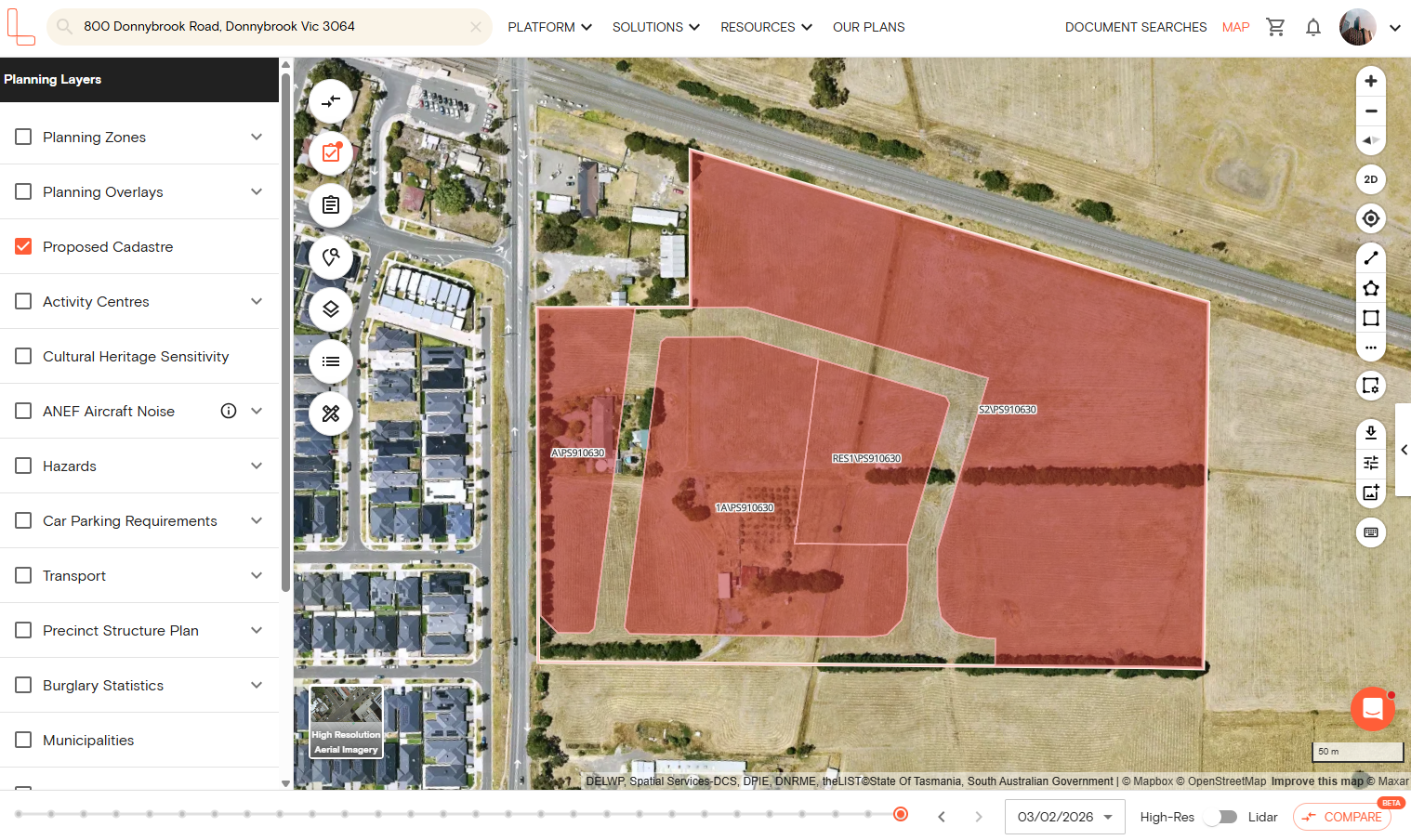
1. Open the Landchecker map and search for a property or area using the address search bar.
2. In the left-hand panel, click the Planning Layers menu.
3. Tick the checkbox beside Proposed Cadastre to enable the layer.
3. Proposed cadastral boundaries will be displayed on the map, overlaid on the existing parcel layout.
What is proposed cadastre?
Proposed cadastre refers to the planned subdivision of a land parcel that has received approval but has not yet been registered as individual titles. Once the plan is registered with Land Use Victoria, the proposed boundaries become the legally recognised cadastre and the parcels are issued separate lot and plan numbers.
Viewing proposed cadastre is useful when assessing a site that is mid-subdivision, or when investigating development activity near a property of interest.
What is the difference between cadastre and proposed cadastre?
The standard cadastre on Landchecker shows currently registered land parcel boundaries — the legal boundaries that appear on the title. Proposed cadastre shows boundaries from plans that have been approved but are yet to be registered. The two layers can be viewed together on the map to compare existing and future parcel configurations.
What can I do after selecting a proposed cadastre parcel?
When you select a proposed cadastre parcel on the map, the lot and plan details for that parcel are displayed in the right-hand information panel.
From there, you can save the parcel to a Project the same way you would save any other property on Landchecker. This lets you track proposed lots alongside other properties you are monitoring, annotate them with labels and notes, and keep your due diligence organised in one place. This is particularly useful when tracking multiple lots within a staged subdivision or assessing a broader site before titles are issued.
You can also layer the proposed cadastre with other planning data to get a more complete picture of a site. For example:
Planning Zones and Overlays – view what zone and overlays apply to the proposed lots to understand what development is permitted.
Easements – check whether any registered easements run across the proposed parcel boundaries, which may affect how the subdivided lots can be used or developed.
Planning Permits and Development Applications – see whether any permits have been lodged or approved on or near the site.
High-Resolution Aerial Imagery – view recent and historical imagery to understand the current state of the site alongside the proposed parcel layout.
Is proposed cadastre available for all properties?
Proposed cadastre is only displayed where a subdivision plan has been lodged and approved. Not all properties will have proposed cadastral data available. If no proposed cadastre appears when you enable the layer, there are no approved, unregistered subdivision plans recorded for that area.
Which states is proposed cadastre available in?
The proposed cadastre is currently available for Victoria only.
For further help, reach out to our team via the live chat in the platform.