
Product Help
How to view acid sulfate soil areas
Acid sulfate soils occur naturally in low-lying coastal areas and can pose significant risks to property developments, infrastructure and the environment.
When disturbed during construction, these soils can release sulfuric acid, potentially damaging building materials, contaminating waterways and affecting vegetation.
Landchecker displays acid sulfate soil risk areas to help you identify properties that may require additional investigation and management measures before development.
What Are Acid Sulfate Soils?
Acid sulfate soils contain iron sulfides that formed in waterlogged conditions. When exposed to air through excavation, drainage or lowering of the water table, these soils oxidise and produce sulfuric acid. This can cause:
Corrosion of concrete and steel in building foundations
Damage to underground services and infrastructure
Contamination of groundwater and waterways
Loss of vegetation and damage to agricultural land
Release of heavy metals into the environment
Areas most at risk include coastal floodplains, estuaries, wetlands and land below 5 metres above sea level.
How to View Acid Sulfate Soil Information on Landchecker
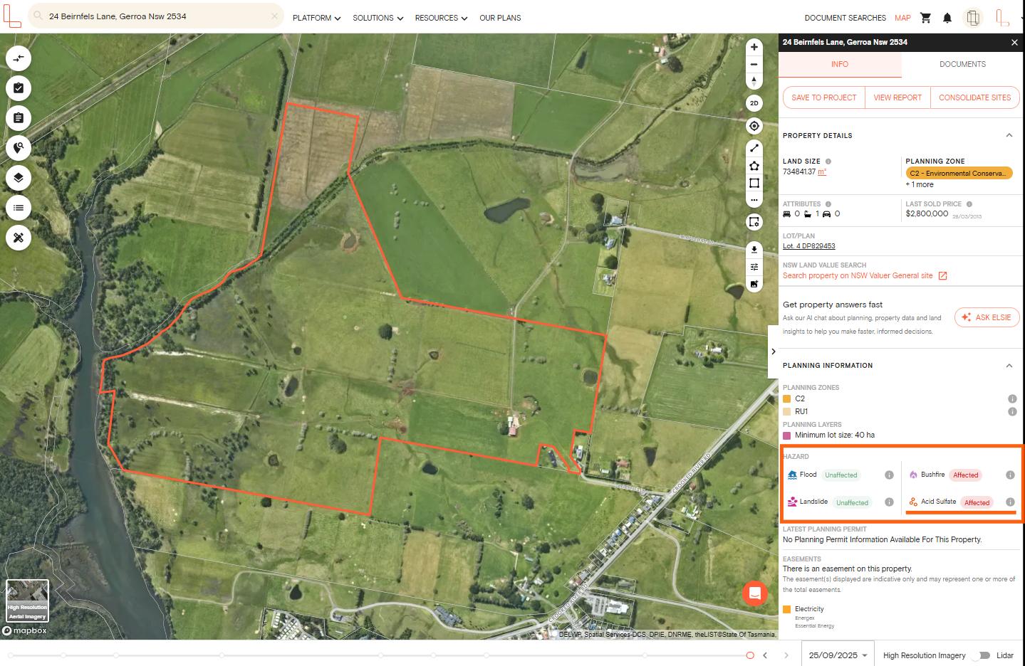
Step 1: Search for Your Property
Enter the property address in the search bar at the top of the map. The Property Information Panel opens on the right-hand side, displaying the Hazards section with your property's acid sulfate soil status (affected or unaffected).
Step 2: View the Acid Sulfate Overlay
To see acid sulfate soil areas displayed on the map:
Open the Planning Layers menu on the left-hand side
Scroll to the Hazards section and tick Acid Sulfate
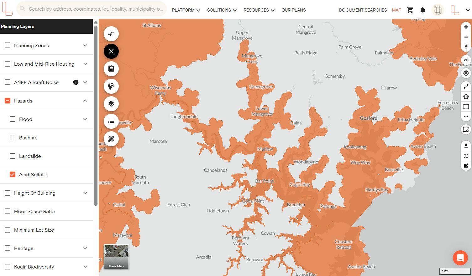
The overlay displays on the map, showing hazard zones across the area
Understanding Your Property's Acid Sulfate Status
Once you've selected your property, the Property Information Panel on the right-hand side shows whether acid sulfate soils affect your site:
Affected – We have coverage for this area and the hazard zone intersects with the property. This means the property falls within the designated hazard area.
Unaffected – We have coverage for this area but the hazard zone doesn't intersect with the property. The property is outside the designated hazard area.
If you click the information (i) button next to the acid sulfate status, you can view more details including:
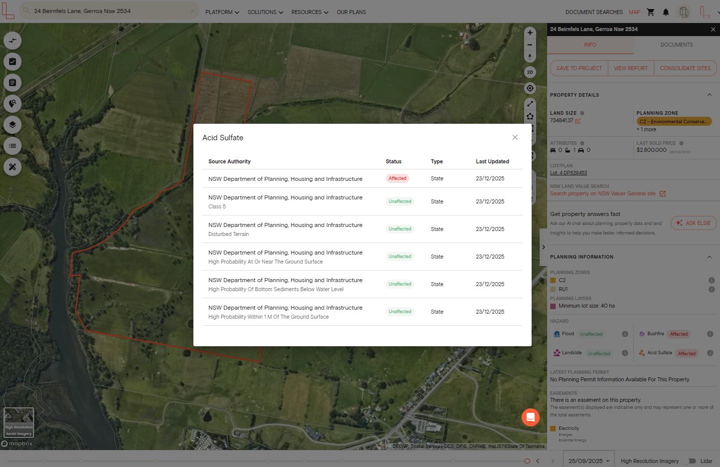
Source Authority – the authority responsible for acid sulfate management in the area and classification
Status – how the hazard affects this specific property (affected or unaffected)
Type – whether the data comes from state government or local council
Last Updated – when the data was last refreshed
This detailed information helps you understand the source and currency of the data when assessing development risks.
Download A Premium Property Report
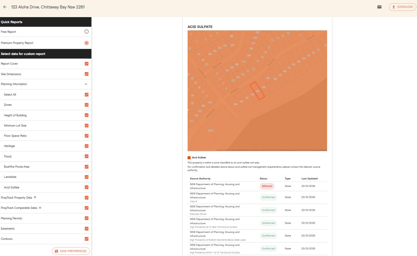
Acid sulfate soil information is included in your Premium Property Report alongside other hazards, planning controls and property details.
The report includes the same detailed information shown in the pop-up window, giving you a comprehensive document for due diligence and planning purposes.
Simply click View Report from the Property Information Panel to generate your comprehensive property assessment. You can choose to add or remove the Hazards in the report if you are on an Advanced plan.