
Product Help
How to purchase an ICEYE Flood Report
ICEYE supplies near real-time flood mapping and analysis across Australia using advanced Synthetic Aperture Radar (SAR) satellite imagery, ground-based observations, and third-party datasets. We’ve partnered with ICEYE to enhance our platform’s historical flood reporting.
The ICEYE Flood Report provides highly accurate flood extent and depth data based on actual events — helping users make better-informed property decisions.
This report is available to users on Standard, Advanced and Enterprise plans, and can be purchased for a small fee.
Sign up today to access ICEYE Flood Data
Via the Info Tab
Use this method if you’re already viewing property details and want a quick way to add the report to your cart. The Info tab shows key property insights alongside purchase options.
1. Search for a property or land parcel using the address search bar.
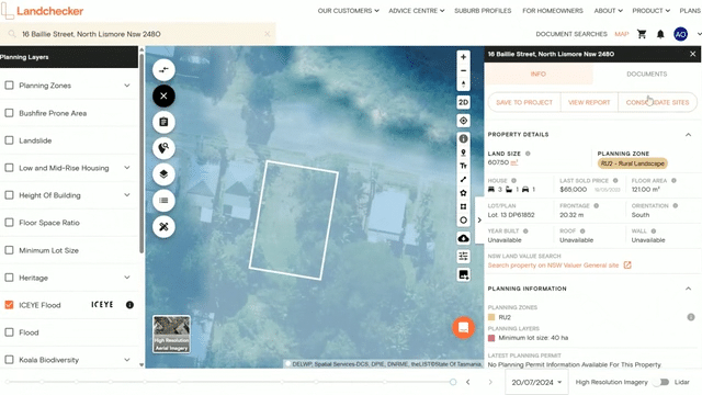
2. In the left-hand panel, open the Planning Layers menu and tick the checkbox for ICEYE Flood.
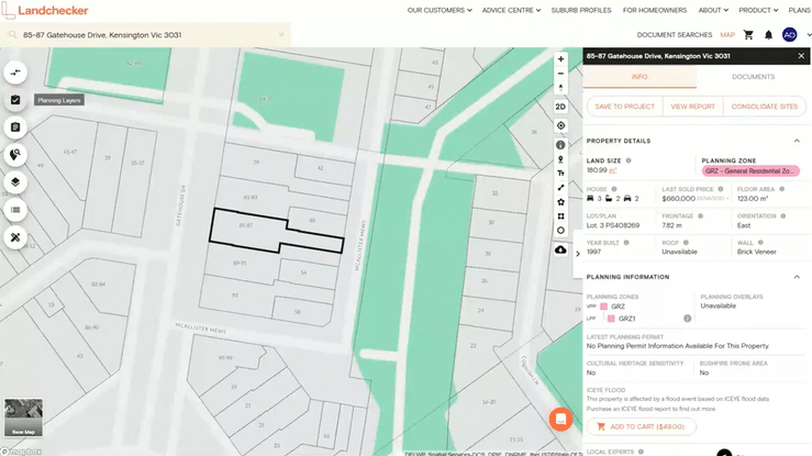
3. In the Info tab on the right-hand side, scroll down to the ICEYE Flood section and click Add to Cart.
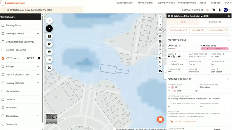
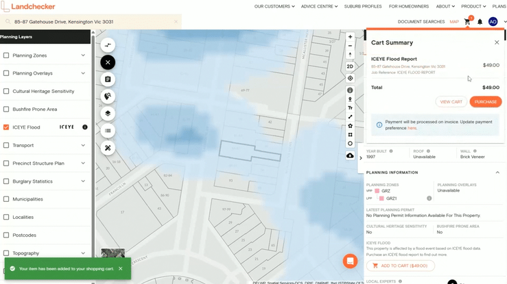
4. Click the shopping cart icon in the navigation bar and select either View Cart to review your order before buying or Purchase to quickly buy the report.
Via the Documents Tab
This method is ideal if you're looking to explore all available reports and documents for a property. The Documents tab allows you to scroll through and select what you need.
1. Search for a property or land parcel using the address search bar.
2. In the left-hand panel, open the Planning Layers menu and tick the checkbox for ICEYE Flood.
3. Go to the Documents tab. Enter a Job Reference and tick the checkbox for ICEYE Flood Report. Then click Add selected items to shopping cart.
4. Click the shopping cart icon in the navigation bar and select either View Cart to review your order before buying or Purchase to quickly buy the report.