
Product Help
How to check if a property is in a mine subsidence district
Mine Subsidence Districts are areas in NSW where there's a potential risk to buildings and structures from underground coal mining. These districts are declared by Subsidence Advisory NSW to help protect properties through regulation of development.
Before buying, building or developing a property in NSW, you should check whether it falls within a Mine Subsidence District. This information helps you determine if special approvals are required and whether the property is eligible for compensation in the event of damage caused by mine subsidence.
How to Check Mine Subsidence Districts in NSW
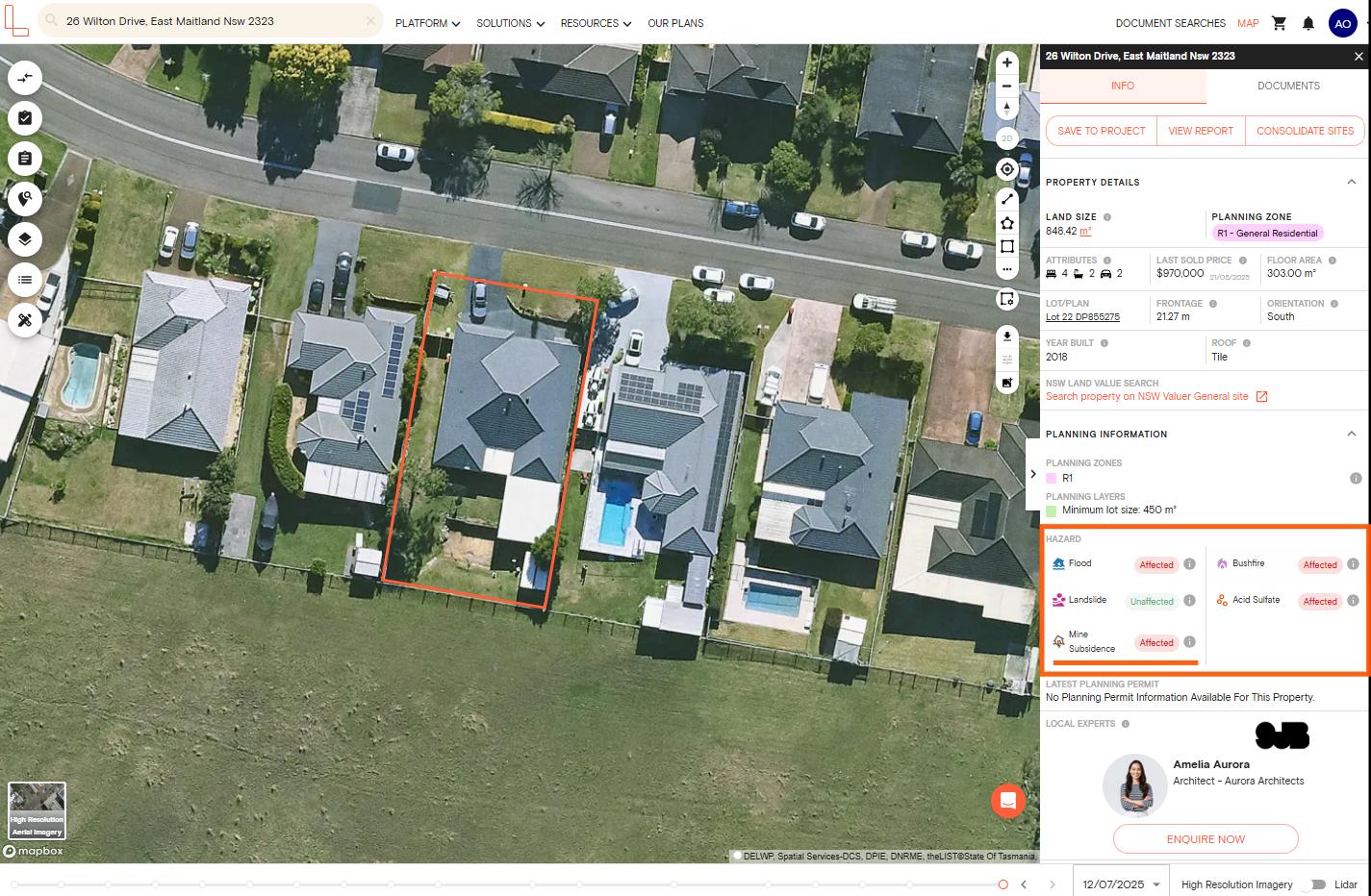
1. Search for your property using the address search bar at the top of the map
2. The Property Information Panel will open on the right-hand side
3. Scroll down to the Hazards section to see if the property is affected by mine subsidence
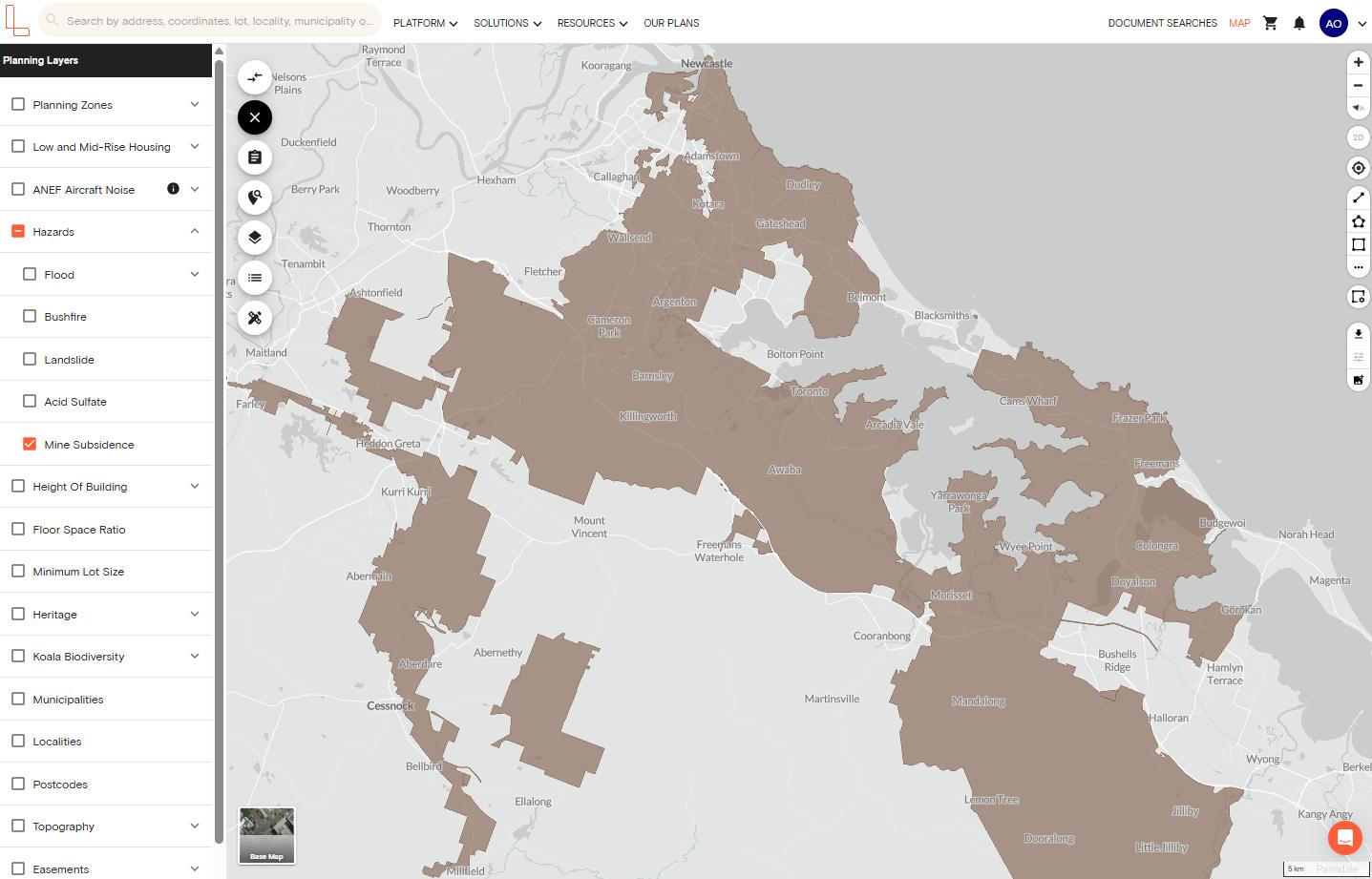
To visualise mine subsidence districts on the map:
1. Click Planning Layers in the left-hand side menu
2. Scroll to the Hazards section and tick the checkbox next to Mine Subsidence
3. Properties within designated districts will be highlighted on the map, showing you at a glance whether special approvals may be required
What You'll Find
When you check for mine subsidence districts on Landchecker, you'll see whether your property falls within a designated district where underground coal mining may affect surface developments.
Understanding Hazard Status
In the Planning Information section on the right-hand side panel, scroll to the Hazards section. Each hazard will show one of two statuses:
Affected – We have coverage for this area and the hazard zone intersects with the property. This means the property falls within the designated mine subsidence district.
Unaffected – We have coverage for this area but the hazard zone doesn't intersect with the property. The property is outside the designated mine subsidence district.
View Detailed Hazard Information
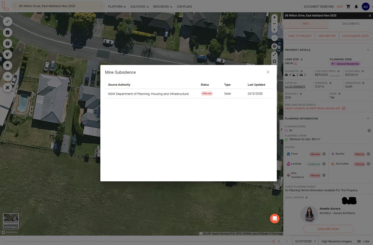
Click the information button (i) next to the hazard status to see:
Source Authority – the authority responsible for mine subsidence management in the area, such as the NSW Department of Planning, Housing and Infrastructure
Status – how the hazard affects this specific property (affected or unaffected)
Type – whether the data comes from state government or local council
Last Updated – when the data was last refreshed
Download a Premium Property Report
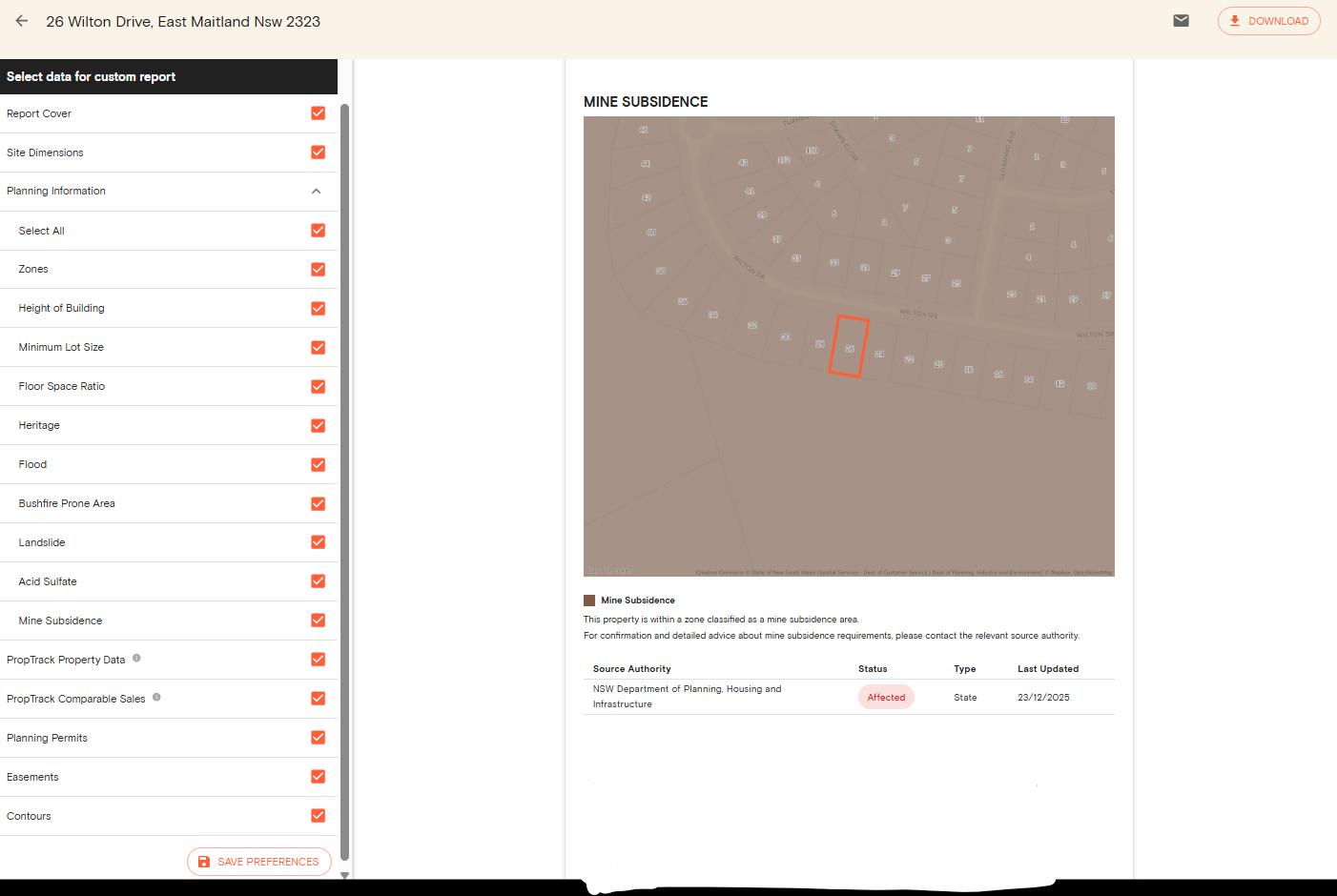
Mine subsidence district information is included in your Premium Property Report alongside other hazards, planning controls and property details.
Click View Report from the Property Information Panel to generate your comprehensive property assessment.
Why This Information Matters
If a property falls within a Mine Subsidence District, you'll need approval from Subsidence Advisory NSW before:
Building or extending a home or structure
Subdividing land
Carrying out other significant development work
These approvals ensure structures are designed to reduce subsidence risk and remain eligible for compensation if damage occurs.
Properties with correct approvals are eligible for compensation if damaged by mine subsidence, whether inside or outside a declared district.
Need More Information?
Landchecker displays mine subsidence areas to help you conduct initial due diligence.
For detailed information about specific properties, development requirements and approval processes, contact Subsidence Advisory NSW or consult with your local council.
Always verify mine subsidence information as part of your comprehensive property research, especially before purchasing, building or developing.