
Flood data coverage and sources
Flood Coverage New South Wales
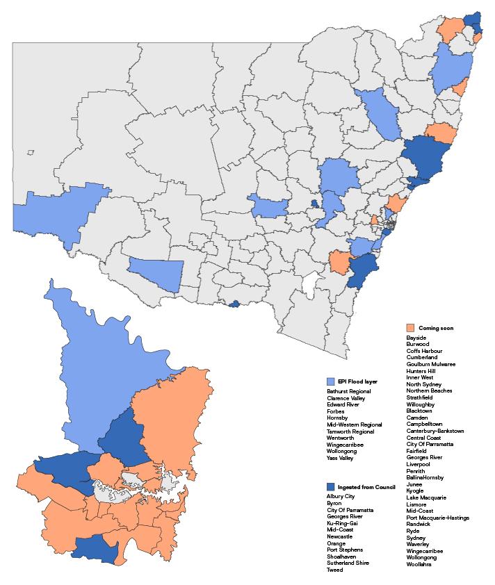
We source Flood data in NSW, from multiple sources and consolidate it into one easy to use interactive map platform. Sources include State Government Dept of Planning and Environment (EPI Flood Layer) and Local Councils. See image below for coverage in NSW.
Flood Coverage Queensland
| <b>Area</b> | <b>Source</b> |
|---|---|
| Brisbane City Council | Brisbane River flood planning area 1-5 |
| Creek/Waterway flood planning area 1-5 | |
| Overland flow flood planning area | |
| Redlands Council | Storm Tide Inundation Area |
| Flood regulation line | |
| Drainage constrained land | |
| 2016 storm tide inundation area | |
| Logan City Council | Flood assesmant area |
| Flood risk area | |
| Flood investigation | |
| High flow area | |
| Isolated islands | |
| Meadowbrook flood assessment area | |
| Moreton Bay Council | Priority Development Area |
| North Lakes Locality | |
| Flood planning area boundary | |
| Flood hazard | |
| Balance flood planning area | |

