
Access the Landchecker Data Vault
Access Landchecker’s national database of up to date planning data in real time.
Register now to speak to an expert
Data on Demand
Landchecker provides accurate, reliable, high-quality data, nationally. We receive and process data from our providers daily. Gain a competitive edge with our premium data solutions.
No more fragmented, outdated, inaccurate data. Our comprehensive data sets are thoroughly collected, analysed, and curated to provide you with the data you need to enhance your products and make informed insight-driven decisions.
Data is available via API, tile server layer or SFTP.
Landchecker’s Data Vault Includes The Following:
Cadastre
Cadastral area boundary is a line layer that is spatially represented, consisting of data representing legal land parcels in every state and territory.
Address
An address and a street number, when used in combination with other address components such as the road name and locality. New and amended addresses are updated daily and weekly.
Road Casings
Road casings contain data related to roads and their boundaries within the cadastre system. This includes detailed information such as precise delineations of the boundaries of roads and streets within the cadastre system, road classifications such as highways, local roads, residential streets, road alignments including geospatial data representing the centreline of roads and road network connectivity indicating how roads are interconnected within the cadastre, including intersections, junctions, and access points.
Administrative Boundaries
Administrative boundary data contains the spatial authoritative boundary information in every state and territory, covering administrative areas and aligned with the State’s cadastre. It includes local governments, local government wards, localities (suburbs), townsites, land districts, port authorities, marine parks and reserves, infrastructure corridors, water control areas, state forests, Native Title claims, and state electoral districts and regions.
Zones and Overlays
Our data solutions allow you identify a piece of land or geographical area that has an overlay, as well as a zone affecting it. A zone and overlay applies a layer of planning controls to a parcel of land.
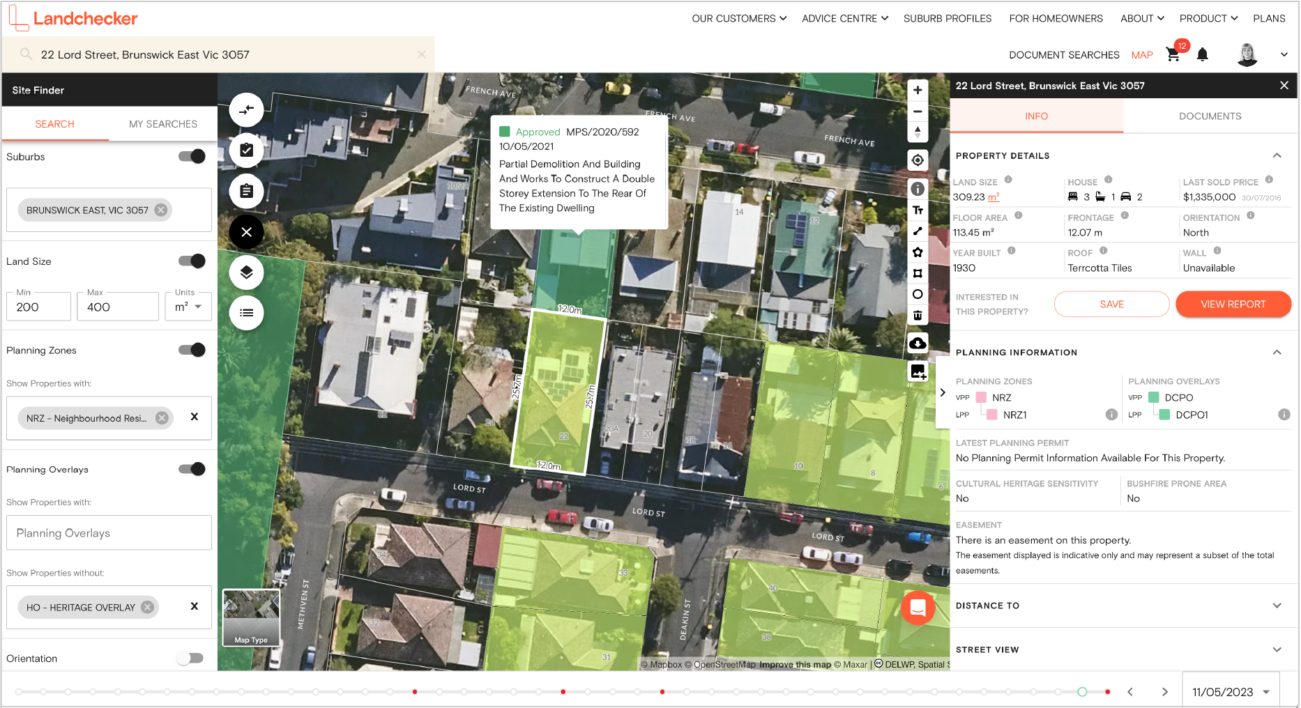
Premium Property Report
Landchecker’s Premium Property Report gives you a comprehensive summary of your subject property. It provides you with information about planning permits and planning schemes affecting your subject property. The report can be white labeled with your company’s information.
Permits/DAs
Our data solutions provide you with access to permits/DAs on a property that are approved, pending and rejected as well as the description in real time.
Reverse Geocoding
Landchecker offer the ability to reverse geocode and easily find addresses using latitude and longitude.
Title and plans (coming soon)